
– Lat/Long: 28.77° S 28.87° E
 Mont-aux-Sources
Weather Forecast, South AfricaIssued: 1 pm Mon 03 Aug Local TimeUpdates in: hr min sUpdate imminent
Issued: 1 pm Mon 03 Aug Local Time
Updates in:
Update imminent hr min s

Issued: 1 pm Mon 03 Aug Local Time
Updates in:
Update imminent hr min s
Days 1–4 Weather SummaryMostly dry. Temperatures will be slightly above freezing (max 4°C on Mon afternoon, min 1°C on Tue night). Winds increasing (calm on Mon night, fresh winds from the WSW by Tue night). | Days 5–7 Weather SummaryMostly dry. Mild temperatures (max 6°C on Sat afternoon, min 3°C on Thu night). Winds increasing (calm on Thu afternoon, fresh winds from the WNW by Sat night). | ||||||||||||||||
Mon 3 | Tuesday 4 | Wednesday 5 | Thursday 6 | Friday 7 | Saturday 8 | ||||||||||||
PM | night | AM | PM | night | AM | PM | night | AM | PM | night | AM | PM | night | AM | PM | night | |
clear | clear | clear | clear | clear | clear | clear | clear | clear | clear | clear | clear | clear | clear | clear | clear | clear | |
Cloud base (m) | 9550 | ||||||||||||||||
km/h | |||||||||||||||||
 |  |  |  |  |  | ||||||||||||
— | — | — | — | — | — | — | — | — | — | — | — | — | — | — | — | — | |
mm | — | — | — | — | — | — | — | — | — | — | — | — | — | — | — | — | — |
max °C | 4 | 3 | 4 | 4 | 3 | 3 | 4 | 3 | 4 | 5 | 4 | 4 | 5 | 4 | 5 | 6 | 4 |
min °C | 3 | 2 | 4 | 3 | 1 | 1 | 3 | 3 | 3 | 5 | 3 | 3 | 5 | 4 | 4 | 5 | 3 |
chill °C | 1 | 0 | 4 | 0 | -5 | -5 | 0 | 0 | -1 | 5 | 0 | 0 | 1 | -2 | 2 | 2 | -3 |
Freezing level m | 3800 | 3800 | 3950 | 3900 | 3600 | 3750 | 3950 | 3850 | 3900 | 4100 | 3800 | 3850 | 4000 | 3850 | 3950 | 4050 | 3850 |
— | — | 6:45 | — | — | 6:45 | — | — | 6:43 | — | — | 6:43 | — | — | 6:41 | — | — | |
5:35 | — | — | 5:35 | — | — | 5:36 | — | — | 5:36 | — | — | 5:37 | — | — | 5:37 | — | |
Loading...
Mont-aux-Sources Weather (Days 0-3):
The weather forecast for Mont-aux-Sources is: Mostly dry. Temperatures will be slightly above freezing (max 4°C on Mon afternoon, min 1°C on Tue night). Winds increasing (calm on Mon night, fresh winds from the WSW by Tue night).
Mont-aux-Sources Weather (Days 3-6):
Mostly dry. Mild temperatures (max 6°C on Sat afternoon, min 3°C on Thu night). Winds increasing (calm on Thu afternoon, fresh winds from the WNW by Sat night).
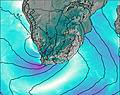
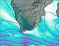
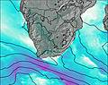
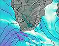
This table gives the weather forecast for Mont-aux-Sources at the specific elevation of 3282 m. Our advanced weather models allow us to provide distinct weather forecasts for several elevations of Mont-aux-Sources. To see the weather forecasts for the other elevations, use the tab navigation above the table. For a wider overview of the weather, consult the Weather Map of South Africa.
| Weather Station | Temp. | Weather | Wind | Gusts | Cloud / Visibility |
|---|---|---|---|---|---|
Van Reenen | |||||
Bethlehem | |||||
Giants Castle | |||||
Vrede |
* NOTE: not all weather observatories update at the same frequency which is the reason why some locations may show data from stations that are further away than known closer ones.