– Lat/Long: 44.17° N 5.28° E
 Mont Ventoux
Weather Forecast, FranceIssued: 1 am Tue 21 Jul Local TimeUpdates in: hr min sUpdate imminent
Issued: 1 am Tue 21 Jul Local Time
Updates in:
Update imminent hr min s

Issued: 1 am Tue 21 Jul Local Time
Updates in:
Update imminent hr min s
Days 1–3 Weather SummaryMostly dry. Warm (max 25°C on Tue afternoon, min 17°C on Tue night). Winds increasing (light winds from the NNE on Wed morning, strong winds from the NNW by Thu afternoon). | Days 4–6 Weather SummaryLight rain (total 4mm), mostly falling on Sat night. Warm (max 26°C on Fri afternoon, min 14°C on Sun night). Winds increasing (calm on Fri night, strong winds from the NNW by Sun night). | |||||||||||||||||
Tuesday 21 | Wednesday 22 | Thursday 23 | Friday 24 | Saturday 25 | Sunday 26 | |||||||||||||
AM | PM | night | AM | PM | night | AM | PM | night | AM | PM | night | AM | PM | night | AM | PM | night | |
some clouds | clear | clear | clear | clear | clear | clear | clear | clear | clear | clear | clear | clear | clear | rain shwrs | rain shwrs | clear | clear | |
Cloud base (m) | 9100 | 9350 | 8700 | 7300 | 3650 | 5450 | ||||||||||||
km/h | ||||||||||||||||||
 |  |  |  |  |  | |||||||||||||
— | — | — | — | — | — | — | — | — | — | — | — | — | — | — | — | — | — | |
mm | — | — | — | — | — | — | — | — | — | — | — | — | — | — | 3 | 0.7 | — | — |
max °C | 23 | 25 | 22 | 20 | 24 | 23 | 21 | 23 | 22 | 22 | 26 | 25 | 22 | 25 | 21 | 19 | 23 | 19 |
min °C | 22 | 24 | 17 | 18 | 23 | 19 | 19 | 23 | 18 | 19 | 25 | 21 | 21 | 24 | 17 | 17 | 22 | 14 |
chill °C | 22 | 24 | 16 | 18 | 23 | 19 | 19 | 23 | 18 | 19 | 25 | 21 | 21 | 24 | 17 | 17 | 22 | 12 |
Freezing level m | 4200 | 4100 | 4400 | 4400 | 4450 | 4300 | 4300 | 4450 | 4650 | 4550 | 4550 | 4600 | 4550 | 4300 | 3950 | 3700 | 3800 | 4300 |
6:13 | — | — | 6:15 | — | — | 6:16 | — | — | 6:16 | — | — | 6:18 | — | — | 6:18 | — | — | |
— | — | 9:15 | — | — | 9:14 | — | — | 9:13 | — | — | 9:12 | — | — | 9:10 | — | — | 9:09 | |
Loading...
Mont Ventoux Weather (Days 0-3):
The weather forecast for Mont Ventoux is: Mostly dry. Warm (max 25°C on Tue afternoon, min 17°C on Tue night). Winds increasing (light winds from the NNE on Wed morning, strong winds from the NNW by Thu afternoon).
Mont Ventoux Weather (Days 3-6):
Light rain (total 4mm), mostly falling on Sat night. Warm (max 26°C on Fri afternoon, min 14°C on Sun night). Winds increasing (calm on Fri night, strong winds from the NNW by Sun night).
This table gives the weather forecast for Mont Ventoux at the specific elevation of 1000 m. Our advanced weather models allow us to provide distinct weather forecasts for several elevations of Mont Ventoux. To see the weather forecasts for the other elevations, use the tab navigation above the table. For a wider overview of the weather, consult the Weather Map of France.
| Weather Station | Temp. | Weather | Wind | Gusts | Cloud / Visibility |
|---|---|---|---|---|---|
thunderstorm affecting Bédoin | |||||
lightning 4km NNE of Mormoiron | |||||
lightning 7km N of Malaucene | |||||
lightning 4km NE of Villes-sur-Auzon | |||||
thunderstorm affecting Caromb | |||||
lightning 11km NE of Buis-les-Baronnies | |||||
thunderstorm affecting Malemort-du-Comtat | |||||
thunderstorm affecting Saint-Didier | |||||
Carpentras (automatic) | |||||
thunderstorm affecting Carpentras |
* NOTE: not all weather observatories update at the same frequency which is the reason why some locations may show data from stations that are further away than known closer ones.
Mont Ventoux Photos
View all
Savoy Alps photos (140) |
Alps photos (1484) |
photos from mountains in France (301) |
all photos
 Upload new photo
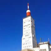
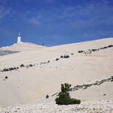

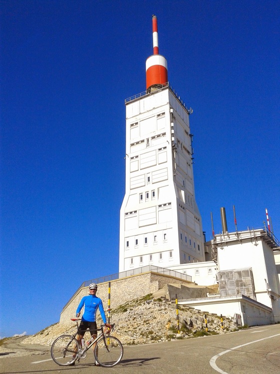
Summit Mont Ventoux
Mont Ventoux