– Lat/Long: 45.98° N 7.66° E
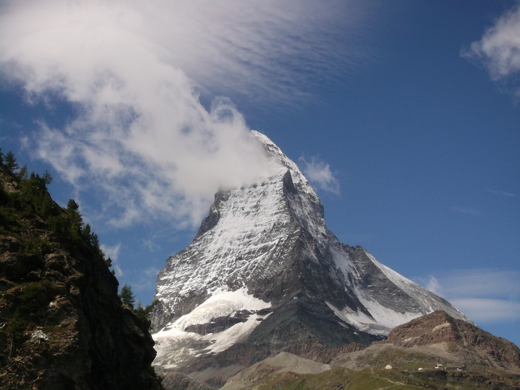
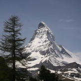
 Matterhorn
Weather Forecast, SwitzerlandIssued: 1 pm Mon 03 Aug Local TimeUpdates in: hr min sUpdate imminent
Issued: 1 pm Mon 03 Aug Local Time
Updates in:
Update imminent hr min s

Issued: 1 pm Mon 03 Aug Local Time
Updates in:
Update imminent hr min s
Days 1–4 Weather SummaryHeavy rain (total 31mm), heaviest during Wed night. Warm (max 22°C on Tue afternoon, min 17°C on Wed night). Wind will be generally light. | Days 5–7 Weather SummaryHeavy rain (total 25mm), heaviest during Thu night. Warm (max 22°C on Thu afternoon, min 15°C on Thu night). Wind will be generally light. | ||||||||||||||||
Mon 3 | Tuesday 4 | Wednesday 5 | Thursday 6 | Friday 7 | Saturday 8 | ||||||||||||
PM | night | AM | PM | night | AM | PM | night | AM | PM | night | AM | PM | night | AM | PM | night | |
risk tstorm | risk tstorm | rain shwrs | risk tstorm | rain shwrs | clear | rain shwrs | rain shwrs | clear | rain shwrs | rain shwrs | rain shwrs | risk tstorm | rain shwrs | clear | rain shwrs | rain shwrs | |
Cloud base (m) | 4000 | 4850 | 4650 | 4350 | 3900 | 2850 | 3700 | ||||||||||
km/h | |||||||||||||||||
 |  |  |  |  |  | ||||||||||||
— | — | — | — | — | — | — | — | — | — | — | — | — | — | — | — | — | |
mm | 3 | 3 | 0.1 | 3 | 5 | — | 3 | 14 | — | 4 | 12 | 0.3 | 3 | 1.1 | — | 3 | 1 |
max °C | 21 | 19 | 21 | 22 | 19 | 21 | 22 | 18 | 21 | 22 | 17 | 20 | 21 | 19 | 20 | 21 | 20 |
min °C | 21 | 18 | 18 | 21 | 18 | 18 | 21 | 17 | 18 | 19 | 15 | 16 | 20 | 16 | 16 | 21 | 17 |
chill °C | 21 | 18 | 18 | 21 | 18 | 18 | 21 | 17 | 18 | 19 | 15 | 16 | 20 | 16 | 16 | 21 | 17 |
Freezing level m | 4500 | 4400 | 4400 | 4500 | 4450 | 4500 | 4550 | 4400 | 4450 | 4400 | 4200 | 4200 | 4400 | 4200 | 4350 | 4450 | 4350 |
— | — | 6:13 | — | — | 6:15 | — | — | 6:16 | — | — | 6:18 | — | — | 6:18 | — | — | |
— | 8:57 | — | — | 8:54 | — | — | 8:53 | — | — | 8:52 | — | — | 8:51 | — | — | 8:49 | |
Loading...
Matterhorn Weather (Days 0-3):
The weather forecast for Matterhorn is: Heavy rain (total 31mm), heaviest during Wed night. Warm (max 22°C on Tue afternoon, min 17°C on Wed night). Wind will be generally light.
Matterhorn Weather (Days 3-6):
Heavy rain (total 25mm), heaviest during Thu night. Warm (max 22°C on Thu afternoon, min 15°C on Thu night). Wind will be generally light.
This table gives the weather forecast for Matterhorn at the specific elevation of 1500 m. Our advanced weather models allow us to provide distinct weather forecasts for several elevations of Matterhorn. To see the weather forecasts for the other elevations, use the tab navigation above the table. For a wider overview of the weather, consult the Weather Map of Switzerland.
Matterhorn Photos
View all
Savoy Alps photos (141) |
Alps photos (1485) |
photos from mountains in Switzerland (649) |
all photos
 Upload new photo
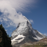
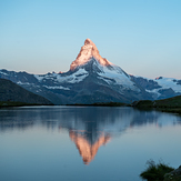
 See 12 more Matterhorn photos
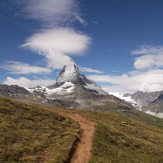
Matterhorn
Matterhorn at the Golden or Magic Hour
Matterhorn
Matterhorn
Matterhorn
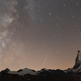
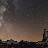
another perseid meteor at Matterhorn
a perseid meteor at Matterhorn