– Lat/Long: 33.38° S 19.67° E
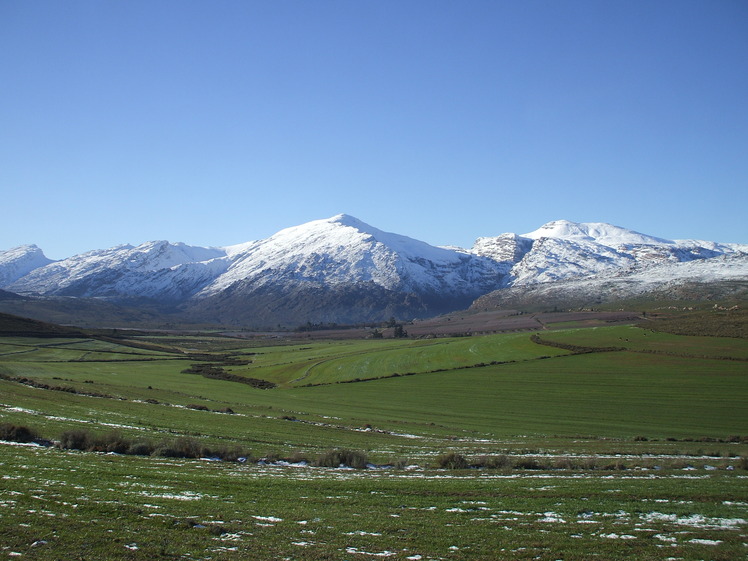
 Matroosberg
Weather Forecast, South AfricaIssued: 7 pm Sun 02 Aug Local TimeUpdates in: hr min sUpdate imminent
Issued: 7 pm Sun 02 Aug Local Time
Updates in:
Update imminent hr min s

Issued: 7 pm Sun 02 Aug Local Time
Updates in:
Update imminent hr min s
Days 1–4 Weather SummaryMostly dry. Very mild (max 11°C on Mon night, min 5°C on Wed afternoon). Winds increasing (light winds from the NW on Sun night, strong winds from the NNW by Mon night). | Days 5–7 Weather SummaryMostly dry. Freeze-thaw conditions (max 9°C on Fri afternoon, min 0°C on Thu morning). Winds increasing (light winds from the WNW on Thu night, strong winds from the WNW by Sat afternoon). | ||||||||||||||||||
Monday 3 | Tuesday 4 | Wednesday 5 | Thursday 6 | Friday 7 | Saturday 8 | ||||||||||||||
night | AM | PM | night | AM | PM | night | AM | PM | night | AM | PM | night | AM | PM | night | AM | PM | night | |
clear | clear | clear | clear | clear | cloudy | clear | clear | clear | clear | cloudy | light rain | clear | clear | clear | some clouds | some clouds | clear | some clouds | |
Cloud base (m) | 9100 | 9250 | 3250 | 8800 | 8150 | 8500 | 700 | 750 | 750 | 7200 | 8550 | 2250 | |||||||
km/h | |||||||||||||||||||
 |  |  |  |  |  |  | |||||||||||||
— | — | — | — | — | — | — | — | — | — | — | — | — | — | — | — | — | — | — | |
mm | — | — | — | — | — | — | — | — | — | — | — | 0.1 | — | — | — | — | — | — | — |
max °C | 10 | 10 | 10 | 11 | 10 | 10 | 8 | 6 | 6 | 4 | 1 | 3 | 4 | 7 | 9 | 9 | 8 | 8 | 5 |
min °C | 10 | 10 | 10 | 11 | 10 | 8 | 7 | 6 | 5 | 2 | 0 | 2 | 3 | 6 | 7 | 9 | 8 | 6 | 1 |
chill °C | 8 | 7 | 7 | 8 | 6 | 4 | 3 | 1 | -1 | -5 | -6 | -4 | -2 | 2 | 3 | 5 | 3 | 0 | -5 |
Freezing level m | 3550 | 3600 | 3650 | 3700 | 3650 | 3050 | 3200 | 3100 | 3250 | 3250 | 2350 | 3150 | 3350 | 3650 | 3700 | 3700 | 3650 | 3550 | 2850 |
— | 7:31 | — | — | 7:30 | — | — | 7:28 | — | — | 7:28 | — | — | 7:26 | — | — | 7:26 | — | — | |
— | — | 6:04 | — | — | 6:04 | — | — | 6:05 | — | — | 6:06 | — | — | 6:06 | — | — | 6:07 | — | |
Loading...
Matroosberg Weather (Days 0-3):
The weather forecast for Matroosberg is: Mostly dry. Very mild (max 11°C on Mon night, min 5°C on Wed afternoon). Winds increasing (light winds from the NW on Sun night, strong winds from the NNW by Mon night).
Matroosberg Weather (Days 3-6):
Mostly dry. Freeze-thaw conditions (max 9°C on Fri afternoon, min 0°C on Thu morning). Winds increasing (light winds from the WNW on Thu night, strong winds from the WNW by Sat afternoon).
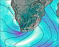
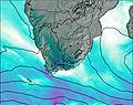
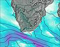
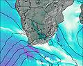
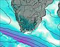
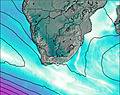
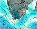
This table gives the weather forecast for Matroosberg at the specific elevation of 2250 m. Our advanced weather models allow us to provide distinct weather forecasts for several elevations of Matroosberg. To see the weather forecasts for the other elevations, use the tab navigation above the table. For a wider overview of the weather, consult the Weather Map of South Africa.
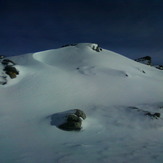
Matroosberg Photos
View all
Cape Ranges photos (22) |
Southern Africa photos (72) |
photos from mountains in South Africa (66) |
all photos
 Upload new photo
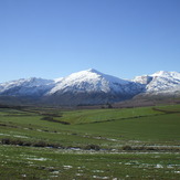
 See 8 more Matroosberg photos
Matroosberg
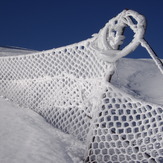
SNOW FENCE
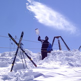
Adrian Boom Shawn De Villiers "TOO MUCH SNOW"
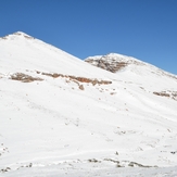
Matroosberg
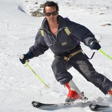
Main slope Matroosberg Adrian Boom
4x4 trail