Karl Marx Peak Guide
- Elevation: 6726
- Difficulty: -
- Best months to climb: -
- Convenient center: -
Karl Marx Peak climbers Notes
Camille de Schoulepnikoff from SWITZERLAND writes:
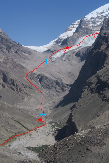
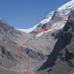
Karl Marx peak south face
Housing in Vrang : 2800m
Beginning of the trail in Inif : 2800m
Camp 1 : 3850m
Camp 2 : 4650m
Camp 3 : 5750m
Summit: 6723m
Day 1: from Vrang to camp1 departure at 5am arrival at 12am
Day 2: from camp 1 to camp 2 departure at 7am arrival at 4pm
Day 3: from camp 2 to camp 3 departure at 6:30am arrival at 3am
Day 4: summit and descent to camp 2 departure at 3:30am, summit at 7:30, back to camp 3 at 9:30am, back to camp 2 at 3pm
Day 5: from camp 2 to camp 1 departure at 7:30am arrival at 11:30am
Day 6: from camp 1 to Vrang departure at 9:30 arrival at 2pm
Vrang is the nearest village of the departure of the shepherd trail which goes to camp 1. It’s possible to sleep in the only hotel of the village or to go in a guesthouse of the village. We decided to go in the hotel which is linked with the only café of the village for breakfast.
The shepherd trail begins in a hamlet called Inif on the maps. We walked on the road for 3km from the hotel to the departure of the trail.
The trail ends slightly before camp 1 and is good enough to allow a mule to go to camp 1. After that point the trail is really rocky and thus not feasible for a mule.
The camp 1 (3850m) is the last flat place with grass and next to a source of drinkable water.
A few meters after camp 1, there’s a river to cross. It is necessary to unwear shoes and wear shorts. Walking sticks can be useful to keep the balance because the water flow is strong. Be careful of the water level rise during the day !
After the river, continue until reaching the left slope and ascent it until reaching the height of the superior plateau. There are some cairns to indicate the level of the crossing on the plateau. Go further on the plateau until a second river crossing. This one does not require to put off your shoes, but you have to search for the good crossing.
Walk up along the glacier until the camp 2.
The camp 2 (4650m) is the last place with a drinkable source of water (sort of puddle which flows very slowly) before the glacier. It is situated on the moraine of the glacier so you have to do some flattening work to put the tent.
From camp 2 walk up as high as possible on the moraine before going on the glacier. It is necessary to wear a helmet for the first meters of the glacier because there are a lot of rock falls.
The glacier crossing that follows is the most technical part of the ascent of the Karl Marx peak. We can describe it as two sections as follows:
- A first one almost completely with ice and with big peaks of ice (around 2 meters high). Take some ice screws to ensure yourself if necessary.
- A second part flatter with huge transversal crevasses. You often have to go 30m transversely to find a way to get around it.
These two sections are around 200m in denivelation and it takes approximately 2:30 hours to go through both of them. Taking a spray bomb could be a great idea in order to mark the pass to facilitate the descent. It’s a real labyrinth!
Once these difficulties passed, the glacier becomes flatter and the crevasses are non-existent or covered by thick bridges of snow. So the rest of the trail to camp 3 is easy.
Camp 3 is situated on a plateau at an altitude of 5750m approximately (place where two small valley descent from the summit are joining each other). It’s the last flat place before the summit.
For the summit ascent take the small valley at the right side until a first pass (6300m). Walk up straight from the pass in the direction of the summit for approximately 200m of denivelation. Then go a few meters to the left horizontally to get around a cornice. Then continue right in the direction of the summit, which is easily reached.
The descent is the same itinerary as the ascent.
2019-09-01 |
Click here to submit your own climbing note for Karl Marx Peak
|
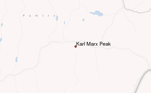
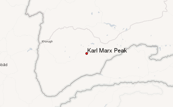
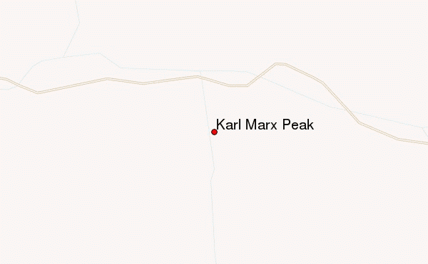
Select Karl Marx Peak Location Map Detail:
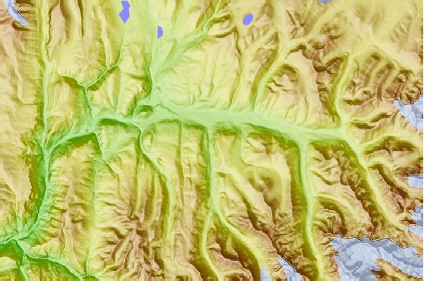
Use this relief map to navigate to mountain peaks in the area of Karl Marx Peak.
10 other mountain peaks closest to Karl Marx Peak:
 Karl Marx Peak – Climbing, Hiking & Mountaineering information
