– Lat/Long: 35.76° N 138.24° E
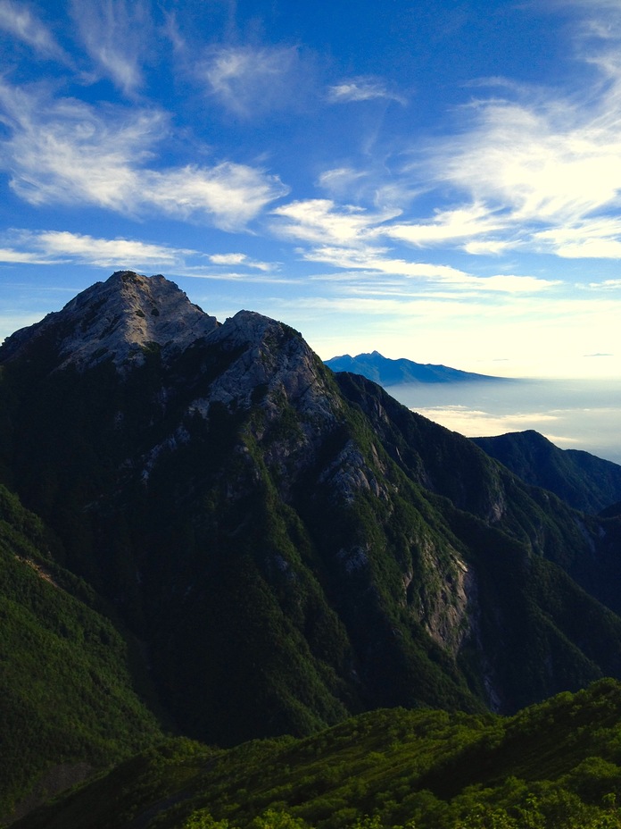
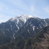
 Kai-Komagatake
Weather Forecast, JapanIssued: 8 pm Mon 03 Aug Local TimeUpdates in: hr min sUpdate imminent
Issued: 8 pm Mon 03 Aug Local Time
Updates in:
Update imminent hr min s

Issued: 8 pm Mon 03 Aug Local Time
Updates in:
Update imminent hr min s
Days 1–4 Weather SummaryLight rain (total 4mm), mostly falling on Thu afternoon. Warm (max 20°C on Wed morning, min 14°C on Tue night). Wind will be generally light. | Days 5–7 Weather SummaryLight rain (total 4mm), mostly falling on Fri afternoon. Very mild (max 19°C on Fri morning, min 14°C on Thu night). Wind will be generally light. | |||||||||||||||
Tuesday 4 | Wednesday 5 | Thursday 6 | Friday 7 | Saturday 8 | ||||||||||||
night | AM | PM | night | AM | PM | night | AM | PM | night | AM | PM | night | AM | PM | night | |
rain shwrs | rain shwrs | rain shwrs | clear | clear | rain shwrs | clear | rain shwrs | risk tstorm | clear | rain shwrs | risk tstorm | rain shwrs | rain shwrs | rain shwrs | rain shwrs | |
Cloud base (m) | 1950 | 1600 | 1800 | 2950 | 1550 | 2500 | 1550 | 1700 | 2300 | 1550 | 1600 | 2850 | 1850 | |||
km/h | ||||||||||||||||
 | 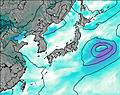 | 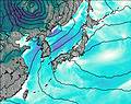 | 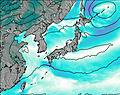 |  |  | |||||||||||
— | — | — | — | — | — | — | — | — | — | — | — | — | — | — | — | |
mm | 0.4 | 0.2 | 0.2 | — | — | 0.3 | — | 0.1 | 3 | — | 0.3 | 2 | 0.3 | 0.1 | 0.5 | 0.1 |
max °C | 16 | 18 | 19 | 15 | 20 | 19 | 15 | 19 | 19 | 16 | 19 | 18 | 15 | 19 | 18 | 15 |
min °C | 15 | 16 | 17 | 14 | 18 | 17 | 15 | 18 | 18 | 14 | 17 | 17 | 15 | 17 | 17 | 14 |
chill °C | 15 | 16 | 17 | 14 | 18 | 17 | 15 | 18 | 18 | 13 | 17 | 17 | 15 | 17 | 17 | 14 |
Freezing level m | 5550 | 5400 | 5300 | 5600 | 5450 | 5300 | 5400 | 5300 | 5300 | 5300 | 5250 | 5150 | 5150 | 5150 | 5000 | 5050 |
— | 4:56 | — | — | 4:56 | — | — | 4:58 | — | — | 4:58 | — | — | 4:58 | — | — | |
— | — | 6:49 | — | — | 6:47 | — | — | 6:46 | — | — | 6:45 | — | — | 6:45 | — | |
Loading...
Kai-Komagatake Weather (Days 0-3):
The weather forecast for Kai-Komagatake is: Light rain (total 4mm), mostly falling on Thu afternoon. Warm (max 20°C on Wed morning, min 14°C on Tue night). Wind will be generally light.
Kai-Komagatake Weather (Days 3-6):
Light rain (total 4mm), mostly falling on Fri afternoon. Very mild (max 19°C on Fri morning, min 14°C on Thu night). Wind will be generally light.
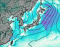
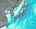
This table gives the weather forecast for Kai-Komagatake at the specific elevation of 2000 m. Our advanced weather models allow us to provide distinct weather forecasts for several elevations of Kai-Komagatake. To see the weather forecasts for the other elevations, use the tab navigation above the table. For a wider overview of the weather, consult the Weather Map of Japan.
| Weather Station | Temp. | Weather | Wind | Gusts | Cloud / Visibility |
|---|---|---|---|---|---|
* NOTE: not all weather observatories update at the same frequency which is the reason why some locations may show data from stations that are further away than known closer ones.
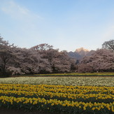
Kai-Komagatake Photos
View all
Honshu photos (153) |
Japanese Archipelago photos (294) |
photos from mountains in Japan (376) |
all photos
 Upload new photo
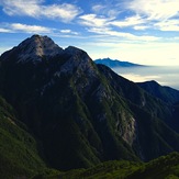
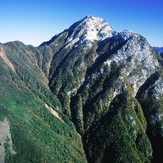
Mt.Kaikoma
Kaikoma over Sakura trees
Kai-Komagatake