– Lat/Long: 35.88° N 76.51° E
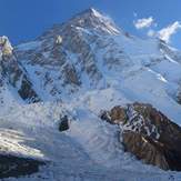
 K2
K2
Weather Forecast, PakistanIssued: 10 pm Sun 02 Aug Local TimeUpdates in: hr min sUpdate imminent
Issued: 10 pm Sun 02 Aug Local Time
Updates in:
Update imminent hr min s

Issued: 10 pm Sun 02 Aug Local Time
Updates in:
Update imminent hr min s
Days 1–4 Weather SummaryA moderate fall of snow, heaviest on Tue night. Extremely cold (max -13°C on Tue night, min -16°C on Wed afternoon). Winds increasing (light winds from the SW on Sun night, fresh winds from the SSW by Wed morning). | Days 5–7 Weather SummaryA heavy fall of snow, heaviest during Thu night. Extremely cold (max -14°C on Sat afternoon, min -17°C on Wed night). Mainly fresh winds. | ||||||||||||||||||
Monday 3 | Tuesday 4 | Wednesday 5 | Thursday 6 | Friday 7 | Saturday 8 | ||||||||||||||
night | AM | PM | night | AM | PM | night | AM | PM | night | AM | PM | night | AM | PM | night | AM | PM | night | |
some clouds | clear | some clouds | some clouds | light snow | light snow | mod. snow | light snow | snow shwrs | light snow | light snow | light snow | heavy snow | snow shwrs | some clouds | some clouds | some clouds | light snow | light snow | |
Cloud base (m) | 5850 | 5650 | 6350 | 6150 | 5700 | 5600 | 5550 | 5550 | 5650 | 5550 | 5550 | 5600 | 5550 | 5550 | 5550 | 5550 | 5600 | 5900 | 5550 |
km/h | |||||||||||||||||||
 |  |  |  |  |  |  | |||||||||||||
— | — | — | — | 1 | 5 | 9 | 2 | 2 | 4 | 2 | 4 | 16 | 1 | — | — | — | 2 | 5 | |
mm | — | — | — | — | — | — | — | — | — | — | — | — | — | — | — | — | — | — | — |
max °C | -15 | -14 | -15 | -14 | -14 | -14 | -13 | -15 | -16 | -16 | -17 | -16 | -15 | -16 | -16 | -15 | -15 | -14 | -13 |
min °C | -15 | -14 | -15 | -14 | -14 | -14 | -15 | -15 | -16 | -17 | -17 | -17 | -17 | -17 | -16 | -15 | -15 | -15 | -14 |
chill °C | -20 | -21 | -22 | -22 | -24 | -23 | -26 | -26 | -27 | -28 | -29 | -28 | -27 | -28 | -26 | -23 | -25 | -25 | -23 |
Freezing level m | 5350 | 5750 | 5900 | 5700 | 5850 | 5800 | 5500 | 5600 | 5700 | 5400 | 5500 | 5650 | 5400 | 5400 | 5600 | 5350 | 5750 | 5850 | 5700 |
— | 5:01 | — | — | 5:03 | — | — | 5:03 | — | — | 5:05 | — | — | 5:05 | — | — | 5:05 | — | — | |
— | — | 6:57 | — | — | 6:55 | — | — | 6:54 | — | — | 6:53 | — | — | 6:52 | — | — | 6:52 | — | |
Loading...
K2 Weather (Days 0-3):
The weather forecast for K2 is: A moderate fall of snow, heaviest on Tue night. Extremely cold (max -13°C on Tue night, min -16°C on Wed afternoon). Winds increasing (light winds from the SW on Sun night, fresh winds from the SSW by Wed morning).
K2 Weather (Days 3-6):
A heavy fall of snow, heaviest during Thu night. Extremely cold (max -14°C on Sat afternoon, min -17°C on Wed night). Mainly fresh winds.
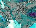
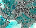
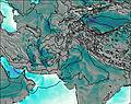
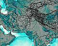
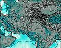
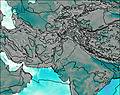
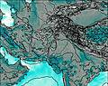
This table gives the weather forecast for K2 at the specific elevation of 8000 m. Our advanced weather models allow us to provide distinct weather forecasts for several elevations of K2. To see the weather forecasts for the other elevations, use the tab navigation above the table. For a wider overview of the weather, consult the Weather Map of Pakistan.
| Weather Station | Temp. | Weather | Wind | Gusts | Cloud / Visibility |
|---|---|---|---|---|---|
Leh K B Rimpoche | |||||
Srinagar (ci / i | |||||
Jammu | |||||
* NOTE: not all weather observatories update at the same frequency which is the reason why some locations may show data from stations that are further away than known closer ones.
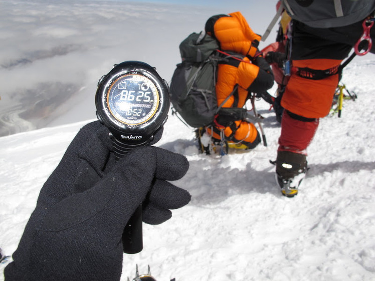
K2 Photos
View all
Karakoram photos (74) |
Greater Himalaya photos (384) |
photos from mountains in Pakistan (125) |
all photos
 Upload new photo
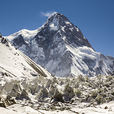
 See 28 more K2 photos
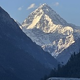
K2 North Side
k2
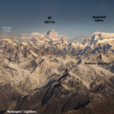
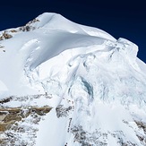
The K2 Massif, Grandscape
Falak Sher
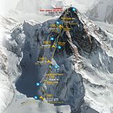
Alpinist Climber Expeditions - ACE
love of my life k2 my childhood dream