
– Lat/Long: 51.43° N 117.85° W
 Iconoclast Mountain
Weather Forecast, CanadaIssued: 5 am Mon 03 Aug Local TimeUpdates in: hr min sUpdate imminent
Issued: 5 am Mon 03 Aug Local Time
Updates in:
Update imminent hr min s

Issued: 5 am Mon 03 Aug Local Time
Updates in:
Update imminent hr min s
Days 1–3 Weather SummaryMostly dry. Very mild (max 13°C on Wed afternoon, min 1°C on Mon morning). Wind will be generally light. | Days 4–6 Weather SummaryLight rain (total 8mm), mostly falling on Fri night. Very mild (max 16°C on Thu afternoon, min 8°C on Fri night). Wind will be generally light. | Days 7–9 Weather SummaryModerate rain (total 20mm), heaviest on Tue morning. Very mild (max 12°C on Mon afternoon, min 5°C on Tue night). Wind will be generally light. | Days 10–12 Weather SummaryModerate rain (total 12mm), heaviest on Fri morning. Mild temperatures (max 8°C on Thu morning, min 3°C on Fri night). Wind will be generally light. | Days 13–16 Weather SummaryMostly dry. Very mild (max 15°C on Mon afternoon, min 5°C on Sat morning). Wind will be generally light. | |||||||||||||||||||||||||||||||||||||||||||
Monday 3 | Tuesday 4 | Wednesday 5 | Thursday 6 | Friday 7 | Saturday 8 | Sunday 9 | Monday 10 | Tuesday 11 | Wednesday 12 | Thursday 13 | Friday 14 | Saturday 15 | Sunday 16 | Monday 17 | Tue 18 | ||||||||||||||||||||||||||||||||
AM | PM | night | AM | PM | night | AM | PM | night | AM | PM | night | AM | PM | night | AM | PM | night | AM | PM | night | AM | PM | night | AM | PM | night | AM | PM | night | AM | PM | night | AM | PM | night | AM | PM | night | AM | PM | night | AM | PM | night | AM | PM | |
some clouds | some clouds | some clouds | clear | some clouds | some clouds | some clouds | clear | clear | clear | clear | some clouds | some clouds | some clouds | rain shwrs | rain shwrs | risk tstorm | risk tstorm | light rain | some clouds | rain shwrs | light rain | light rain | rain shwrs | risk tstorm | risk tstorm | risk tstorm | rain shwrs | rain shwrs | some clouds | some clouds | rain shwrs | some clouds | rain shwrs | rain shwrs | rain shwrs | clear | some clouds | clear | clear | clear | clear | clear | clear | some clouds | some clouds | some clouds | |
Cloud base (m) | 2450 | 3150 | 9150 | 3500 | 4900 | 5850 | 8100 | 4250 | 5450 | 4500 | 5900 | 5000 | 2350 | 3850 | 4850 | 3650 | 2650 | 3100 | 6200 | 5600 | 2950 | 3700 | 4450 | 3200 | 3000 | 3150 | 6000 | 9550 | 6550 | 5700 | |||||||||||||||||
km/h | |||||||||||||||||||||||||||||||||||||||||||||||
 |  |  |  |  |  |  |  |  |  |  |  |  |  |  |  | ||||||||||||||||||||||||||||||||
— | — | — | — | — | — | — | — | — | — | — | — | — | — | — | — | — | — | — | — | — | — | — | — | — | — | — | — | — | — | — | — | — | — | — | — | — | — | — | — | — | — | — | — | — | — | — | |
mm | — | — | — | — | — | — | — | — | — | — | — | — | — | — | 3 | 2 | 2 | 0.2 | 0.2 | — | 0.5 | 0.9 | 0.5 | 4 | 6 | 4 | 3 | 2 | 0.3 | — | — | 1.1 | — | 3 | 3 | 2 | — | — | — | — | — | — | — | — | — | — | — |
max °C | 3 | 7 | 7 | 7 | 10 | 9 | 10 | 13 | 12 | 13 | 16 | 15 | 12 | 13 | 9 | 9 | 11 | 10 | 9 | 11 | 11 | 10 | 12 | 10 | 10 | 10 | 9 | 5 | 7 | 7 | 8 | 8 | 8 | 8 | 8 | 6 | 5 | 9 | 8 | 10 | 13 | 13 | 13 | 15 | 13 | 12 | 13 |
min °C | 1 | 6 | 5 | 5 | 9 | 8 | 8 | 12 | 12 | 12 | 15 | 13 | 12 | 13 | 8 | 8 | 10 | 8 | 8 | 11 | 9 | 9 | 11 | 8 | 9 | 9 | 5 | 4 | 6 | 7 | 8 | 7 | 7 | 7 | 8 | 3 | 4 | 8 | 7 | 8 | 12 | 12 | 12 | 14 | 10 | 11 | 13 |
chill °C | 0 | 5 | 5 | 5 | 8 | 7 | 7 | 11 | 11 | 12 | 14 | 12 | 11 | 12 | 7 | 7 | 9 | 8 | 8 | 10 | 9 | 9 | 10 | 7 | 7 | 7 | 2 | 1 | 4 | 6 | 5 | 4 | 6 | 5 | 6 | 1 | 4 | 8 | 7 | 8 | 12 | 12 | 11 | 13 | 8 | 10 | 12 |
Freezing level m | 2700 | 3100 | 3250 | 3200 | 3600 | 3800 | 3800 | 4150 | 4300 | 4250 | 4400 | 4500 | 4300 | 4100 | 4000 | 3750 | 3800 | 3800 | 3650 | 3850 | 3950 | 3850 | 4000 | 3950 | 3900 | 3750 | 3650 | 3200 | 3200 | 3700 | 3750 | 3450 | 3650 | 3600 | 3450 | 3250 | 3050 | 3400 | 3650 | 3800 | 4050 | 4250 | 4200 | 4150 | 4250 | 4150 | 4250 |
6:16 | — | — | 6:18 | — | — | 6:20 | — | — | 6:22 | — | — | 6:24 | — | — | 6:24 | — | — | 6:26 | — | — | 6:28 | — | — | 6:30 | — | — | 6:31 | — | — | 6:33 | — | — | 6:35 | — | — | 6:35 | — | — | 6:37 | — | — | 6:39 | — | — | 6:41 | — | |
— | — | 9:36 | — | — | 9:34 | — | — | 9:31 | — | — | 9:30 | — | — | 9:29 | — | — | 9:27 | — | — | 9:24 | — | — | 9:22 | — | — | 9:21 | — | — | 9:19 | — | — | 9:17 | — | — | 9:15 | — | — | 9:14 | — | — | 9:12 | — | — | 9:09 | — | 9:07 | |
Iconoclast Mountain Weather (Days 0-3):
The weather forecast for Iconoclast Mountain is: Mostly dry. Very mild (max 13°C on Wed afternoon, min 1°C on Mon morning). Wind will be generally light.
Iconoclast Mountain Weather (Days 3-6):
Light rain (total 8mm), mostly falling on Fri night. Very mild (max 16°C on Thu afternoon, min 8°C on Fri night). Wind will be generally light.
Iconoclast Mountain Weather (Days 6-9):
Moderate rain (total 20mm), heaviest on Tue morning. Very mild (max 12°C on Mon afternoon, min 5°C on Tue night). Wind will be generally light.
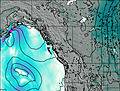
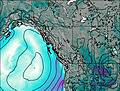
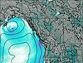
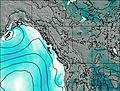
This table gives the weather forecast for Iconoclast Mountain at the specific elevation of 2500 m. Our advanced weather models allow us to provide distinct weather forecasts for several elevations of Iconoclast Mountain. To see the weather forecasts for the other elevations, use the tab navigation above the table. For a wider overview of the weather, consult the Weather Map of British-Columbia.
| Weather Station | Temp. | Weather | Wind | Gusts | Cloud / Visibility |
|---|---|---|---|---|---|
Revelstoke Airport | |||||
Revelstoke A- BC (71685 -0) | |||||
Golden Airport | |||||
Mount 7 | |||||
Yoho Park- BC | |||||
Blue River Airport | |||||
Blue River Cs- BC | |||||
Salmon Arm Airport | |||||
Salmon Arm Cs- BC |
* NOTE: not all weather observatories update at the same frequency which is the reason why some locations may show data from stations that are further away than known closer ones.