
– Lat/Long: 51.43° N 117.85° W
 Iconoclast Mountain
Weather Forecast, CanadaIssued: 5 am Tue 28 Jul Local TimeUpdates in: hr min sUpdate imminent
Issued: 5 am Tue 28 Jul Local Time
Updates in:
Update imminent hr min s

Issued: 5 am Tue 28 Jul Local Time
Updates in:
Update imminent hr min s
Days 1–3 Weather SummaryLight rain (total 5mm), mostly falling on Tue afternoon. Mild temperatures (max 9°C on Thu afternoon, min 3°C on Tue night). Winds decreasing (fresh winds from the SSW on Tue afternoon, light winds from the SW by Wed afternoon). | Days 4–6 Weather SummaryLight rain (total 7mm) at first, then becoming colder with a dusting of snow on Sat night. Freeze-thaw conditions (max 11°C on Fri night, min -4°C on Sun morning). Winds decreasing (strong winds from the SW on Sat night, light winds from the W by Sun night). | ||||||||||||||||||||
Tuesday 28 | Wednesday 29 | Thursday 30 | Friday 31 | Saturday 1 | Sunday 2 | Monday 3 | |||||||||||||||
AM | PM | night | AM | PM | night | AM | PM | night | AM | PM | night | AM | PM | night | AM | PM | night | AM | PM | night | |
rain shwrs | rain shwrs | rain shwrs | clear | some clouds | some clouds | clear | clear | clear | clear | clear | clear | some clouds | risk tstorm | snow shwrs | snow shwrs | some clouds | some clouds | some clouds | some clouds | clear | |
Cloud base (m) | 2900 | 9150 | 6900 | 7000 | 9350 | 4850 | 4650 | 3200 | 3250 | 2500 | 2500 | 2800 | 2850 | 3150 | 3550 | ||||||
km/h | |||||||||||||||||||||
 |  |  |  |  |  |  | |||||||||||||||
— | — | — | — | — | — | — | — | — | — | — | — | — | — | 1 | 1 | — | — | — | — | — | |
mm | 0.2 | 5 | 0.6 | — | — | — | — | — | — | — | — | — | — | 7 | — | — | — | — | — | — | — |
max °C | 5 | 4 | 4 | 3 | 5 | 7 | 7 | 9 | 9 | 8 | 10 | 11 | 9 | 5 | 1 | -3 | -2 | -2 | -1 | 3 | 3 |
min °C | 4 | 4 | 3 | 3 | 4 | 6 | 7 | 8 | 8 | 8 | 9 | 9 | 8 | 3 | -3 | -4 | -2 | -3 | -2 | 1 | 3 |
chill °C | -1 | -1 | 0 | -1 | 1 | 4 | 5 | 6 | 5 | 5 | 7 | 6 | 4 | -2 | -9 | -10 | -8 | -6 | -4 | 1 | 3 |
Freezing level m | 3700 | 3600 | 3600 | 3500 | 3650 | 4000 | 4050 | 4200 | 4400 | 4250 | 4300 | 4550 | 4250 | 3700 | 2900 | 2500 | 2750 | 2700 | 2700 | 3150 | 3400 |
6:09 | — | — | 6:09 | — | — | 6:11 | — | — | 6:13 | — | — | 6:13 | — | — | 6:16 | — | — | 6:16 | — | — | |
— | — | 9:45 | — | — | 9:44 | — | — | 9:42 | — | — | 9:40 | — | — | 9:38 | — | — | 9:37 | — | — | 9:36 | |
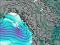
Iconoclast Mountain Weather (Days 0-3):
The weather forecast for Iconoclast Mountain is: Light rain (total 5mm), mostly falling on Tue afternoon. Mild temperatures (max 9°C on Thu afternoon, min 3°C on Tue night). Winds decreasing (fresh winds from the SSW on Tue afternoon, light winds from the SW by Wed afternoon).
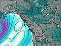
Iconoclast Mountain Weather (Days 3-6):
Light rain (total 7mm) at first, then becoming colder with a dusting of snow on Sat night. Freeze-thaw conditions (max 11°C on Fri night, min -4°C on Sun morning). Winds decreasing (strong winds from the SW on Sat night, light winds from the W by Sun night).
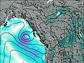
Iconoclast Mountain Weather (Days 6-9):
Mostly dry. Freeze-thaw conditions (max 12°C on Wed night, min -2°C on Mon morning). Wind will be generally light.
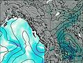
This table gives the weather forecast for Iconoclast Mountain at the specific elevation of 3000 m. Our advanced weather models allow us to provide distinct weather forecasts for several elevations of Iconoclast Mountain. To see the weather forecasts for the other elevations, use the tab navigation above the table. For a wider overview of the weather, consult the Weather Map of British-Columbia.
| Weather Station | Temp. | Weather | Wind | Gusts | Cloud / Visibility |
|---|---|---|---|---|---|
Revelstoke Airport | |||||
Revelstoke A- BC (71685 -0) | |||||
Golden Airport | |||||
Mount 7 | |||||
Yoho Park- BC | |||||
Blue River Airport | |||||
Blue River Cs- BC | |||||
Salmon Arm Airport | |||||
Salmon Arm Cs- BC |
* NOTE: not all weather observatories update at the same frequency which is the reason why some locations may show data from stations that are further away than known closer ones.