– Lat/Long: 64.02° N 16.68° W
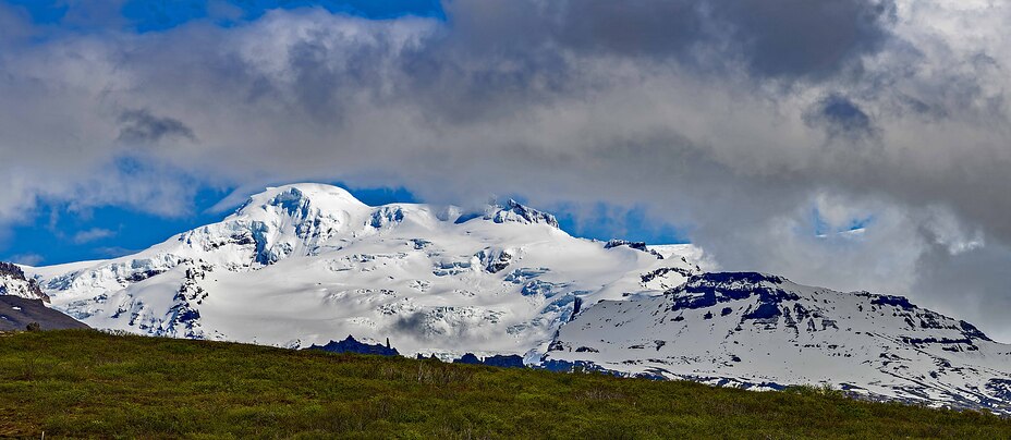
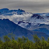
 Hvannadalshnukur
Weather Forecast, IcelandIssued: 11 am Mon 03 Aug Local TimeUpdates in: hr min sUpdate imminent
Issued: 11 am Mon 03 Aug Local Time
Updates in:
Update imminent hr min s

Issued: 11 am Mon 03 Aug Local Time
Updates in:
Update imminent hr min s
Days 1–3 Weather SummaryMostly dry. Mild temperatures (max 5°C on Mon night, min 2°C on Mon morning). Wind will be generally light. | Days 4–6 Weather SummaryHeavy rain (total 76mm), mostly on Fri morning. Becoming colder with a light covering of snow, mostly falling on Fri night. Temperatures will be slightly above freezing (max 4°C on Thu morning, min 1°C on Sat night). Wind will be generally light. | |||||||||||||||||
Monday 3 | Tuesday 4 | Wednesday 5 | Thursday 6 | Friday 7 | Saturday 8 | |||||||||||||
AM | PM | night | AM | PM | night | AM | PM | night | AM | PM | night | AM | PM | night | AM | PM | night | |
some clouds | clear | clear | clear | clear | some clouds | some clouds | some clouds | clear | light rain | light rain | heavy rain | heavy rain | heavy rain | light snow | light snow | some clouds | some clouds | |
Cloud base (m) | 1700 | 1700 | 2050 | 2250 | 1850 | 9100 | 5800 | 600 | 1700 | 500 | 450 | 400 | 400 | 450 | 450 | 1450 | 850 | |
km/h | ||||||||||||||||||
 |  |  |  |  |  | |||||||||||||
— | — | — | — | — | — | — | — | — | — | — | — | — | — | 5 | 1 | — | — | |
mm | — | — | — | — | — | — | — | — | — | 0.1 | 3 | 24 | 18 | 20 | 11 | 0.2 | — | — |
max °C | 3 | 3 | 5 | 5 | 5 | 5 | 5 | 4 | 5 | 4 | 3 | 4 | 3 | 4 | 2 | 3 | 3 | 2 |
min °C | 2 | 3 | 4 | 4 | 5 | 5 | 5 | 4 | 5 | 3 | 3 | 3 | 3 | 3 | 2 | 2 | 3 | 1 |
chill °C | -2 | 0 | 2 | 4 | 4 | 4 | 2 | 2 | 3 | -1 | -2 | -1 | -1 | 1 | -1 | -3 | -2 | -2 |
Freezing level m | 1900 | 2000 | 2100 | 2250 | 2350 | 2450 | 2550 | 2650 | 2650 | 2200 | 2050 | 2100 | 2050 | 2100 | 1900 | 1850 | 2000 | 1800 |
4:20 | — | — | 4:22 | — | — | 4:26 | — | — | 4:30 | — | — | 4:33 | — | — | 4:35 | — | — | |
— | — | 10:01 | — | — | 9:59 | — | — | 9:55 | — | — | 9:52 | — | — | 9:49 | — | — | 9:45 | |
Loading...
Hvannadalshnukur Weather (Days 0-3):
The weather forecast for Hvannadalshnukur is: Mostly dry. Mild temperatures (max 5°C on Mon night, min 2°C on Mon morning). Wind will be generally light.
Hvannadalshnukur Weather (Days 3-6):
Heavy rain (total 76mm), mostly on Fri morning. Becoming colder with a light covering of snow, mostly falling on Fri night. Temperatures will be slightly above freezing (max 4°C on Thu morning, min 1°C on Sat night). Wind will be generally light.
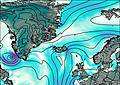
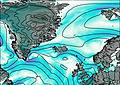
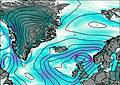
This table gives the weather forecast for Hvannadalshnukur at the specific elevation of 1500 m. Our advanced weather models allow us to provide distinct weather forecasts for several elevations of Hvannadalshnukur. To see the weather forecasts for the other elevations, use the tab navigation above the table. For a wider overview of the weather, consult the Weather Map of Iceland.
| Weather Station | Temp. | Weather | Wind | Gusts | Cloud / Visibility |
|---|---|---|---|---|---|
ASCATB344E64N | |||||
Hofn | |||||
Hjardarnes Horna | |||||
ASCATB345E64N | |||||
Skardsfjoruviti | |||||
ASCATB346E64N | |||||
ASCATB343E63N | |||||
ASCATB344E63N | |||||
ASCATB347E64N |
* NOTE: not all weather observatories update at the same frequency which is the reason why some locations may show data from stations that are further away than known closer ones.
Hvannadalshnukur Photos
View all
Iceland photos (9) |
Atlantic Islands photos (85) |
photos from mountains in Iceland (29) |
all photos
 Upload new photo
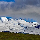
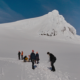
Hvannadalshnjúkur in May
Hvannadalshnjúkur in summer
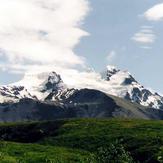
Hvannadalshnukur south face
Hvannadalshnukur