– Lat/Long: 35.35° N 111.68° W
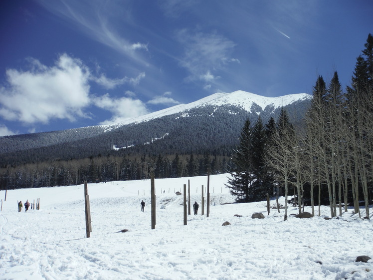
 Humphreys Peak
Weather Forecast, United StatesIssued: 10 am Sun 02 Aug Local TimeUpdates in: hr min sUpdate imminent
Issued: 10 am Sun 02 Aug Local Time
Updates in:
Update imminent hr min s

Issued: 10 am Sun 02 Aug Local Time
Updates in:
Update imminent hr min s
Days 1–3 Weather SummaryMostly dry. Very mild (max 15°C on Sun afternoon, min 11°C on Mon night). Winds increasing (light winds from the W on Sun morning, fresh winds from the W by Mon morning). | Days 4–6 Weather SummaryLight rain (total 8mm), mostly falling on Thu afternoon. Very mild (max 14°C on Wed afternoon, min 11°C on Thu afternoon). Winds decreasing (fresh winds from the WNW on Wed night, calm by Thu afternoon). | |||||||||||||||||
Sunday 2 | Monday 3 | Tuesday 4 | Wednesday 5 | Thursday 6 | Friday 7 | |||||||||||||
AM | PM | night | AM | PM | night | AM | PM | night | AM | PM | night | AM | PM | night | AM | PM | night | |
some clouds | some clouds | clear | clear | some clouds | clear | clear | some clouds | clear | clear | rain shwrs | rain shwrs | some clouds | mod. rain | some clouds | clear | rain shwrs | risk tstorm | |
Cloud base (m) | 5750 | 5550 | 5550 | 6200 | 5550 | 5650 | 5650 | 5750 | 5450 | 6150 | 5650 | 5100 | 8750 | 5750 | 9150 | |||
km/h | ||||||||||||||||||
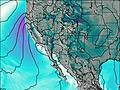 | 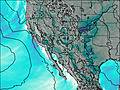 | 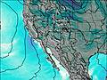 |  |  |  | |||||||||||||
— | — | — | — | — | — | — | — | — | — | — | — | — | — | — | — | — | — | |
mm | — | — | — | — | — | — | — | — | — | — | 0.1 | 0.4 | — | 7 | — | — | 0.1 | 0.2 |
max °C | 14 | 15 | 14 | 13 | 15 | 14 | 13 | 15 | 14 | 12 | 14 | 13 | 13 | 12 | 13 | 12 | 14 | 14 |
min °C | 14 | 15 | 13 | 13 | 14 | 11 | 12 | 14 | 12 | 12 | 13 | 12 | 12 | 11 | 12 | 12 | 14 | 13 |
chill °C | 13 | 14 | 10 | 10 | 12 | 8 | 10 | 12 | 9 | 10 | 11 | 9 | 10 | 11 | 10 | 12 | 13 | 11 |
Freezing level m | 5750 | 5850 | 5700 | 5700 | 5750 | 5500 | 5600 | 5750 | 5500 | 5500 | 5600 | 5450 | 5450 | 5350 | 5450 | 5400 | 5500 | 5500 |
5:35 | — | — | 5:37 | — | — | 5:37 | — | — | 5:37 | — | — | 5:39 | — | — | 5:39 | — | — | |
— | 7:29 | — | — | 7:28 | — | — | 7:27 | — | — | 7:25 | — | — | 7:24 | — | — | 7:23 | — | |
Loading...
Humphreys Peak Weather (Days 0-3):
The weather forecast for Humphreys Peak is: Mostly dry. Very mild (max 15°C on Sun afternoon, min 11°C on Mon night). Winds increasing (light winds from the W on Sun morning, fresh winds from the W by Mon morning).
Humphreys Peak Weather (Days 3-6):
Light rain (total 8mm), mostly falling on Thu afternoon. Very mild (max 14°C on Wed afternoon, min 11°C on Thu afternoon). Winds decreasing (fresh winds from the WNW on Wed night, calm by Thu afternoon).
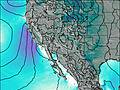
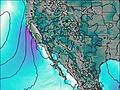
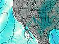
This table gives the weather forecast for Humphreys Peak at the specific elevation of 3851 m. Our advanced weather models allow us to provide distinct weather forecasts for several elevations of Humphreys Peak. To see the weather forecasts for the other elevations, use the tab navigation above the table. For a wider overview of the weather, consult the Weather Map of Arizona.
| Weather Station | Temp. | Weather | Wind | Gusts | Cloud / Visibility |
|---|---|---|---|---|---|
Elden - AZHPA | |||||
Flagstaff Airport | |||||
* NOTE: not all weather observatories update at the same frequency which is the reason why some locations may show data from stations that are further away than known closer ones.
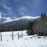
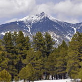
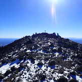
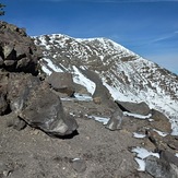
Humphreys Peak Photos
View all
Colorado Plateau photos (25) |
Intermountain West photos (151) |
photos from mountains in United States (3056) |
all photos
 Upload new photo
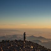


 See 15 more Humphreys Peak photos
Humphreys Peak
Humphrey's Peak
Trail crew all Native American. Ran into this great crew on trek up Humphreys Peak. Trail crew takes care of trails in New Mexico, Colorado, and Arizona specifically on Indian reservation land.
Humphreys Peak
My first trip to Humphreys Peak
Humphreys Peak