– Lat/Long: 9.03° S 77.68° W
 Huandoy
Weather Forecast, PeruIssued: 6 am Mon 03 Aug Local TimeUpdates in: hr min sUpdate imminent
Issued: 6 am Mon 03 Aug Local Time
Updates in:
Update imminent hr min s

Issued: 6 am Mon 03 Aug Local Time
Updates in:
Update imminent hr min s
Days 1–3 Weather SummaryA light covering of new snow mostly falling on Wed afternoon. Temperatures will be well below freezing (max -6°C on Mon morning, min -8°C on Mon night). Winds increasing (calm on Tue afternoon, fresh winds from the E by Wed night). | Days 4–6 Weather SummaryA dusting of new snow. Temperatures will be well below freezing (max -6°C on Thu morning, min -10°C on Fri night). Mainly fresh winds. | |||||||||||||||||
Monday 3 | Tuesday 4 | Wednesday 5 | Thursday 6 | Friday 7 | Saturday 8 | |||||||||||||
AM | PM | night | AM | PM | night | AM | PM | night | AM | PM | night | AM | PM | night | AM | PM | night | |
clear | some clouds | some clouds | some clouds | snow shwrs | snow shwrs | some clouds | snow shwrs | snow shwrs | clear | snow shwrs | clear | clear | clear | clear | some clouds | snow shwrs | clear | |
Cloud base (m) | 5900 | 5050 | 5050 | 5250 | 5100 | 5150 | 5500 | 5100 | 5200 | 5800 | 5400 | 5400 | ||||||
km/h | ||||||||||||||||||
 |  |  |  |  |  | |||||||||||||
— | — | — | — | 2 | 1 | — | 3 | 1 | — | 1 | — | — | — | — | — | 2 | — | |
mm | — | — | — | — | — | — | — | — | — | — | — | — | — | — | — | — | — | — |
max °C | -6 | -7 | -7 | -6 | -7 | -7 | -6 | -6 | -7 | -6 | -6 | -6 | -6 | -6 | -7 | -7 | -7 | -8 |
min °C | -7 | -7 | -8 | -7 | -7 | -8 | -7 | -7 | -7 | -6 | -7 | -8 | -7 | -7 | -10 | -8 | -7 | -9 |
chill °C | -13 | -11 | -12 | -11 | -7 | -14 | -15 | -15 | -16 | -14 | -15 | -17 | -16 | -16 | -20 | -16 | -13 | -17 |
Freezing level m | 5300 | 5450 | 5050 | 5300 | 5450 | 5150 | 5400 | 5450 | 5150 | 5400 | 5550 | 5200 | 5350 | 5550 | 5050 | 5250 | 5350 | 4950 |
6:24 | — | — | 6:24 | — | — | 6:24 | — | — | 6:22 | — | — | 6:22 | — | — | 6:22 | — | — | |
— | 6:08 | — | — | 6:08 | — | — | 6:08 | — | — | 6:08 | — | — | 6:08 | — | — | 6:08 | — | |
Loading...
Huandoy Weather (Days 0-3):
The weather forecast for Huandoy is: A light covering of new snow mostly falling on Wed afternoon. Temperatures will be well below freezing (max -6°C on Mon morning, min -8°C on Mon night). Winds increasing (calm on Tue afternoon, fresh winds from the E by Wed night).
Huandoy Weather (Days 3-6):
A dusting of new snow. Temperatures will be well below freezing (max -6°C on Thu morning, min -10°C on Fri night). Mainly fresh winds.
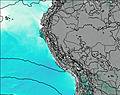
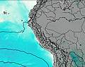
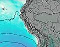
This table gives the weather forecast for Huandoy at the specific elevation of 6395 m. Our advanced weather models allow us to provide distinct weather forecasts for several elevations of Huandoy. To see the weather forecasts for the other elevations, use the tab navigation above the table. For a wider overview of the weather, consult the Weather Map of Peru.
| Weather Station | Temp. | Weather | Wind | Gusts | Cloud / Visibility |
|---|---|---|---|---|---|
Huaraz Ant / omandante FAP Germán Arias Graziani Airport | |||||
ASCATB282E10S | |||||
Trujillo Airport | |||||
Tingo Maria Airport | |||||
ASCATB281E9S | |||||
ASCATB281E8S | |||||
ASCATB280E8S | |||||
* NOTE: not all weather observatories update at the same frequency which is the reason why some locations may show data from stations that are further away than known closer ones.
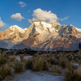
Huandoy Photos
View all
Peruvian Andes photos (92) |
Andes photos (1029) |
photos from mountains in Peru (109) |
all photos
 Upload new photo
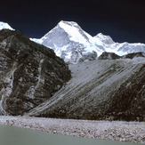
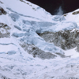


 See 9 more Huandoy photos
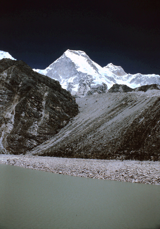
Huandoy from Laguna Parón
Huandoy North West Wall
Los Huandoy
Pico sur del Huandoy
3 Picos del Huandoy
Huandoy
Huandoy West Peak