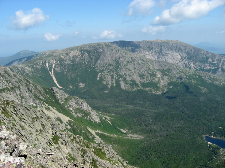
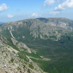
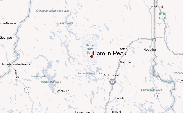
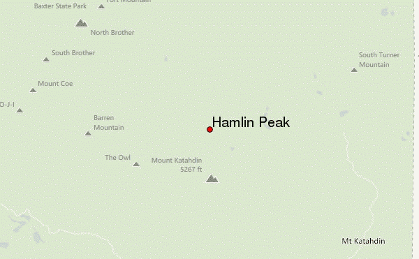
Three of us submitted Hamlin last Saturday, Feb 17. We started out of our lean-to down in Roaring Brook. Our intent was to tag Hamlin, proceed to Katahdin, South Peak, Knife Edge, Pamola then down via Helon Trail, however we didn't leave Roaring Brook until 7:30am.
We arrived at Chimney Pond around 9:15am and after speaking with Greg, the Ranger assigned to Chimney who we'd spoken too twice down at Roaring Brook about our planned route, determined we probably weren't going to make the full route given our late departure. He indicated, and we agreed to, if we were only standing on Hamlin by 1pm and not any further, we should return via the same route.
Our original route was to take the N. Basic Cutoff after crossing the frozen Basin Pond, however we missed it and continued to Chimney. Not a huge issue as we picked up North Basin just before Chimney. This trail hadn't been used in a few days. Greg indicated we'd be most likely breaking trail. It was obvious where the trail was as it was packed down but with a fair amount of fresh powder. There was flagging tape in tree branches as well to guide us.
It's a relatively steep, winding trail. We donned snowshoes just as we broke out of treeline. At that point in the morning, approximately 10am, one could've either had snowshoes or crampons. The snow was quite hard with only a few post holes by one in our team who didn't donn snowshoes right away. The pitch is quite steep for the first .5 mile out of treeline. We used trekking poles the entire way up but it's exposed as you break from treeline so an ice axe would also be useful for arresting a slip.
Further up, the terrain becomes a mix of hard snow and rock, totally doable with crampons with slow steady progress. We reached Hamlin Peak around noon with bluebird, clear skies and steady winds. At that point even though we'd beat the 1pm turnaround, I felt not strong enough to complete the full route safely after the 13 mile ski/pulk in the day before, so we turned around and came back the same route.
Things we will change next year for this attempt:
1 - Leave a rest day in between the ski/pulk in and the summit attempt
2 - Either pack lighter for the pulk or secure one of the cabins so as not requiring a four season tent, extra clothing, etc.
3 - True alpine start by 4am if we leave from Roaring Brook
4 - Consider pulking in all the way to Chimney Pond so right at trailhead for summit attempt
If you are pulking like the vast majority of folks in Winter, the trail from Roaring Brook to Chimney, you'll need to switch from skis to snowshoes as the grade become much too steep in various sections to ski/herringbone up. The grade is MUCH steeper than sections you'll ski up on Park Tote or Roaring Brook roads.
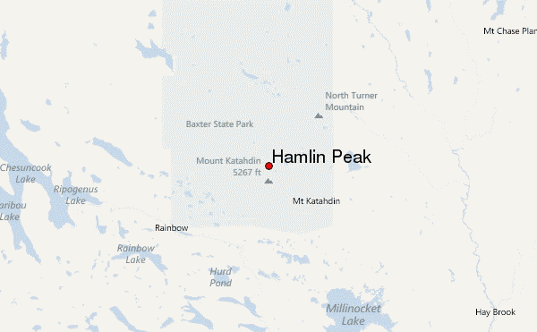
 Hamlin Peak – Climbing, Hiking & Mountaineering information