
– Lat/Long: 43.33° N 5.55° E
 Garlaban
Weather Forecast, FranceIssued: 7 pm Wed 01 Jul Local TimeUpdates in: hr min sUpdate imminent
Issued: 7 pm Wed 01 Jul Local Time
Updates in:
Update imminent hr min s

Issued: 7 pm Wed 01 Jul Local Time
Updates in:
Update imminent hr min s
Days 1–4 Weather SummaryMostly dry. Warm (max 33°C on Thu afternoon, min 24°C on Wed night). Winds decreasing (strong winds from the NNW on Wed night, calm by Thu night). | Days 5–7 Weather SummaryMostly dry. Warm (max 32°C on Sun afternoon, min 24°C on Sun night). Wind will be generally light. | ||||||||||||||||||
Thursday 2 | Friday 3 | Saturday 4 | Sunday 5 | Monday 6 | Tuesday 7 | ||||||||||||||
night | AM | PM | night | AM | PM | night | AM | PM | night | AM | PM | night | AM | PM | night | AM | PM | night | |
clear | clear | clear | clear | clear | clear | clear | clear | clear | clear | clear | clear | clear | clear | clear | clear | clear | clear | clear | |
km/h | |||||||||||||||||||
 |  |  |  |  |  |  | |||||||||||||
— | — | — | — | — | — | — | — | — | — | — | — | — | — | — | — | — | — | — | |
mm | — | — | — | — | — | — | — | — | — | — | — | — | — | — | — | — | — | — | — |
max °C | 30 | 29 | 33 | 32 | 30 | 33 | 31 | 31 | 32 | 31 | 30 | 32 | 29 | 30 | 31 | 29 | 29 | 31 | 29 |
min °C | 24 | 24 | 32 | 25 | 26 | 32 | 25 | 26 | 32 | 25 | 27 | 31 | 24 | 26 | 31 | 25 | 26 | 30 | 25 |
chill °C | 24 | 24 | 32 | 25 | 26 | 32 | 25 | 26 | 32 | 25 | 27 | 31 | 24 | 26 | 31 | 25 | 26 | 30 | 25 |
Freezing level m | 4600 | 4300 | 4300 | 4350 | 4350 | 4300 | 4600 | 4350 | 4300 | 4500 | 4300 | 4450 | 4550 | 4450 | 4300 | 4500 | 4550 | 4550 | 4750 |
Cloud base (m) | 9450 | 9350 | 9700 | ||||||||||||||||
— | 6:01 | — | — | 6:01 | — | — | 6:01 | — | — | 6:03 | — | — | 6:03 | — | — | 6:03 | — | — | |
— | — | — | 9:21 | — | — | 9:21 | — | — | 9:21 | — | — | 9:21 | — | — | 9:20 | — | — | 9:20 | |
Loading...
Garlaban Weather (Days 0-3):
The weather forecast for Garlaban is: Mostly dry. Warm (max 33°C on Thu afternoon, min 24°C on Wed night). Winds decreasing (strong winds from the NNW on Wed night, calm by Thu night).
Garlaban Weather (Days 3-6):
Mostly dry. Warm (max 32°C on Sun afternoon, min 24°C on Sun night). Wind will be generally light.
This table gives the weather forecast for Garlaban at the specific elevation of 0 m. Our advanced weather models allow us to provide distinct weather forecasts for several elevations of Garlaban. To see the weather forecasts for the other elevations, use the tab navigation above the table. For a wider overview of the weather, consult the Weather Map of France.
| Weather Station | Temp. | Weather | Wind | Gusts | Cloud / Visibility |
|---|---|---|---|---|---|
AMS PR | |||||
Marignane | |||||
1676 | |||||
Acpm83 | |||||
* NOTE: not all weather observatories update at the same frequency which is the reason why some locations may show data from stations that are further away than known closer ones.
Garlaban Photos
View all
Maritime Alps photos (29) |
Alps photos (1484) |
photos from mountains in France (301) |
all photos
 Upload new photo
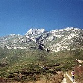
Garlaban