
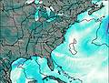
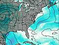
– Lat/Long: 36.33° N 81.68° W
 Elk Knob (Watauga County, North Carolina)
Weather Forecast, United StatesIssued: 1 am Mon 03 Aug Local TimeUpdates in: hr min sUpdate imminent
Issued: 1 am Mon 03 Aug Local Time
Updates in:
Update imminent hr min s

Issued: 1 am Mon 03 Aug Local Time
Updates in:
Update imminent hr min s
Days 1–3 Weather SummaryModerate rain (total 16mm), heaviest on Mon afternoon. Very mild (max 17°C on Mon afternoon, min 15°C on Mon morning). Winds increasing (calm on Mon morning, fresh winds from the S by Wed night). | Days 4–6 Weather SummaryHeavy rain (total 20mm), heaviest during Fri night. Warm (max 20°C on Sat afternoon, min 17°C on Thu morning). Winds decreasing (fresh winds from the SSW on Thu night, calm by Sat night). | |||||||||||||||||
Monday 3 | Tuesday 4 | Wednesday 5 | Thursday 6 | Friday 7 | Saturday 8 | |||||||||||||
AM | PM | night | AM | PM | night | AM | PM | night | AM | PM | night | AM | PM | night | AM | PM | night | |
rain shwrs | risk tstorm | risk tstorm | rain shwrs | risk tstorm | rain shwrs | rain shwrs | risk tstorm | risk tstorm | rain shwrs | risk tstorm | risk tstorm | rain shwrs | risk tstorm | rain shwrs | some clouds | rain shwrs | rain shwrs | |
Cloud base (m) | 800 | 700 | 1900 | 750 | 1600 | 2150 | 5100 | 4850 | 2050 | 4150 | 4800 | 2250 | 4800 | |||||
km/h | ||||||||||||||||||
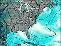 | 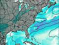 | 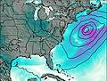 | 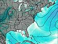 |  |  | |||||||||||||
— | — | — | — | — | — | — | — | — | — | — | — | — | — | — | — | — | — | |
mm | 0.1 | 4 | 2 | 0.6 | 1.7 | 1.8 | 0.3 | 3 | 1.4 | 1.2 | 5 | 3 | 1.1 | 4 | 4 | — | 0.5 | 3 |
max °C | 16 | 17 | 17 | 16 | 16 | 16 | 15 | 17 | 17 | 17 | 19 | 18 | 18 | 18 | 18 | 18 | 20 | 19 |
min °C | 15 | 17 | 17 | 16 | 16 | 15 | 15 | 17 | 17 | 17 | 17 | 18 | 17 | 17 | 18 | 18 | 20 | 19 |
chill °C | 15 | 17 | 17 | 15 | 15 | 14 | 14 | 16 | 16 | 16 | 17 | 18 | 17 | 16 | 18 | 18 | 20 | 19 |
Freezing level m | 4600 | 4550 | 4500 | 4600 | 4700 | 4650 | 4650 | 4700 | 4800 | 4650 | 4600 | 4700 | 4550 | 4550 | 4650 | 4600 | 4650 | 4750 |
6:33 | — | — | 6:35 | — | — | 6:35 | — | — | 6:37 | — | — | 6:37 | — | — | 6:37 | — | — | |
— | — | 8:30 | — | — | 8:29 | — | — | 8:28 | — | — | 8:27 | — | — | 8:25 | — | — | 8:24 | |
Loading...
Elk Knob (Watauga County, North Carolina) Weather (Days 0-3):
The weather forecast for Elk Knob (Watauga County, North Carolina) is: Moderate rain (total 16mm), heaviest on Mon afternoon. Very mild (max 17°C on Mon afternoon, min 15°C on Mon morning). Winds increasing (calm on Mon morning, fresh winds from the S by Wed night).
Elk Knob (Watauga County, North Carolina) Weather (Days 3-6):
Heavy rain (total 20mm), heaviest during Fri night. Warm (max 20°C on Sat afternoon, min 17°C on Thu morning). Winds decreasing (fresh winds from the SSW on Thu night, calm by Sat night).
This table gives the weather forecast for Elk Knob (Watauga County, North Carolina) at the specific elevation of 1688 m. Our advanced weather models allow us to provide distinct weather forecasts for several elevations of Elk Knob (Watauga County, North Carolina). To see the weather forecasts for the other elevations, use the tab navigation above the table. For a wider overview of the weather, consult the Weather Map of North-Carolina.