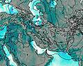
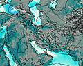
– Lat/Long: 36.89° N 49.70° E
 Dorfak
Weather Forecast, IranIssued: 2 pm Mon 03 Aug Local TimeUpdates in: hr min sUpdate imminent
Issued: 2 pm Mon 03 Aug Local Time
Updates in:
Update imminent hr min s

Issued: 2 pm Mon 03 Aug Local Time
Updates in:
Update imminent hr min s
Days 1–4 Weather SummaryMostly dry. Warm (max 24°C on Wed morning, min 16°C on Wed night). Wind will be generally light. | Days 5–7 Weather SummaryMostly dry. Warm (max 25°C on Sun morning, min 16°C on Thu night). Wind will be generally light. | ||||||||||||||||
Mon 3 | Tuesday 4 | Wednesday 5 | Thursday 6 | Friday 7 | Saturday 8 | ||||||||||||
PM | night | AM | PM | night | AM | PM | night | AM | PM | night | AM | PM | night | AM | PM | night | |
clear | clear | clear | clear | clear | clear | clear | some clouds | clear | clear | some clouds | clear | clear | some clouds | clear | clear | some clouds | |
Cloud base (m) | 5500 | 750 | 1800 | 4950 | 5500 | 5500 | 5550 | 5200 | 5900 | 5800 | |||||||
km/h | |||||||||||||||||
 |  |  |  |  |  | ||||||||||||
— | — | — | — | — | — | — | — | — | — | — | — | — | — | — | — | — | |
mm | — | — | — | — | — | — | — | — | — | — | — | — | — | — | — | — | — |
max °C | 21 | 18 | 22 | 23 | 21 | 24 | 24 | 20 | 21 | 20 | 17 | 21 | 21 | 18 | 23 | 23 | 20 |
min °C | 19 | 18 | 20 | 21 | 20 | 22 | 21 | 16 | 18 | 18 | 16 | 18 | 19 | 18 | 20 | 21 | 19 |
chill °C | 19 | 18 | 20 | 21 | 20 | 22 | 21 | 16 | 18 | 18 | 16 | 18 | 19 | 18 | 20 | 21 | 19 |
Freezing level m | 5300 | 5300 | 5300 | 5450 | 5550 | 5500 | 5700 | 5800 | 5600 | 5600 | 5300 | 5250 | 5250 | 5400 | 5300 | 5550 | 5550 |
— | — | 5:18 | — | — | 5:18 | — | — | 5:20 | — | — | 5:20 | — | — | 5:22 | — | — | |
7:15 | — | — | 7:15 | — | — | 7:14 | — | — | 7:13 | — | — | 7:12 | — | — | 7:10 | — | |
Loading...
Dorfak Weather (Days 0-3):
The weather forecast for Dorfak is: Mostly dry. Warm (max 24°C on Wed morning, min 16°C on Wed night). Wind will be generally light.
Dorfak Weather (Days 3-6):
Mostly dry. Warm (max 25°C on Sun morning, min 16°C on Thu night). Wind will be generally light.
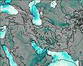
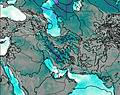
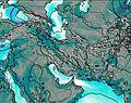
This table gives the weather forecast for Dorfak at the specific elevation of 1500 m. Our advanced weather models allow us to provide distinct weather forecasts for several elevations of Dorfak. To see the weather forecasts for the other elevations, use the tab navigation above the table. For a wider overview of the weather, consult the Weather Map of Iran.
| Weather Station | Temp. | Weather | Wind | Gusts | Cloud / Visibility |
|---|---|---|---|---|---|
Rasht Airport | |||||
Ghazvin Airport | |||||
Ramsar Airport | |||||
Zanjan Airport | |||||
Noshahr Airport | |||||
Kara / ayam Airport | |||||
Ardabil Airport | |||||
Tehra / ehrabad Airport | |||||
Tehran Imam Khomeini International Airport | |||||
Lenkoran Airport |
* NOTE: not all weather observatories update at the same frequency which is the reason why some locations may show data from stations that are further away than known closer ones.
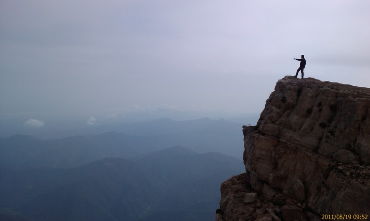
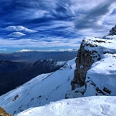
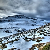
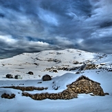
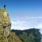
Dorfak Photos
View all
photos (8580) |
Alborz photos (8620) |
photos from mountains in Iran (11849) |
all photos
 Upload new photo
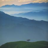
 See 175 more Dorfak photos
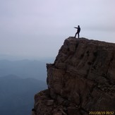
naser ramezani dorfak
North wall
hossein fallah.91/09/14
hossein fallah.91/09/14
hossein fallah.91/09/14
hossein fallah.91/09/14
BEST LOCATION FOR VIEWING GILAN