– Lat/Long: 46.10° N 7.85° E
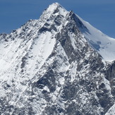
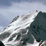
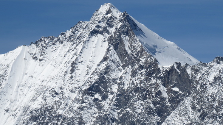
 Dom
Dom
Weather Forecast, SwitzerlandIssued: 1 pm Mon 03 Aug Local TimeUpdates in: hr min sUpdate imminent
Issued: 1 pm Mon 03 Aug Local Time
Updates in:
Update imminent hr min s

Issued: 1 pm Mon 03 Aug Local Time
Updates in:
Update imminent hr min s
Days 1–4 Weather SummaryHeavy rain (total 30mm), heaviest during Wed night. Temperatures will be slightly above freezing (max 4°C on Wed afternoon, min 2°C on Mon night). Wind will be generally light. | Days 5–7 Weather SummaryMild at first with light rain (total 9mm) on Thu afternoon followed by colder weather and light fall of snow, heaviest on Thu night. Temperatures will be slightly above freezing (max 3°C on Thu afternoon, min 1°C on Thu night). Wind will be generally light. | ||||||||||||||||
Mon 3 | Tuesday 4 | Wednesday 5 | Thursday 6 | Friday 7 | Saturday 8 | ||||||||||||
PM | night | AM | PM | night | AM | PM | night | AM | PM | night | AM | PM | night | AM | PM | night | |
risk tstorm | risk tstorm | clear | risk tstorm | rain shwrs | clear | rain shwrs | rain shwrs | clear | risk tstorm | snow shwrs | clear | snow shwrs | snow shwrs | clear | rain shwrs | rain shwrs | |
Cloud base (m) | 4000 | 4850 | 4650 | 4350 | 3900 | 2850 | 3700 | ||||||||||
km/h | |||||||||||||||||
 |  |  |  |  |  | ||||||||||||
— | — | — | — | — | — | — | — | — | — | 7 | — | 2 | 1 | — | — | — | |
mm | 3 | 3 | — | 3 | 4 | — | 3 | 13 | — | 5 | — | — | — | — | — | 3 | 1 |
max °C | 3 | 3 | 2 | 3 | 3 | 3 | 4 | 3 | 2 | 3 | 1 | 1 | 2 | 2 | 2 | 3 | 3 |
min °C | 3 | 2 | 2 | 3 | 3 | 2 | 3 | 2 | 2 | 2 | 1 | 1 | 1 | 1 | 1 | 2 | 2 |
chill °C | 0 | -2 | -2 | -1 | 0 | 1 | 2 | 2 | 0 | -1 | -2 | -2 | -3 | -3 | -3 | -2 | -1 |
Freezing level m | 4500 | 4400 | 4350 | 4500 | 4450 | 4400 | 4500 | 4450 | 4350 | 4400 | 4200 | 4150 | 4300 | 4200 | 4250 | 4450 | 4350 |
— | — | 6:13 | — | — | 6:13 | — | — | 6:15 | — | — | 6:16 | — | — | 6:18 | — | — | |
— | 8:55 | — | — | 8:54 | — | — | 8:52 | — | — | 8:52 | — | — | 8:50 | — | — | 8:49 | |
Loading...
Dom Weather (Days 0-3):
The weather forecast for Dom is: Heavy rain (total 30mm), heaviest during Wed night. Temperatures will be slightly above freezing (max 4°C on Wed afternoon, min 2°C on Mon night). Wind will be generally light.
Dom Weather (Days 3-6):
Mild at first with light rain (total 9mm) on Thu afternoon followed by colder weather and light fall of snow, heaviest on Thu night. Temperatures will be slightly above freezing (max 3°C on Thu afternoon, min 1°C on Thu night). Wind will be generally light.
This table gives the weather forecast for Dom at the specific elevation of 4000 m. Our advanced weather models allow us to provide distinct weather forecasts for several elevations of Dom. To see the weather forecasts for the other elevations, use the tab navigation above the table. For a wider overview of the weather, consult the Weather Map of Switzerland.
| Weather Station | Temp. | Weather | Wind | Gusts | Cloud / Visibility |
|---|---|---|---|---|---|
ZFC: Gornergrat N. | |||||
ZFC: Gornergr. North | |||||
ZFC: Riffelberg | |||||
ZFC: Landing Zermatt | |||||
ZFC: Schwarzsee | |||||
Bürchen Mällig | |||||
lightning 8km WSW of Zermatt | |||||
ZFC: Kl. Matterhorn | |||||
lightning 10km SE of Evolene | |||||
Evolène La Vieille |
* NOTE: not all weather observatories update at the same frequency which is the reason why some locations may show data from stations that are further away than known closer ones.