– Lat/Long: 42.52° N 2.46° E
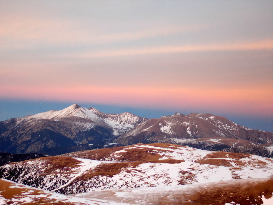
 Canigou
Weather Forecast, FranceIssued: 7 am Mon 03 Aug Local TimeUpdates in: hr min sUpdate imminent
Issued: 7 am Mon 03 Aug Local Time
Updates in:
Update imminent hr min s

Issued: 7 am Mon 03 Aug Local Time
Updates in:
Update imminent hr min s
Days 1–3 Weather SummaryLight rain (total 9mm), mostly falling on Mon night. Warm (max 20°C on Mon afternoon, min 13°C on Mon night). Wind will be generally light. | Days 4–6 Weather SummaryHeavy rain (total 48mm), heaviest during Thu night. Very mild (max 18°C on Sat afternoon, min 13°C on Fri morning). Wind will be generally light. | |||||||||||||||||
Monday 3 | Tuesday 4 | Wednesday 5 | Thursday 6 | Friday 7 | Saturday 8 | |||||||||||||
AM | PM | night | AM | PM | night | AM | PM | night | AM | PM | night | AM | PM | night | AM | PM | night | |
clear | cloudy | rain shwrs | clear | light rain | risk tstorm | clear | rain shwrs | risk tstorm | rain shwrs | risk tstorm | rain shwrs | clear | risk tstorm | risk tstorm | clear | risk tstorm | risk tstorm | |
Cloud base (m) | 9400 | 5900 | 800 | 2700 | 3450 | 2800 | 4300 | 1700 | 2400 | 2750 | 4100 | |||||||
km/h | ||||||||||||||||||
 |  |  |  |  |  | |||||||||||||
— | — | — | — | — | — | — | — | — | — | — | — | — | — | — | — | — | — | |
mm | — | — | 3 | — | 2 | 1.5 | — | 0.2 | 3 | 1.1 | 10 | 14 | — | 3 | 0.9 | — | 7 | 13 |
max °C | 17 | 20 | 19 | 16 | 17 | 17 | 17 | 19 | 17 | 15 | 16 | 14 | 15 | 16 | 16 | 17 | 18 | 18 |
min °C | 17 | 19 | 13 | 15 | 15 | 16 | 16 | 18 | 16 | 15 | 14 | 14 | 13 | 16 | 15 | 16 | 17 | 15 |
chill °C | 16 | 19 | 12 | 15 | 15 | 16 | 16 | 18 | 16 | 14 | 14 | 14 | 13 | 16 | 15 | 16 | 17 | 15 |
Freezing level m | 4650 | 4600 | 4450 | 4200 | 4350 | 4450 | 4500 | 4450 | 4550 | 4350 | 4450 | 4500 | 4450 | 4400 | 4550 | 4550 | 4600 | 4600 |
6:43 | — | — | 6:43 | — | — | 6:45 | — | — | 6:46 | — | — | 6:47 | — | — | 6:48 | — | — | |
— | — | 9:07 | — | — | 9:07 | — | — | 9:06 | — | — | 9:04 | — | — | 9:02 | — | — | 9:01 | |
Loading...
Canigou Weather (Days 0-3):
The weather forecast for Canigou is: Light rain (total 9mm), mostly falling on Mon night. Warm (max 20°C on Mon afternoon, min 13°C on Mon night). Wind will be generally light.
Canigou Weather (Days 3-6):
Heavy rain (total 48mm), heaviest during Thu night. Very mild (max 18°C on Sat afternoon, min 13°C on Fri morning). Wind will be generally light.
This table gives the weather forecast for Canigou at the specific elevation of 2000 m. Our advanced weather models allow us to provide distinct weather forecasts for several elevations of Canigou. To see the weather forecasts for the other elevations, use the tab navigation above the table. For a wider overview of the weather, consult the Weather Map of France.
| Weather Station | Temp. | Weather | Wind | Gusts | Cloud / Visibility |
|---|---|---|---|---|---|
VIGNE DEL REY | |||||
Perpignan | |||||
La Molina | |||||
1336 | |||||
Club nautique CNCP | |||||
Gare Maritime PV | |||||
môle Port-Vendres | |||||
Cap del Rec |
* NOTE: not all weather observatories update at the same frequency which is the reason why some locations may show data from stations that are further away than known closer ones.
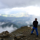
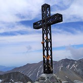
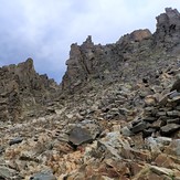
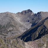
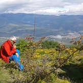
Canigou Photos
View all
Corbières photos (8) |
Pyrenees photos (143) |
photos from mountains in France (302) |
all photos
 Upload new photo
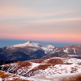
Le massif du Canigou au coucher de soleil depuis l'Ouest
La croix sommitale du Pic du Canigou
Le couloir final, du pic du Canigou
Canigou vu depuis le Tretzevents, au Sud