
– Lat/Long: 37.22° N 2.55° W
 Calar Alto
Weather Forecast, SpainIssued: 7 am Mon 03 Aug Local TimeUpdates in: hr min sUpdate imminent
Issued: 7 am Mon 03 Aug Local Time
Updates in:
Update imminent hr min s

Issued: 7 am Mon 03 Aug Local Time
Updates in:
Update imminent hr min s
Days 1–3 Weather SummaryMostly dry. Warm (max 22°C on Mon afternoon, min 18°C on Mon night). Wind will be generally light. | Days 4–6 Weather SummaryMostly dry. Warm (max 22°C on Sat afternoon, min 19°C on Thu morning). Wind will be generally light. | |||||||||||||||||
Monday 3 | Tuesday 4 | Wednesday 5 | Thursday 6 | Friday 7 | Saturday 8 | |||||||||||||
AM | PM | night | AM | PM | night | AM | PM | night | AM | PM | night | AM | PM | night | AM | PM | night | |
some clouds | some clouds | clear | clear | clear | clear | clear | clear | clear | clear | clear | clear | clear | clear | clear | clear | rain shwrs | risk tstorm | |
Cloud base (m) | 6550 | 6050 | 9400 | 5200 | ||||||||||||||
km/h | ||||||||||||||||||
 |  |  |  |  |  | |||||||||||||
— | — | — | — | — | — | — | — | — | — | — | — | — | — | — | — | — | — | |
mm | — | — | — | — | — | — | — | — | — | — | — | — | — | — | — | — | 0.5 | 0.1 |
max °C | 20 | 22 | 21 | 19 | 22 | 21 | 19 | 21 | 20 | 19 | 21 | 20 | 19 | 21 | 21 | 20 | 22 | 22 |
min °C | 20 | 21 | 18 | 18 | 20 | 19 | 19 | 20 | 19 | 19 | 20 | 19 | 19 | 20 | 20 | 20 | 19 | 21 |
chill °C | 20 | 21 | 18 | 18 | 20 | 19 | 19 | 20 | 19 | 19 | 20 | 19 | 19 | 20 | 20 | 20 | 19 | 21 |
Freezing level m | 4900 | 4900 | 5000 | 4900 | 5000 | 5000 | 4950 | 4950 | 4950 | 4950 | 4900 | 4950 | 4950 | 4900 | 5050 | 5000 | 4900 | 5100 |
7:15 | — | — | 7:16 | — | — | 7:16 | — | — | 7:18 | — | — | 7:18 | — | — | 7:20 | — | — | |
— | — | 9:15 | — | — | 9:15 | — | — | 9:14 | — | — | 9:13 | — | — | 9:12 | — | — | 9:10 | |
Loading...
Calar Alto Weather (Days 0-3):
The weather forecast for Calar Alto is: Mostly dry. Warm (max 22°C on Mon afternoon, min 18°C on Mon night). Wind will be generally light.
Calar Alto Weather (Days 3-6):
Mostly dry. Warm (max 22°C on Sat afternoon, min 19°C on Thu morning). Wind will be generally light.
This table gives the weather forecast for Calar Alto at the specific elevation of 2168 m. Our advanced weather models allow us to provide distinct weather forecasts for several elevations of Calar Alto. To see the weather forecasts for the other elevations, use the tab navigation above the table. For a wider overview of the weather, consult the Weather Map of Spain.
* NOTE: not all weather observatories update at the same frequency which is the reason why some locations may show data from stations that are further away than known closer ones.
Calar Alto Photos
View all
Sierra de Los Filabres photos (11) |
Baetic System photos (59) |
photos from mountains in Spain (451) |
all photos
 Upload new photo
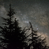
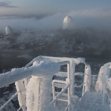
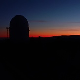
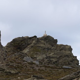 See 11 more Calar Alto photos
Calar Alto sky
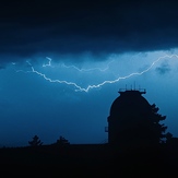
Electrical storm
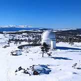
Dome 1.23.
Dome 2.2.
After the storm
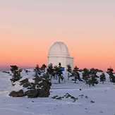
Puesta de Sol en Calar Alto
CALAR ALTO