– Lat/Long: 46.12° N 7.71° E
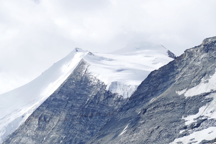
 Bishorn
Weather Forecast, SwitzerlandIssued: 1 pm Mon 03 Aug Local TimeUpdates in: hr min sUpdate imminent
Issued: 1 pm Mon 03 Aug Local Time
Updates in:
Update imminent hr min s

Issued: 1 pm Mon 03 Aug Local Time
Updates in:
Update imminent hr min s
Days 1–4 Weather SummaryMild at first with light rain (total 8mm) on Wed afternoon followed by colder weather and light fall of snow, heaviest on Wed night. Temperatures will be slightly above freezing (max 3°C on Mon afternoon, min 1°C on Tue morning). Wind will be generally light. | Days 5–7 Weather SummaryDrizzle, on Thu afternoon followed by colder weather and a moderate fall of snow, heaviest on Thu night.. Freeze-thaw conditions (max 2°C on Thu afternoon, min 0°C on Thu night). Wind will be generally light. | ||||||||||||||||
Mon 3 | Tuesday 4 | Wednesday 5 | Thursday 6 | Friday 7 | Saturday 8 | ||||||||||||
PM | night | AM | PM | night | AM | PM | night | AM | PM | night | AM | PM | night | AM | PM | night | |
risk tstorm | snow shwrs | clear | risk tstorm | snow shwrs | clear | rain shwrs | snow shwrs | clear | snow shwrs | snow shwrs | clear | snow shwrs | clear | clear | snow shwrs | clear | |
Cloud base (m) | 4000 | 4850 | 4650 | 4350 | 3900 | 2850 | 3700 | ||||||||||
km/h | |||||||||||||||||
 |  |  |  |  |  | ||||||||||||
— | 1 | — | — | 2 | — | — | 7 | — | 2 | 7 | — | 2 | — | — | 1 | — | |
mm | 1.9 | — | — | 2 | — | — | 4 | — | — | 1.1 | — | — | — | — | — | — | — |
max °C | 3 | 2 | 2 | 2 | 2 | 2 | 3 | 2 | 2 | 2 | 0 | 0 | 1 | 0 | 1 | 2 | 2 |
min °C | 2 | 2 | 1 | 2 | 2 | 1 | 2 | 1 | 1 | 1 | 0 | 0 | 0 | 0 | 0 | 1 | 1 |
chill °C | -2 | -2 | -3 | -3 | -1 | 0 | 0 | 0 | -2 | -3 | -3 | -4 | -4 | -5 | -4 | -3 | -3 |
Freezing level m | 4500 | 4400 | 4400 | 4550 | 4450 | 4450 | 4500 | 4400 | 4400 | 4350 | 4150 | 4150 | 4300 | 4200 | 4300 | 4450 | 4350 |
— | — | 6:13 | — | — | 6:15 | — | — | 6:16 | — | — | 6:16 | — | — | 6:18 | — | — | |
— | 8:57 | — | — | 8:54 | — | — | 8:53 | — | — | 8:52 | — | — | 8:51 | — | — | 8:50 | |
Loading...
Bishorn Weather (Days 0-3):
The weather forecast for Bishorn is: Mild at first with light rain (total 8mm) on Wed afternoon followed by colder weather and light fall of snow, heaviest on Wed night. Temperatures will be slightly above freezing (max 3°C on Mon afternoon, min 1°C on Tue morning). Wind will be generally light.
Bishorn Weather (Days 3-6):
Drizzle, on Thu afternoon followed by colder weather and a moderate fall of snow, heaviest on Thu night.. Freeze-thaw conditions (max 2°C on Thu afternoon, min 0°C on Thu night). Wind will be generally light.
This table gives the weather forecast for Bishorn at the specific elevation of 4153 m. Our advanced weather models allow us to provide distinct weather forecasts for several elevations of Bishorn. To see the weather forecasts for the other elevations, use the tab navigation above the table. For a wider overview of the weather, consult the Weather Map of Switzerland.
Bishorn Photos
View all
Pennine Alps photos (202) |
Alps photos (1485) |
photos from mountains in Switzerland (649) |
all photos
 Upload new photo
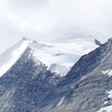
Bishorn
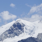
Bishorn
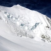
Bishorn