– Lat/Long: 40.87° N 41.53° E
 Altiparmak
Weather Forecast, TurkeyIssued: 2 pm Mon 03 Aug Local TimeUpdates in: hr min sUpdate imminent
Issued: 2 pm Mon 03 Aug Local Time
Updates in:
Update imminent hr min s

Issued: 2 pm Mon 03 Aug Local Time
Updates in:
Update imminent hr min s
Days 1–4 Weather SummaryLight rain (total 2mm), mostly falling on Wed afternoon. Very mild (max 14°C on Mon afternoon, min 8°C on Wed night). Wind will be generally light. | Days 5–7 Weather SummaryMostly dry. Very mild (max 12°C on Fri afternoon, min 9°C on Thu night). Wind will be generally light. | ||||||||||||||||
Mon 3 | Tuesday 4 | Wednesday 5 | Thursday 6 | Friday 7 | Saturday 8 | ||||||||||||
PM | night | AM | PM | night | AM | PM | night | AM | PM | night | AM | PM | night | AM | PM | night | |
rain shwrs | rain shwrs | clear | risk tstorm | rain shwrs | rain shwrs | rain shwrs | rain shwrs | clear | rain shwrs | rain shwrs | clear | clear | clear | clear | rain shwrs | clear | |
Cloud base (m) | 5200 | 4700 | 5150 | 4750 | 4850 | 4750 | 4050 | 4850 | 5000 | 5000 | 4950 | ||||||
km/h | |||||||||||||||||
 |  |  |  |  |  | ||||||||||||
— | — | — | — | — | — | — | — | — | — | — | — | — | — | — | — | — | |
mm | 0.1 | 0.1 | — | 0.3 | 0.2 | 0.1 | 1.4 | 0.1 | — | 0.4 | 0.1 | — | — | — | — | 0.3 | — |
max °C | 14 | 13 | 11 | 13 | 10 | 9 | 9 | 9 | 8 | 10 | 10 | 10 | 12 | 12 | 11 | 12 | 11 |
min °C | 14 | 11 | 11 | 12 | 9 | 9 | 9 | 8 | 8 | 10 | 9 | 10 | 12 | 11 | 11 | 12 | 9 |
chill °C | 14 | 10 | 9 | 11 | 9 | 7 | 7 | 8 | 7 | 10 | 8 | 9 | 12 | 10 | 10 | 12 | 8 |
Freezing level m | 5600 | 5350 | 5300 | 5400 | 5150 | 5200 | 5300 | 5200 | 5150 | 5250 | 5250 | 5400 | 5600 | 5600 | 5550 | 5550 | 5450 |
— | — | 5:11 | — | — | 5:13 | — | — | 5:13 | — | — | 5:15 | — | — | 5:16 | — | — | |
7:27 | — | — | 7:25 | — | — | 7:24 | — | — | 7:23 | — | — | 7:22 | — | — | 7:21 | — | |
Loading...
Altiparmak Weather (Days 0-3):
The weather forecast for Altiparmak is: Light rain (total 2mm), mostly falling on Wed afternoon. Very mild (max 14°C on Mon afternoon, min 8°C on Wed night). Wind will be generally light.
Altiparmak Weather (Days 3-6):
Mostly dry. Very mild (max 12°C on Fri afternoon, min 9°C on Thu night). Wind will be generally light.
This table gives the weather forecast for Altiparmak at the specific elevation of 3605 m. Our advanced weather models allow us to provide distinct weather forecasts for several elevations of Altiparmak. To see the weather forecasts for the other elevations, use the tab navigation above the table. For a wider overview of the weather, consult the Weather Map of Turkey.
| Weather Station | Temp. | Weather | Wind | Gusts | Cloud / Visibility |
|---|---|---|---|---|---|
lightning 26km SE of Ardanuc | |||||
Batumi Airport | |||||
lightning 15km ENE of Senkaya | |||||
Erzurum Havalimani | |||||
Erzurum Airport | |||||
Kars Airport | |||||
* NOTE: not all weather observatories update at the same frequency which is the reason why some locations may show data from stations that are further away than known closer ones.
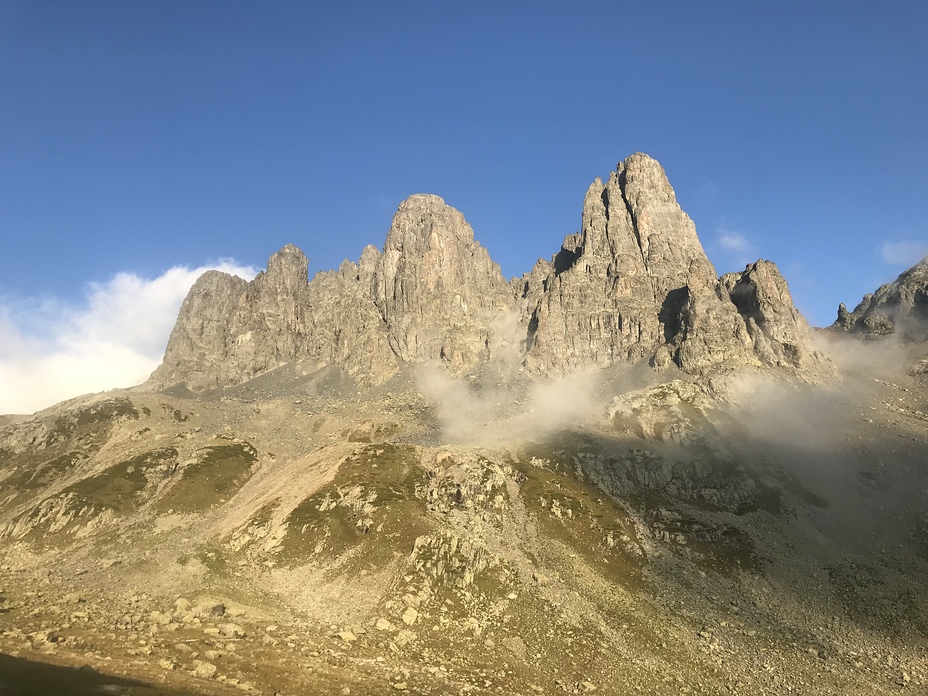
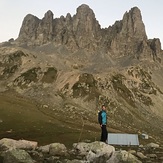
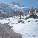
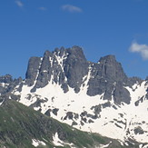
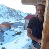
Altiparmak Photos
View all
Northern Anatolia (Black Sea) photos (86) |
Anatolia photos (529) |
photos from mountains in Turkey (496) |
all photos
 Upload new photo
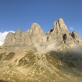


 See 9 more Altiparmak photos
Altıparmak
Altıparmak
Didigola yaylasi
Altiparmak
Didi goladan kar manzalari
Kaçkarlar
Halit abim