– Lat/Long: 46.47° N 7.98° E
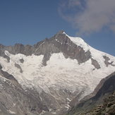
 Aletschhorn
Weather Forecast, SwitzerlandIssued: 1 am Fri 03 Jul Local TimeUpdates in: hr min sUpdate imminent
Issued: 1 am Fri 03 Jul Local Time
Updates in:
Update imminent hr min s

Issued: 1 am Fri 03 Jul Local Time
Updates in:
Update imminent hr min s
Days 1–3 Weather SummaryMostly dry. Temperatures will be below freezing (max 0°C on Fri night, min -3°C on Sun night). Mainly fresh winds. | Days 4–6 Weather SummaryMostly dry. Freeze-thaw conditions (max 2°C on Wed night, min -4°C on Tue afternoon). Mainly fresh winds. | |||||||||||||||||
Friday 3 | Saturday 4 | Sunday 5 | Monday 6 | Tuesday 7 | Wednesday 8 | |||||||||||||
AM | PM | night | AM | PM | night | AM | PM | night | AM | PM | night | AM | PM | night | AM | PM | night | |
clear | clear | clear | clear | clear | clear | clear | clear | clear | clear | clear | clear | some clouds | cloudy | some clouds | some clouds | clear | clear | |
km/h | ||||||||||||||||||
 |  |  |  |  |  | |||||||||||||
— | — | — | — | — | — | — | — | — | — | — | — | — | — | — | — | — | — | |
mm | — | — | — | — | — | — | — | — | — | — | — | — | — | — | — | — | — | — |
max °C | -2 | -1 | 0 | -1 | -1 | -1 | -1 | -2 | -2 | -2 | -1 | 0 | -1 | -2 | -1 | 0 | 1 | 2 |
min °C | -2 | -2 | -1 | -1 | -1 | -1 | -2 | -2 | -3 | -2 | -1 | -1 | -2 | -4 | -2 | -1 | 0 | 1 |
chill °C | -7 | -7 | -7 | -7 | -7 | -7 | -9 | -9 | -10 | -9 | -6 | -6 | -8 | -11 | -9 | -6 | -4 | -3 |
Freezing level m | 3800 | 3950 | 4200 | 4050 | 4000 | 4100 | 3850 | 3900 | 3750 | 3800 | 4100 | 4100 | 3900 | 3600 | 3950 | 4100 | 4300 | 4500 |
Cloud base (m) | 2700 | 3000 | 8800 | 2850 | 3050 | 3050 | ||||||||||||
5:39 | — | — | 5:39 | — | — | 5:41 | — | — | 5:41 | — | — | 5:41 | — | — | 5:43 | — | — | |
— | — | 9:23 | — | — | 9:22 | — | — | 9:22 | — | — | 9:22 | — | — | 9:22 | — | — | 9:22 | |
Loading...
Aletschhorn Weather (Days 0-3):
The weather forecast for Aletschhorn is: Mostly dry. Temperatures will be below freezing (max 0°C on Fri night, min -3°C on Sun night). Mainly fresh winds.
Aletschhorn Weather (Days 3-6):
Mostly dry. Freeze-thaw conditions (max 2°C on Wed night, min -4°C on Tue afternoon). Mainly fresh winds.
This table gives the weather forecast for Aletschhorn at the specific elevation of 4195 m. Our advanced weather models allow us to provide distinct weather forecasts for several elevations of Aletschhorn. To see the weather forecasts for the other elevations, use the tab navigation above the table. For a wider overview of the weather, consult the Weather Map of Switzerland.
Aletschhorn Photos
View all
Bernese Alps photos (163) |
Alps photos (1484) |
photos from mountains in Switzerland (649) |
all photos
 Upload new photo
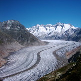
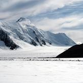
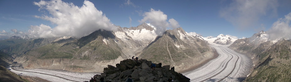
Aletsch Glacier
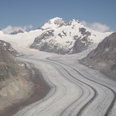
Aletsch
Konkordia Platz
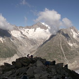
Aletschhorn
Aletschhorn