– Lat/Long: 44.96° N 6.24° E
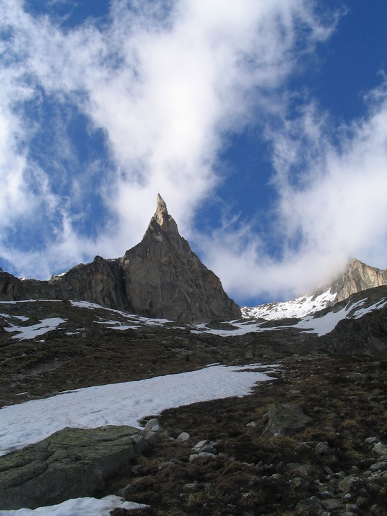
 Aiguille Dibona
Weather Forecast, FranceIssued: 7 pm Tue 28 Jul Local TimeUpdates in: hr min sUpdate imminent
Issued: 7 pm Tue 28 Jul Local Time
Updates in:
Update imminent hr min s

Issued: 7 pm Tue 28 Jul Local Time
Updates in:
Update imminent hr min s
Days 1–4 Weather SummaryMostly dry. Warm (max 23°C on Thu afternoon, min 15°C on Tue night). Wind will be generally light. | Days 5–7 Weather SummaryLight rain (total 6mm), mostly falling on Sun afternoon. Warm (max 22°C on Sun afternoon, min 15°C on Sun afternoon). Wind will be generally light. | ||||||||||||||||||
Wednesday 29 | Thursday 30 | Friday 31 | Saturday 1 | Sunday 2 | Monday 3 | ||||||||||||||
night | AM | PM | night | AM | PM | night | AM | PM | night | AM | PM | night | AM | PM | night | AM | PM | night | |
rain shwrs | clear | clear | clear | clear | clear | some clouds | some clouds | rain shwrs | rain shwrs | clear | risk tstorm | rain shwrs | clear | light rain | rain shwrs | rain shwrs | light rain | risk tstorm | |
Cloud base (m) | 4800 | 5400 | 4700 | 3850 | 4800 | 4900 | 4400 | 4900 | 3100 | 4700 | 5650 | 8400 | |||||||
km/h | |||||||||||||||||||
 |  |  |  |  |  |  | |||||||||||||
— | — | — | — | — | — | — | — | — | — | — | — | — | — | — | — | — | — | — | |
mm | 0.1 | — | — | — | — | — | — | — | 0.3 | 0.3 | — | 0.2 | 0.2 | — | 2 | 1.8 | 0.2 | 0.7 | 10 |
max °C | 19 | 18 | 22 | 20 | 21 | 23 | 22 | 21 | 23 | 20 | 20 | 21 | 20 | 20 | 22 | 18 | 20 | 22 | 17 |
min °C | 15 | 16 | 20 | 18 | 19 | 22 | 18 | 19 | 19 | 17 | 18 | 20 | 17 | 18 | 15 | 16 | 18 | 19 | 15 |
chill °C | 15 | 16 | 20 | 18 | 19 | 22 | 18 | 19 | 19 | 17 | 18 | 20 | 17 | 18 | 15 | 16 | 18 | 19 | 15 |
Freezing level m | 4600 | 4500 | 4800 | 4750 | 4650 | 4900 | 4800 | 4700 | 4650 | 4550 | 4550 | 4750 | 4750 | 4650 | 4600 | 4650 | 4600 | 4600 | 4450 |
— | 6:16 | — | — | 6:16 | — | — | 6:18 | — | — | 6:18 | — | — | 6:20 | — | — | 6:20 | — | — | |
— | — | — | 9:05 | — | — | 9:04 | — | — | 9:02 | — | — | 9:01 | — | — | 9:00 | — | — | 8:59 | |
Loading...
Aiguille Dibona Weather (Days 0-3):
The weather forecast for Aiguille Dibona is: Mostly dry. Warm (max 23°C on Thu afternoon, min 15°C on Tue night). Wind will be generally light.
Aiguille Dibona Weather (Days 3-6):
Light rain (total 6mm), mostly falling on Sun afternoon. Warm (max 22°C on Sun afternoon, min 15°C on Sun afternoon). Wind will be generally light.
This table gives the weather forecast for Aiguille Dibona at the specific elevation of 2000 m. Our advanced weather models allow us to provide distinct weather forecasts for several elevations of Aiguille Dibona. To see the weather forecasts for the other elevations, use the tab navigation above the table. For a wider overview of the weather, consult the Weather Map of France.
Aiguille Dibona Photos
View all
Dauphine Alps photos (34) |
Alps photos (1485) |
photos from mountains in France (302) |
all photos
 Upload new photo
Aiguille Dibona