
– Lat/Long: 47.54° N 10.56° E
 Aggenstein
Weather Forecast, AustriaIssued: 7 am Tue 14 Jul Local TimeUpdates in: hr min sUpdate imminent
Issued: 7 am Tue 14 Jul Local Time
Updates in:
Update imminent hr min s

Issued: 7 am Tue 14 Jul Local Time
Updates in:
Update imminent hr min s
Days 1–3 Weather SummaryHeavy rain (total 30mm), heaviest during Tue night. Very mild (max 19°C on Tue afternoon, min 12°C on Tue night). Winds decreasing (fresh winds from the WNW on Tue afternoon, light winds from the WNW by Wed night). | Days 4–6 Weather SummaryModerate rain (total 19mm), heaviest on Fri night. Very mild (max 17°C on Fri morning, min 7°C on Sun morning). Winds increasing (calm on Fri morning, fresh winds from the W by Sun afternoon). | |||||||||||||||||
Tuesday 14 | Wednesday 15 | Thursday 16 | Friday 17 | Saturday 18 | Sunday 19 | |||||||||||||
AM | PM | night | AM | PM | night | AM | PM | night | AM | PM | night | AM | PM | night | AM | PM | night | |
risk tstorm | rain shwrs | risk tstorm | risk tstorm | risk tstorm | risk tstorm | some clouds | clear | risk tstorm | some clouds | risk tstorm | rain shwrs | rain shwrs | risk tstorm | rain shwrs | light rain | rain shwrs | rain shwrs | |
km/h | ||||||||||||||||||
 |  |  |  |  |  | |||||||||||||
— | — | — | — | — | — | — | — | — | — | — | — | — | — | — | — | — | — | |
mm | 5 | 0.1 | 16 | 2 | 2 | 5 | — | — | 0.3 | — | 0.1 | 6 | 0.4 | 0.1 | 9 | 1.6 | 2 | 0.5 |
max °C | 17 | 19 | 15 | 14 | 15 | 14 | 14 | 18 | 17 | 17 | 17 | 13 | 12 | 13 | 9 | 9 | 10 | 8 |
min °C | 16 | 17 | 12 | 13 | 14 | 13 | 13 | 17 | 17 | 15 | 17 | 12 | 12 | 13 | 9 | 7 | 8 | 7 |
chill °C | 15 | 16 | 10 | 12 | 13 | 12 | 11 | 16 | 17 | 15 | 17 | 10 | 10 | 11 | 7 | 3 | 4 | 4 |
Freezing level m | 4200 | 4200 | 4000 | 3950 | 4100 | 4000 | 4050 | 4350 | 4350 | 4200 | 4250 | 3850 | 3550 | 3550 | 3250 | 3150 | 3050 | 2900 |
Cloud base (m) | 4050 | 1950 | 3300 | 4700 | 1950 | 3000 | 5900 | 5700 | 5050 | 3250 | 1750 | 1750 | 2650 | 2400 | ||||
5:33 | — | — | 5:35 | — | — | 5:35 | — | — | 5:37 | — | — | 5:37 | — | — | 5:39 | — | — | |
— | — | 9:12 | — | — | 9:10 | — | — | 9:09 | — | — | 9:08 | — | — | 9:08 | — | — | 9:07 | |
Loading...
Aggenstein Weather (Days 0-3):
The weather forecast for Aggenstein is: Heavy rain (total 30mm), heaviest during Tue night. Very mild (max 19°C on Tue afternoon, min 12°C on Tue night). Winds decreasing (fresh winds from the WNW on Tue afternoon, light winds from the WNW by Wed night).
Aggenstein Weather (Days 3-6):
Moderate rain (total 19mm), heaviest on Fri night. Very mild (max 17°C on Fri morning, min 7°C on Sun morning). Winds increasing (calm on Fri morning, fresh winds from the W by Sun afternoon).
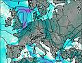
This table gives the weather forecast for Aggenstein at the specific elevation of 1986 m. Our advanced weather models allow us to provide distinct weather forecasts for several elevations of Aggenstein. To see the weather forecasts for the other elevations, use the tab navigation above the table. For a wider overview of the weather, consult the Weather Map of Austria.
| Weather Station | Temp. | Weather | Wind | Gusts | Cloud / Visibility |
|---|---|---|---|---|---|
Breitenberg Pfronten | |||||
lightning 6km SSW of Pfronten | |||||
Landeplatz Tannheim | |||||
9erköpfle West | |||||
thunderstorm affecting Fussen | |||||
lightning 5km ESE of Wertach | |||||
Hahnenkamm Grat | |||||
lightning 12km WSW of Reutte | |||||
ImbergerHorn Hindela | |||||
* NOTE: not all weather observatories update at the same frequency which is the reason why some locations may show data from stations that are further away than known closer ones.