– Lat/Long: 45.93° N 7.87° E
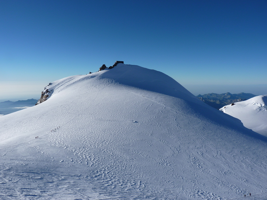
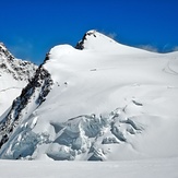
 Zumsteinspitze
Weather Forecast, SwitzerlandIssued: 1 am Mon 03 Aug Local TimeUpdates in: hr min sUpdate imminent
Issued: 1 am Mon 03 Aug Local Time
Updates in:
Update imminent hr min s

Issued: 1 am Mon 03 Aug Local Time
Updates in:
Update imminent hr min s
Days 1–3 Weather SummaryHeavy rain (total 32mm), heaviest during Mon night. Warm (max 25°C on Tue afternoon, min 20°C on Mon night). Wind will be generally light. | Days 4–6 Weather SummaryHeavy rain (total 30mm), heaviest during Thu night. Warm (max 26°C on Thu afternoon, min 19°C on Thu night). Wind will be generally light. | |||||||||||||||||
Monday 3 | Tuesday 4 | Wednesday 5 | Thursday 6 | Friday 7 | Saturday 8 | |||||||||||||
AM | PM | night | AM | PM | night | AM | PM | night | AM | PM | night | AM | PM | night | AM | PM | night | |
rain shwrs | risk tstorm | risk tstorm | clear | risk tstorm | risk tstorm | clear | risk tstorm | risk tstorm | rain shwrs | risk tstorm | rain shwrs | rain shwrs | risk tstorm | risk tstorm | rain shwrs | rain shwrs | risk tstorm | |
Cloud base (m) | 2850 | 4200 | 2900 | 3200 | 2850 | 4050 | ||||||||||||
km/h | ||||||||||||||||||
 |  |  |  |  |  | |||||||||||||
— | — | — | — | — | — | — | — | — | — | — | — | — | — | — | — | — | — | |
mm | 1.2 | 5 | 10 | — | 3 | 4 | — | 4 | 4 | 0.3 | 7 | 15 | 0.1 | 3 | 3 | 0.4 | 1.5 | 0.4 |
max °C | 24 | 24 | 22 | 24 | 25 | 22 | 25 | 25 | 23 | 25 | 26 | 20 | 24 | 25 | 23 | 23 | 25 | 24 |
min °C | 21 | 24 | 20 | 21 | 25 | 21 | 22 | 25 | 22 | 23 | 23 | 19 | 21 | 25 | 21 | 21 | 25 | 21 |
chill °C | 21 | 24 | 20 | 21 | 25 | 21 | 22 | 25 | 22 | 23 | 23 | 19 | 21 | 25 | 21 | 21 | 25 | 21 |
Freezing level m | 4400 | 4450 | 4350 | 4300 | 4450 | 4450 | 4500 | 4550 | 4450 | 4400 | 4400 | 4450 | 4350 | 4450 | 4350 | 4350 | 4550 | 4450 |
6:11 | — | — | 6:13 | — | — | 6:15 | — | — | 6:16 | — | — | 6:16 | — | — | 6:18 | — | — | |
— | — | 8:55 | — | — | 8:53 | — | — | 8:52 | — | — | 8:51 | — | — | 8:50 | — | — | 8:49 | |
Loading...
Zumsteinspitze Weather (Days 0-3):
The weather forecast for Zumsteinspitze is: Heavy rain (total 32mm), heaviest during Mon night. Warm (max 25°C on Tue afternoon, min 20°C on Mon night). Wind will be generally light.
Zumsteinspitze Weather (Days 3-6):
Heavy rain (total 30mm), heaviest during Thu night. Warm (max 26°C on Thu afternoon, min 19°C on Thu night). Wind will be generally light.
This table gives the weather forecast for Zumsteinspitze at the specific elevation of 1000 m. Our advanced weather models allow us to provide distinct weather forecasts for several elevations of Zumsteinspitze. To see the weather forecasts for the other elevations, use the tab navigation above the table. For a wider overview of the weather, consult the Weather Map of Switzerland.
| Weather Station | Temp. | Weather | Wind | Gusts | Cloud / Visibility |
|---|---|---|---|---|---|
ZFC: Kl. Matterhorn | |||||
ZFC: Landing Zermatt | |||||
ZFC: Gornergr. North | |||||
ZFC: Gornergrat N. | |||||
ZFC: Riffelberg | |||||
ZFC: Schwarzsee | |||||
thunderstorm affecting Saint-Vincent |
* NOTE: not all weather observatories update at the same frequency which is the reason why some locations may show data from stations that are further away than known closer ones.
Zumsteinspitze Photos
View all
Pennine Alps photos (202) |
Alps photos (1485) |
photos from mountains in Switzerland (649) |
all photos
 Upload new photo
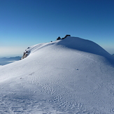
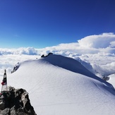
Punta Gnifetti
Zumsteinspitze
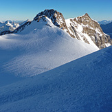
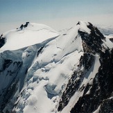
Approach to Punta Gnifetti
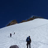
Zumstein from Lys pässe
Zumsteinspitze