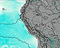
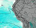
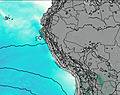
– Lat/Long: 10.27° S 76.90° W
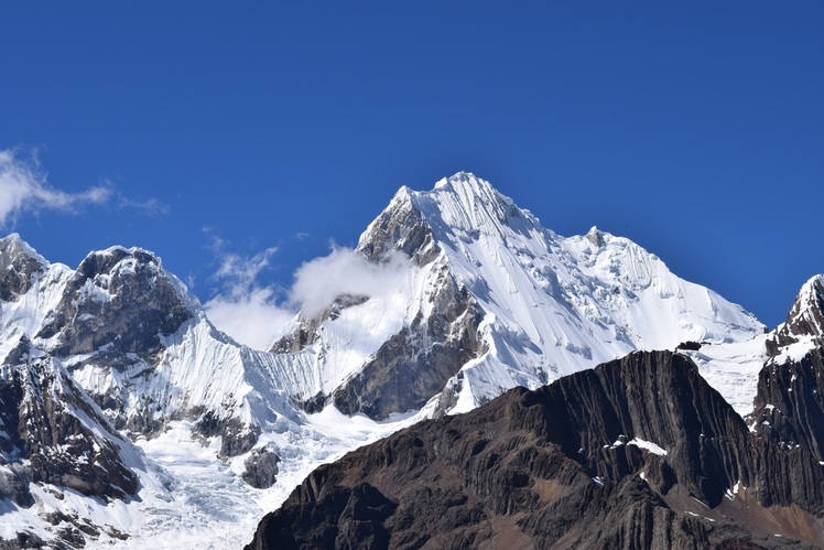
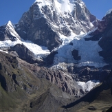
 Yerupaja
Weather Forecast, PeruIssued: 12 am Mon 03 Aug Local TimeUpdates in: hr min sUpdate imminent
Issued: 12 am Mon 03 Aug Local Time
Updates in:
Update imminent hr min s

Issued: 12 am Mon 03 Aug Local Time
Updates in:
Update imminent hr min s
Days 1–4 Weather SummaryMostly dry. Temperatures will be below freezing (max -3°C on Mon morning, min -7°C on Sun night). Wind will be generally light. | Days 5–7 Weather SummaryMostly dry. Temperatures will be below freezing (max -3°C on Thu morning, min -7°C on Fri night). Mainly fresh winds. | ||||||||||||||||||
Monday 3 | Tuesday 4 | Wednesday 5 | Thursday 6 | Friday 7 | Saturday 8 | ||||||||||||||
night | AM | PM | night | AM | PM | night | AM | PM | night | AM | PM | night | AM | PM | night | AM | PM | night | |
clear | clear | some clouds | some clouds | some clouds | some clouds | some clouds | some clouds | some clouds | clear | clear | clear | clear | clear | clear | clear | clear | some clouds | some clouds | |
Cloud base (m) | 4900 | 6200 | 5500 | 5500 | 5850 | 5200 | 5000 | 6050 | 4950 | 6550 | 4800 | 6800 | 5200 | ||||||
km/h | |||||||||||||||||||
 |  |  |  |  |  |  | |||||||||||||
— | — | — | — | — | — | — | — | — | — | — | — | — | — | — | — | — | — | — | |
mm | — | — | — | — | — | — | — | — | — | — | — | — | — | — | — | — | — | — | — |
max °C | -6 | -3 | -4 | -5 | -3 | -4 | -5 | -3 | -4 | -5 | -3 | -3 | -5 | -3 | -4 | -5 | -4 | -5 | -6 |
min °C | -7 | -4 | -5 | -7 | -4 | -5 | -6 | -4 | -5 | -6 | -4 | -5 | -6 | -4 | -5 | -7 | -5 | -5 | -7 |
chill °C | -14 | -9 | -8 | -12 | -9 | -10 | -12 | -11 | -13 | -14 | -12 | -13 | -15 | -12 | -13 | -15 | -12 | -12 | -14 |
Freezing level m | 4850 | 5350 | 5450 | 5050 | 5350 | 5450 | 5050 | 5400 | 5450 | 4950 | 5450 | 5550 | 4900 | 5400 | 5500 | 4900 | 5350 | 5400 | 4900 |
— | 6:22 | — | — | 6:22 | — | — | 6:22 | — | — | 6:22 | — | — | 6:22 | — | — | 6:20 | — | — | |
— | — | 6:04 | — | — | 6:04 | — | — | 6:04 | — | — | 6:04 | — | — | 6:04 | — | — | 6:04 | — | |
Loading...
Yerupaja Weather (Days 0-3):
The weather forecast for Yerupaja is: Mostly dry. Temperatures will be below freezing (max -3°C on Mon morning, min -7°C on Sun night). Wind will be generally light.
Yerupaja Weather (Days 3-6):
Mostly dry. Temperatures will be below freezing (max -3°C on Thu morning, min -7°C on Fri night). Mainly fresh winds.
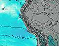
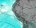
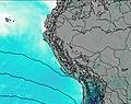
This table gives the weather forecast for Yerupaja at the specific elevation of 6000 m. Our advanced weather models allow us to provide distinct weather forecasts for several elevations of Yerupaja. To see the weather forecasts for the other elevations, use the tab navigation above the table. For a wider overview of the weather, consult the Weather Map of Peru.
| Weather Station | Temp. | Weather | Wind | Gusts | Cloud / Visibility |
|---|---|---|---|---|---|
SHIP6157 | |||||
Lima Jorge Chávez International Airport | |||||
Jauja Airport | |||||
Pucallpa Airport | |||||
SHIP1393 | |||||
SHIP1993 | |||||
Lima Jorge Chávez International Airport | |||||
Jauja Airport |
* NOTE: not all weather observatories update at the same frequency which is the reason why some locations may show data from stations that are further away than known closer ones.
Yerupaja Photos
View all
Peruvian Andes photos (92) |
Andes photos (1029) |
photos from mountains in Peru (109) |
all photos
 Upload new photo
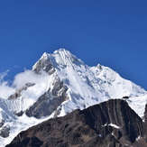

Yerupaja West Face
Yerupaja Jirishanca
Yerupaja