– Lat/Long: 40.26° N 111.61° W
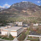
 Y Mountain
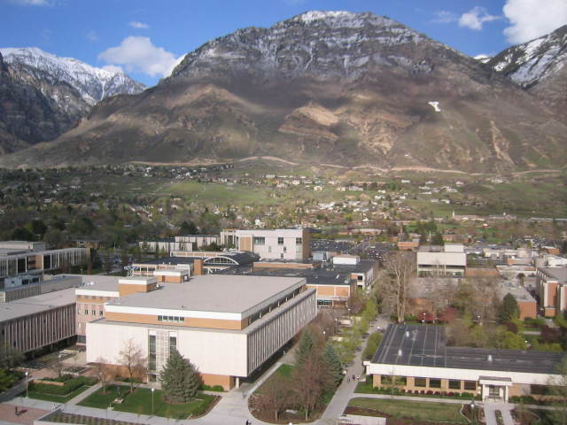
Weather Forecast, United StatesIssued: 11 pm Sun 02 Aug Local TimeUpdates in: hr min sUpdate imminent
Issued: 11 pm Sun 02 Aug Local Time
Updates in:
Update imminent hr min s

Issued: 11 pm Sun 02 Aug Local Time
Updates in:
Update imminent hr min s
Days 1–4 Weather SummaryMostly dry. Warm (max 24°C on Sun night, min 16°C on Tue night). Winds increasing (calm on Mon night, fresh winds from the NW by Tue night). | Days 5–7 Weather SummaryMostly dry. Warm (max 27°C on Fri afternoon, min 19°C on Wed night). Wind will be generally light. | ||||||||||||||||||
Monday 3 | Tuesday 4 | Wednesday 5 | Thursday 6 | Friday 7 | Saturday 8 | ||||||||||||||
night | AM | PM | night | AM | PM | night | AM | PM | night | AM | PM | night | AM | PM | night | AM | PM | night | |
clear | clear | clear | clear | clear | clear | clear | clear | clear | clear | clear | clear | clear | clear | clear | clear | clear | clear | some clouds | |
Cloud base (m) | 6100 | 8950 | 9500 | 8700 | 6350 | ||||||||||||||
km/h | |||||||||||||||||||
 |  |  |  |  |  |  | |||||||||||||
— | — | — | — | — | — | — | — | — | — | — | — | — | — | — | — | — | — | — | |
mm | — | — | — | — | — | — | — | — | — | — | — | — | — | — | — | — | — | — | — |
max °C | 24 | 20 | 22 | 20 | 19 | 22 | 19 | 20 | 23 | 21 | 23 | 25 | 23 | 24 | 27 | 25 | 25 | 27 | 24 |
min °C | 18 | 18 | 21 | 17 | 18 | 21 | 16 | 18 | 22 | 19 | 21 | 25 | 20 | 22 | 26 | 21 | 23 | 26 | 20 |
chill °C | 18 | 18 | 21 | 17 | 18 | 21 | 16 | 18 | 22 | 19 | 21 | 25 | 20 | 22 | 26 | 21 | 23 | 26 | 20 |
Freezing level m | 5600 | 5300 | 5300 | 5250 | 5150 | 5300 | 5250 | 5150 | 5300 | 5350 | 5350 | 5450 | 5550 | 5500 | 5500 | 5550 | 5500 | 5550 | 5600 |
— | 6:24 | — | — | 6:26 | — | — | 6:26 | — | — | 6:28 | — | — | 6:28 | — | — | 6:30 | — | — | |
— | — | 8:37 | — | — | 8:37 | — | — | 8:36 | — | — | 8:35 | — | — | 8:34 | — | — | 8:32 | — | |
Loading...
Y Mountain Weather (Days 0-3):
The weather forecast for Y Mountain is: Mostly dry. Warm (max 24°C on Sun night, min 16°C on Tue night). Winds increasing (calm on Mon night, fresh winds from the NW by Tue night).
Y Mountain Weather (Days 3-6):
Mostly dry. Warm (max 27°C on Fri afternoon, min 19°C on Wed night). Wind will be generally light.
This table gives the weather forecast for Y Mountain at the specific elevation of 2597 m. Our advanced weather models allow us to provide distinct weather forecasts for several elevations of Y Mountain. To see the weather forecasts for the other elevations, use the tab navigation above the table. For a wider overview of the weather, consult the Weather Map of Utah.
| Weather Station | Temp. | Weather | Wind | Gusts | Cloud / Visibility |
|---|---|---|---|---|---|
* NOTE: not all weather observatories update at the same frequency which is the reason why some locations may show data from stations that are further away than known closer ones.