– Lat/Long: 37.63° N 118.26° W
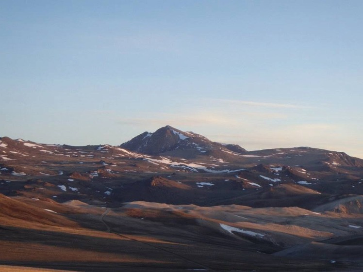
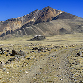
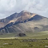
 White Mountain Peak
Weather Forecast, United StatesIssued: 10 pm Sun 02 Aug Local TimeUpdates in: hr min sUpdate imminent
Issued: 10 pm Sun 02 Aug Local Time
Updates in:
Update imminent hr min s

Issued: 10 pm Sun 02 Aug Local Time
Updates in:
Update imminent hr min s
Days 1–4 Weather SummaryMostly dry. Very mild (max 11°C on Sun night, min 7°C on Mon morning). Wind will be generally light. | Days 5–7 Weather SummaryMostly dry. Very mild (max 12°C on Fri afternoon, min 8°C on Wed night). Wind will be generally light. | ||||||||||||||||||
Monday 3 | Tuesday 4 | Wednesday 5 | Thursday 6 | Friday 7 | Saturday 8 | ||||||||||||||
night | AM | PM | night | AM | PM | night | AM | PM | night | AM | PM | night | AM | PM | night | AM | PM | night | |
clear | clear | clear | clear | clear | clear | clear | clear | some clouds | clear | clear | some clouds | clear | clear | some clouds | some clouds | clear | rain shwrs | some clouds | |
Cloud base (m) | 9600 | 6350 | 6150 | 5850 | 5750 | 5800 | 5900 | ||||||||||||
km/h | |||||||||||||||||||
 |  |  |  |  |  |  | |||||||||||||
— | — | — | — | — | — | — | — | — | — | — | — | — | — | — | — | — | — | — | |
mm | — | — | — | — | — | — | — | — | — | — | — | — | — | — | — | — | — | 0.1 | — |
max °C | 11 | 8 | 11 | 10 | 8 | 11 | 11 | 9 | 11 | 11 | 9 | 11 | 11 | 9 | 12 | 10 | 9 | 11 | 10 |
min °C | 8 | 7 | 10 | 8 | 8 | 10 | 9 | 8 | 10 | 8 | 8 | 10 | 9 | 9 | 11 | 9 | 9 | 10 | 9 |
chill °C | 7 | 6 | 9 | 8 | 8 | 9 | 9 | 8 | 9 | 7 | 7 | 9 | 8 | 8 | 10 | 9 | 9 | 9 | 7 |
Freezing level m | 5550 | 5450 | 5700 | 5500 | 5500 | 5750 | 5550 | 5500 | 5650 | 5500 | 5450 | 5650 | 5600 | 5600 | 5750 | 5600 | 5600 | 5650 | 5550 |
— | 5:58 | — | — | 5:58 | — | — | 5:58 | — | — | 6:00 | — | — | 6:01 | — | — | 6:01 | — | — | |
— | — | 7:59 | — | — | 7:58 | — | — | 7:57 | — | — | 7:55 | — | — | 7:54 | — | — | 7:53 | — | |
Loading...
White Mountain Peak Weather (Days 0-3):
The weather forecast for White Mountain Peak is: Mostly dry. Very mild (max 11°C on Sun night, min 7°C on Mon morning). Wind will be generally light.
White Mountain Peak Weather (Days 3-6):
Mostly dry. Very mild (max 12°C on Fri afternoon, min 8°C on Wed night). Wind will be generally light.
This table gives the weather forecast for White Mountain Peak at the specific elevation of 4342 m. Our advanced weather models allow us to provide distinct weather forecasts for several elevations of White Mountain Peak. To see the weather forecasts for the other elevations, use the tab navigation above the table. For a wider overview of the weather, consult the Weather Map of California.
| Weather Station | Temp. | Weather | Wind | Gusts | Cloud / Visibility |
|---|---|---|---|---|---|
Bishop Airport | |||||
Tonopah Airport | |||||
Fresno Chandler | |||||
Visalia Municipal Airport | |||||
Hanford Airport |
* NOTE: not all weather observatories update at the same frequency which is the reason why some locations may show data from stations that are further away than known closer ones.
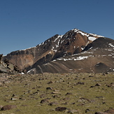
White Mountain Peak Photos
View all
Great Basin Ranges photos (64) |
Intermountain West photos (151) |
photos from mountains in United States (3056) |
all photos
 Upload new photo
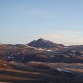
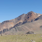
 See 10 more White Mountain Peak photos
White Mountain Peak
White Mountain Peak
White Mountain Peak
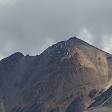
White Mountain
view of summit
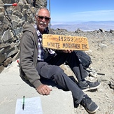
White Mountain Peak, Mike Smith.