
– Lat/Long: 18.57° N 95.17° W
 Volcan De San Martin
Weather Forecast, MexicoIssued: 11 pm Tue 23 Jun Local TimeUpdates in: hr min sUpdate imminent
Issued: 11 pm Tue 23 Jun Local Time
Updates in:
Update imminent hr min s

Issued: 11 pm Tue 23 Jun Local Time
Updates in:
Update imminent hr min s
Days 1–4 Weather SummaryModerate rain (total 16mm), heaviest on Wed night. Warm (max 23°C on Thu afternoon, min 20°C on Tue night). Wind will be generally light. | Days 5–7 Weather SummaryLight rain (total 9mm), mostly falling on Sat night. Warm (max 23°C on Sun afternoon, min 21°C on Fri night). Wind will be generally light. | ||||||||||||||||||
Wednesday 24 | Thursday 25 | Friday 26 | Saturday 27 | Sunday 28 | Monday 29 | ||||||||||||||
night | AM | PM | night | AM | PM | night | AM | PM | night | AM | PM | night | AM | PM | night | AM | PM | night | |
risk tstorm | risk tstorm | risk tstorm | risk tstorm | risk tstorm | risk tstorm | rain shwrs | rain shwrs | risk tstorm | rain shwrs | rain shwrs | risk tstorm | risk tstorm | light rain | rain shwrs | risk tstorm | risk tstorm | risk tstorm | rain shwrs | |
km/h | |||||||||||||||||||
 |  |  |  |  |  |  | |||||||||||||
— | — | — | — | — | — | — | — | — | — | — | — | — | — | — | — | — | — | — | |
mm | 4 | 1.9 | 0.1 | 7 | 0.5 | 0.2 | 1.7 | 0.1 | 0.4 | 0.8 | 0.2 | 1.3 | 3 | 0.1 | 0.1 | 3 | 0.2 | 0.1 | 1.8 |
max °C | 21 | 21 | 22 | 21 | 22 | 23 | 22 | 22 | 23 | 22 | 22 | 22 | 22 | 22 | 23 | 22 | 23 | 23 | 23 |
min °C | 20 | 20 | 21 | 20 | 21 | 23 | 21 | 22 | 23 | 21 | 22 | 22 | 21 | 22 | 23 | 21 | 23 | 23 | 21 |
chill °C | 20 | 20 | 21 | 20 | 21 | 23 | 21 | 22 | 23 | 21 | 22 | 22 | 21 | 22 | 23 | 21 | 23 | 23 | 21 |
Freezing level m | 4900 | 4850 | 4900 | 4700 | 4750 | 4850 | 4700 | 4700 | 4850 | 4650 | 4900 | 4950 | 4900 | 4950 | 5000 | 4750 | 4700 | 4700 | 4600 |
Cloud base (m) | 650 | 750 | 4800 | 950 | 6600 | 6550 | 1900 | 2050 | 9650 | 1550 | 5250 | 800 | 1650 | ||||||
— | 5:45 | — | — | 5:46 | — | — | 5:46 | — | — | 5:46 | — | — | 5:46 | — | — | 5:47 | — | — | |
— | — | 7:00 | — | — | 7:00 | — | — | 7:00 | — | — | 7:00 | — | — | 7:00 | — | — | 7:00 | — | |
Loading...
Volcan De San Martin Weather (Days 0-3):
The weather forecast for Volcan De San Martin is: Moderate rain (total 16mm), heaviest on Wed night. Warm (max 23°C on Thu afternoon, min 20°C on Tue night). Wind will be generally light.
Volcan De San Martin Weather (Days 3-6):
Light rain (total 9mm), mostly falling on Sat night. Warm (max 23°C on Sun afternoon, min 21°C on Fri night). Wind will be generally light.
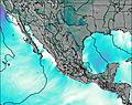
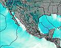
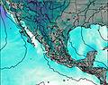
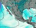
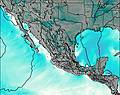
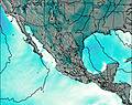
This table gives the weather forecast for Volcan De San Martin at the specific elevation of 1000 m. Our advanced weather models allow us to provide distinct weather forecasts for several elevations of Volcan De San Martin. To see the weather forecasts for the other elevations, use the tab navigation above the table. For a wider overview of the weather, consult the Weather Map of Mexico.
| Weather Station | Temp. | Weather | Wind | Gusts | Cloud / Visibility |
|---|---|---|---|---|---|
lightning 21km NNE of Villa Azueta | |||||
lightning 70km NNE of Catemaco | |||||
lightning 16km WNW of Juan Rodriguez Clara | |||||
lightning 40km N of Alvarado | |||||
lightning 10km SSW of Chacaltianguis | |||||
lightning 12km E of Tlacojalpan | |||||
lightning 98km NNE of Angel R. Cabada | |||||
SHIP3774 | |||||
SHIP3905 | |||||
SHIP3646 |
* NOTE: not all weather observatories update at the same frequency which is the reason why some locations may show data from stations that are further away than known closer ones.