– Lat/Long: 50.06° N 126.10° W
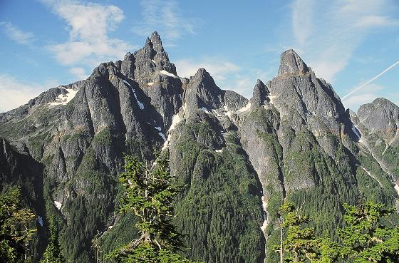
 Victoria Peak (Sutton Range)
Weather Forecast, CanadaIssued: 10 pm Sun 02 Aug Local TimeUpdates in: hr min sUpdate imminent
Issued: 10 pm Sun 02 Aug Local Time
Updates in:
Update imminent hr min s

Issued: 10 pm Sun 02 Aug Local Time
Updates in:
Update imminent hr min s
Days 1–4 Weather SummaryMostly dry. Warm (max 25°C on Tue afternoon, min 10°C on Sun night). Wind will be generally light. | Days 5–7 Weather SummaryMostly dry. Warm (max 26°C on Thu afternoon, min 12°C on Fri night). Wind will be generally light. | ||||||||||||||||||
Monday 3 | Tuesday 4 | Wednesday 5 | Thursday 6 | Friday 7 | Saturday 8 | ||||||||||||||
night | AM | PM | night | AM | PM | night | AM | PM | night | AM | PM | night | AM | PM | night | AM | PM | night | |
clear | clear | clear | clear | clear | clear | clear | clear | clear | clear | clear | some clouds | some clouds | some clouds | some clouds | clear | clear | clear | clear | |
Cloud base (m) | 9450 | 7200 | 5350 | 3850 | 2550 | 600 | |||||||||||||
km/h | |||||||||||||||||||
 |  |  |  |  |  |  | |||||||||||||
— | — | — | — | — | — | — | — | — | — | — | — | — | — | — | — | — | — | — | |
mm | — | — | — | — | — | — | — | — | — | — | — | — | — | — | — | — | — | — | — |
max °C | 14 | 17 | 22 | 18 | 22 | 25 | 20 | 22 | 25 | 20 | 23 | 26 | 20 | 20 | 22 | 18 | 17 | 20 | 16 |
min °C | 10 | 12 | 21 | 14 | 17 | 25 | 15 | 17 | 25 | 16 | 18 | 25 | 15 | 16 | 22 | 12 | 14 | 19 | 11 |
chill °C | 10 | 12 | 21 | 14 | 17 | 25 | 15 | 17 | 25 | 16 | 18 | 25 | 15 | 16 | 22 | 12 | 14 | 19 | 10 |
Freezing level m | 3600 | 3650 | 3700 | 3900 | 4000 | 4200 | 4450 | 4550 | 4550 | 4450 | 4250 | 4250 | 3750 | 3500 | 3400 | 3500 | 3300 | 3150 | 3250 |
— | 5:54 | — | — | 5:56 | — | — | 5:58 | — | — | 6:00 | — | — | 6:01 | — | — | 6:03 | — | — | |
— | — | — | 9:04 | — | — | 9:01 | — | — | 9:00 | — | — | 8:59 | — | — | 8:57 | — | — | 8:55 | |
Loading...
Victoria Peak (Sutton Range) Weather (Days 0-3):
The weather forecast for Victoria Peak (Sutton Range) is: Mostly dry. Warm (max 25°C on Tue afternoon, min 10°C on Sun night). Wind will be generally light.
Victoria Peak (Sutton Range) Weather (Days 3-6):
Mostly dry. Warm (max 26°C on Thu afternoon, min 12°C on Fri night). Wind will be generally light.
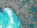
This table gives the weather forecast for Victoria Peak (Sutton Range) at the specific elevation of 500 m. Our advanced weather models allow us to provide distinct weather forecasts for several elevations of Victoria Peak (Sutton Range). To see the weather forecasts for the other elevations, use the tab navigation above the table. For a wider overview of the weather, consult the Weather Map of British-Columbia.
Victoria Peak (Sutton Range) Photos
View all
Vancouver Island Ranges photos (47) |
Pacific Coast Ranges photos (1060) |
photos from mountains in Canada (457) |
all photos
 Upload new photo
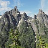
Victoria Peak (British Columbia)