– Lat/Long: 50.75° N 6.02° E
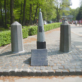
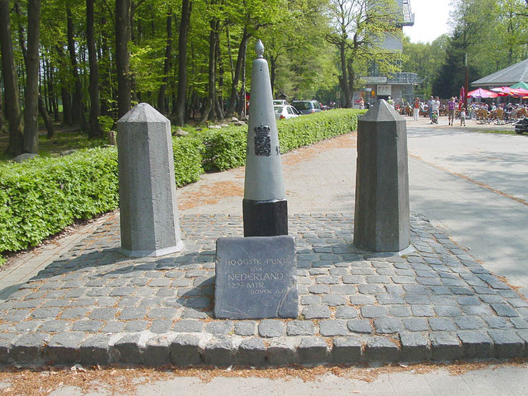
 Vaalserberg
Weather Forecast, NetherlandsIssued: 1 pm Mon 03 Aug Local TimeUpdates in: hr min sUpdate imminent
Issued: 1 pm Mon 03 Aug Local Time
Updates in:
Update imminent hr min s

Issued: 1 pm Mon 03 Aug Local Time
Updates in:
Update imminent hr min s
Days 1–4 Weather SummaryMostly dry. Warm (max 34°C on Mon afternoon, min 13°C on Wed night). Winds increasing (calm on Mon night, fresh winds from the WSW by Wed afternoon). | Days 5–7 Weather SummaryMostly dry. Warm (max 26°C on Sat afternoon, min 12°C on Thu night). Wind will be generally light. | ||||||||||||||||
Mon 3 | Tuesday 4 | Wednesday 5 | Thursday 6 | Friday 7 | Saturday 8 | ||||||||||||
PM | night | AM | PM | night | AM | PM | night | AM | PM | night | AM | PM | night | AM | PM | night | |
some clouds | rain shwrs | some clouds | some clouds | rain shwrs | some clouds | clear | clear | clear | some clouds | clear | clear | some clouds | some clouds | clear | clear | clear | |
Cloud base (m) | 3400 | 4800 | 4000 | 2500 | 4950 | 8750 | 2050 | 7000 | |||||||||
km/h | |||||||||||||||||
 |  |  |  |  |  | ||||||||||||
— | — | — | — | — | — | — | — | — | — | — | — | — | — | — | — | — | |
mm | — | 0.5 | — | — | 0.4 | — | — | — | — | — | — | — | — | — | — | — | — |
max °C | 34 | 30 | 27 | 29 | 26 | 24 | 27 | 25 | 19 | 23 | 20 | 18 | 23 | 21 | 22 | 26 | 26 |
min °C | 32 | 21 | 23 | 28 | 20 | 21 | 26 | 13 | 14 | 21 | 12 | 13 | 20 | 15 | 17 | 25 | 19 |
chill °C | 32 | 21 | 23 | 28 | 20 | 21 | 26 | 12 | 12 | 21 | 12 | 13 | 20 | 15 | 17 | 25 | 19 |
Freezing level m | 4100 | 4150 | 4150 | 4200 | 3900 | 3950 | 4050 | 3800 | 3500 | 3250 | 3450 | 3550 | 3550 | 3450 | 3450 | 3400 | 3750 |
— | — | 6:05 | — | — | 6:07 | — | — | 6:07 | — | — | 6:09 | — | — | 6:11 | — | — | |
— | 9:17 | — | — | 9:16 | — | — | 9:15 | — | — | 9:13 | — | — | 9:12 | — | — | 9:09 | |
Loading...
Vaalserberg Weather (Days 0-3):
The weather forecast for Vaalserberg is: Mostly dry. Warm (max 34°C on Mon afternoon, min 13°C on Wed night). Winds increasing (calm on Mon night, fresh winds from the WSW by Wed afternoon).
Vaalserberg Weather (Days 3-6):
Mostly dry. Warm (max 26°C on Sat afternoon, min 12°C on Thu night). Wind will be generally light.
This table gives the weather forecast for Vaalserberg at the specific elevation of 322 m. Our advanced weather models allow us to provide distinct weather forecasts for several elevations of Vaalserberg. To see the weather forecasts for the other elevations, use the tab navigation above the table. For a wider overview of the weather, consult the Weather Map of Netherlands.
| Weather Station | Temp. | Weather | Wind | Gusts | Cloud / Visibility |
|---|---|---|---|---|---|
lightning 4km NE of La Calamine | |||||
lightning 5km SSW of Aachen | |||||
thunderstorm affecting Plombieres | |||||
thunderstorm affecting Baelen | |||||
thunderstorm affecting Limbourg | |||||
thunderstorm affecting Jalhay | |||||
thunderstorm affecting Alsdorf | |||||
lightning 5km NW of Eschweiler | |||||
lightning 7km WSW of Hurtgenwald |
* NOTE: not all weather observatories update at the same frequency which is the reason why some locations may show data from stations that are further away than known closer ones.