
– Lat/Long: 45.28° N 22.53° E
 Tarcu
Tarcu
Weather Forecast, RomaniaIssued: 2 pm Fri 03 Jul Local TimeUpdates in: hr min sUpdate imminent
Issued: 2 pm Fri 03 Jul Local Time
Updates in:
Update imminent hr min s

Issued: 2 pm Fri 03 Jul Local Time
Updates in:
Update imminent hr min s
Days 1–4 Weather SummaryLight rain (total 3mm), mostly falling on Fri afternoon. Very mild (max 17°C on Fri afternoon, min 9°C on Sun morning). Winds decreasing (fresh winds from the N on Fri night, light winds from the NW by Sun night). | Days 5–7 Weather SummaryLight rain (total 3mm), mostly falling on Wed afternoon. Very mild (max 15°C on Tue afternoon, min 10°C on Wed morning). Wind will be generally light. | ||||||||||||||||
Fri 3 | Saturday 4 | Sunday 5 | Monday 6 | Tuesday 7 | Wednesday 8 | ||||||||||||
PM | night | AM | PM | night | AM | PM | night | AM | PM | night | AM | PM | night | AM | PM | night | |
risk tstorm | clear | clear | clear | clear | clear | light rain | rain shwrs | rain shwrs | rain shwrs | rain shwrs | cloudy | clear | rain shwrs | rain shwrs | light rain | rain shwrs | |
km/h | |||||||||||||||||
 |  |  |  |  |  | ||||||||||||
— | — | — | — | — | — | — | — | — | — | — | — | — | — | — | — | — | |
mm | 2 | — | — | — | — | — | 0.4 | 0.5 | 0.1 | 0.1 | 0.2 | — | — | 0.2 | 0.6 | 1.2 | 0.5 |
max °C | 17 | 17 | 12 | 14 | 14 | 11 | 12 | 12 | 12 | 14 | 13 | 12 | 15 | 15 | 11 | 13 | 12 |
min °C | 14 | 12 | 11 | 13 | 11 | 9 | 12 | 10 | 10 | 13 | 11 | 11 | 14 | 11 | 10 | 11 | 11 |
chill °C | 13 | 10 | 8 | 11 | 8 | 6 | 9 | 8 | 8 | 11 | 9 | 10 | 13 | 10 | 8 | 9 | 9 |
Freezing level m | 4000 | 3650 | 3500 | 3350 | 3050 | 3000 | 3050 | 3150 | 3250 | 3200 | 3300 | 3400 | 3400 | 3500 | 3300 | 3500 | 3400 |
Cloud base (m) | 850 | 2500 | 2350 | 2400 | 1900 | 2500 | 2150 | 5400 | 3500 | 3500 | 1600 | 1850 | 1850 | ||||
— | — | 5:47 | — | — | 5:47 | — | — | 5:48 | — | — | 5:48 | — | — | 5:50 | — | — | |
— | 9:21 | — | — | 9:20 | — | — | 9:20 | — | — | 9:20 | — | — | 9:19 | — | — | 9:19 | |
Loading...
Tarcu Weather (Days 0-3):
The weather forecast for Tarcu is: Light rain (total 3mm), mostly falling on Fri afternoon. Very mild (max 17°C on Fri afternoon, min 9°C on Sun morning). Winds decreasing (fresh winds from the N on Fri night, light winds from the NW by Sun night).
Tarcu Weather (Days 3-6):
Light rain (total 3mm), mostly falling on Wed afternoon. Very mild (max 15°C on Tue afternoon, min 10°C on Wed morning). Wind will be generally light.
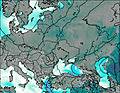
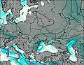
This table gives the weather forecast for Tarcu at the specific elevation of 1500 m. Our advanced weather models allow us to provide distinct weather forecasts for several elevations of Tarcu. To see the weather forecasts for the other elevations, use the tab navigation above the table. For a wider overview of the weather, consult the Weather Map of Romania.
| Weather Station | Temp. | Weather | Wind | Gusts | Cloud / Visibility |
|---|---|---|---|---|---|
lightning 13km NNW of Isverna | |||||
Clopotiva | |||||
lightning 4km NW of Ponoarele | |||||
thunderstorm affecting Baia de Aramă | |||||
thunderstorm affecting Tismana | |||||
lightning 5km ENE of Balta | |||||
lightning 6km SSW of Uricani | |||||
lightning 5km NW of Sovarna |
* NOTE: not all weather observatories update at the same frequency which is the reason why some locations may show data from stations that are further away than known closer ones.