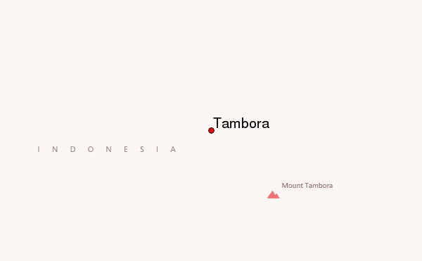
From May 21 to May 25 I made an expedition to the base of the Tambora crater. I was with a group of twelve, mainly young graduates from Bima College.
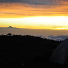
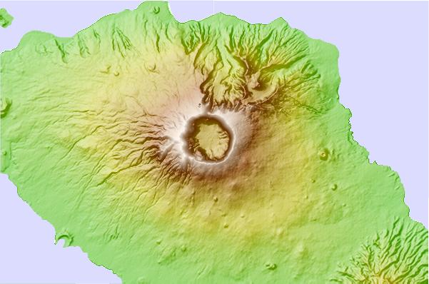
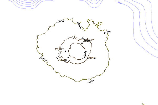
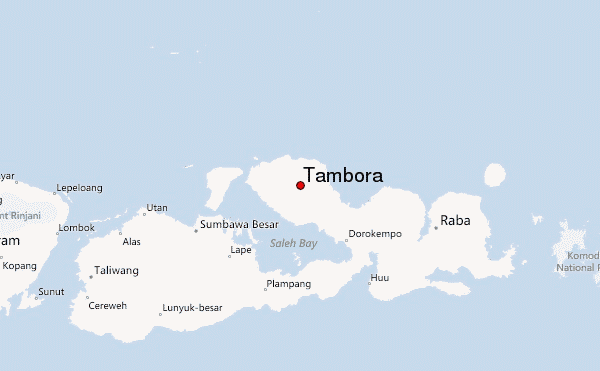
I flew in to Bima, because the people that have been into the crater mainly live there. After 6 hours drive from the airport we arrived at the coffee plantation above Pancasila (800m above sea level). From here the trail starts and I stayed overnight in the nice guest house. At this altitude there are no mosquitoes. Next day we started at 7 am and built camp at 5 pm at Pos V (at 2.300m), just below the tree-line, which is quite low at Tambora. Next morning we started at sunrise to reach the rim (2.650m) at 8.30 am. Tambora as it stands now, after the eruption in 1815, is the base of a former 4.100m (or so) giant, so only the last stretch between Pos V and the rim was somewhat steep.
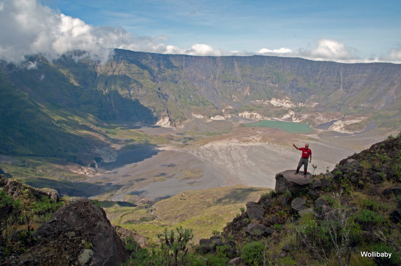
When we arrived at the rim to reach the entry point into the caldera we turned left,. So, on this western edge of the crater we walked some 1.000m north, close to the peak, left, that is opposite to the real peak, which we had left behind on our right. The trail downhill generally followed two historic landslides which today are stable and partly overgrown. It ended just 1.200m below the point where trekkers coming from Pos V usually enjoy their view on Tambora crater, at 1.450m.
In large parts the trail downhill had an inclination of 35 to 40 degrees. But nearly half of the trail has 45 up to 50 degrees and these are not solid rock but different lose materials. Here the only firm grips for our hands often were only bushes and grass, whereas Edelweiss did not hold. The first stop we had at 2.250m, in a granite formation at a place called Pos Wadunae. Here we found fresh water. After this point we kept right-hand and entered one of the steepest parts of the whole trail. While ropes nowhere else are really indispensable (except as a precautionary measure) here each of us hung on the rope for two meters or so. Whenever we came to a junction from here we should have kept right, but did so only on the way uphill, two days later. Instead, on one of those junctions we took the left option, so we had a very steep and rocky way downhill on our last 400m, which belonged to the steepest of the whole way. This detour cost us one hour extra and we arrived at the crater base at sunset, at 6 pm, 12 hours after we left Pos V.
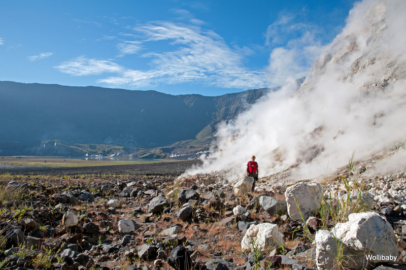
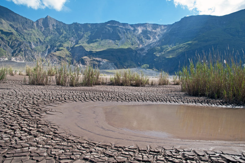
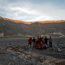
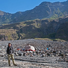
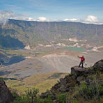
We camped two nights on the crater base, at the sandy banks of a small creek, between a lot of big debris. The crater lake, at the lowest point in the east, was already starting to dry up (as was our creek) end of May, but still measured 800 by 800 meters. Two other creeks, further to the east, had much more water. Fumaroles were ejecting white steam at many places all around the crater theatre that measures some 6,5 by 6,5 km. They flag the border line between the (horizontal) cold and rocky cap on the giant magma chamber under our feet and the (vertical) crater walls – with one exception. That is the area around Doro Api Toi, the mini crater in the south-eastern corner, 20 m high with a diameter of 100m. While this mini crater does not appear to have grown in recent years, some fumaroles sprang up in its vicinity, making even the water of a creek passing the area boil. The steam fumaroles were strongest in the mornings, after sunrise, losing power during the day.
We packed tents before sunrise after the second night to start our climb at 6 am. This time we found the best entry point immediately. Nevertheless, the first 150m were very steep, again. It took us eight and a half hours to reach the rim again. At Pos V, at 4.30 pm, our Indonesian friends had to register that the wild pigs had eaten all their rice that they had hidden on the ground. So we decided to continue our walk to the guest house of the coffee plantation through the night. We arrived there at 11.30 pm, nearly 18 hours after we started our climb on the crater base.
Remarks and recommendations:
- Plan the water resources very carefully. At the beginning of the dry season, end of May, all springs (including at Pos V) and creeks on the crater base had plenty of water. The longer the dry season the less water you will find.
- Consider plan B: in case of extended rain falls or sickness/accident you may have to stay extra days in the crater. So, take extra food with you.
- In the crater you will be incommunicado (unless you have an Iridium phone). There is no point to register, hence you will not be missed for quite a while. So, form a sufficiently big team.
- One point below Pos Wadunae at 2.250m you can only pass by hanging in a rope for two meters or so. At some other steep parts a rope is helpful as safeguard and precaution.
- A safety helmet seems advisable as your companions above may trigger stones.
- It is indispensable to take a guide and porters. I had two porters with ten kilos each. The few guides you get only in Bima. Ask Rik Stoetman for assistance. He runs two blogs, one under visitttambora, and is very cooperative. Indeed, without him I could not have made it.
 Tambora – Climbing, Hiking & Mountaineering information
