– Lat/Long: 61.98° N 10.29° E
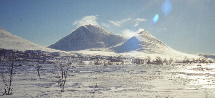
 Storsølnkletten (Storsolnkletten)
Weather Forecast, NorwayIssued: 7 am Sun 26 Jul Local TimeUpdates in: hr min sUpdate imminent
Issued: 7 am Sun 26 Jul Local Time
Updates in:
Update imminent hr min s

Issued: 7 am Sun 26 Jul Local Time
Updates in:
Update imminent hr min s
Days 1–3 Weather SummaryMostly dry. Very mild (max 12°C on Sun afternoon, min 7°C on Sun morning). Wind will be generally light. | Days 4–6 Weather SummaryLight rain (total 5mm), mostly falling on Thu night. Very mild (max 18°C on Thu afternoon, min 6°C on Fri night). Winds increasing (calm on Wed morning, strong winds from the SSW by Thu afternoon). | |||||||||||||||||
Sunday 26 | Monday 27 | Tuesday 28 | Wednesday 29 | Thursday 30 | Friday 31 | |||||||||||||
AM | PM | night | AM | PM | night | AM | PM | night | AM | PM | night | AM | PM | night | AM | PM | night | |
some clouds | cloudy | rain shwrs | some clouds | some clouds | some clouds | some clouds | some clouds | some clouds | some clouds | some clouds | clear | some clouds | cloudy | rain shwrs | rain shwrs | rain shwrs | light rain | |
Cloud base (m) | 2500 | 2300 | 2000 | 2550 | 2300 | 2500 | 1950 | 2100 | 2450 | 2350 | 2600 | 5300 | 2150 | 850 | 1600 | 1450 | 800 | |
km/h | ||||||||||||||||||
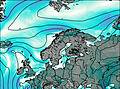 | 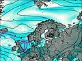 | 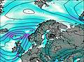 |  |  |  | |||||||||||||
— | — | — | — | — | — | — | — | — | — | — | — | — | — | — | — | — | — | |
mm | — | — | 0.1 | — | — | — | — | — | — | — | — | — | — | — | 3 | 0.2 | 0.1 | 2 |
max °C | 9 | 12 | 11 | 10 | 12 | 11 | 9 | 11 | 11 | 11 | 15 | 15 | 15 | 18 | 15 | 14 | 10 | 7 |
min °C | 7 | 12 | 7 | 7 | 11 | 8 | 8 | 10 | 7 | 8 | 15 | 13 | 14 | 17 | 13 | 13 | 9 | 6 |
chill °C | 5 | 11 | 6 | 6 | 8 | 7 | 5 | 7 | 7 | 8 | 14 | 12 | 12 | 16 | 11 | 12 | 7 | 2 |
Freezing level m | 2150 | 2350 | 2100 | 2200 | 2300 | 2200 | 2300 | 2750 | 2700 | 2600 | 3050 | 3300 | 3550 | 3700 | 3650 | 3200 | 2700 | 2100 |
4:26 | — | — | 4:30 | — | — | 4:31 | — | — | 4:35 | — | — | 4:37 | — | — | 4:39 | — | — | |
— | — | 10:21 | — | — | 10:17 | — | — | 10:15 | — | — | 10:13 | — | — | 10:09 | — | — | 10:07 | |
Loading...
Storsølnkletten Weather (Days 0-3):
The weather forecast for Storsølnkletten is: Mostly dry. Very mild (max 12°C on Sun afternoon, min 7°C on Sun morning). Wind will be generally light.
Storsølnkletten Weather (Days 3-6):
Light rain (total 5mm), mostly falling on Thu night. Very mild (max 18°C on Thu afternoon, min 6°C on Fri night). Winds increasing (calm on Wed morning, strong winds from the SSW by Thu afternoon).
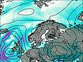
This table gives the weather forecast for Storsølnkletten at the specific elevation of 1000 m. Our advanced weather models allow us to provide distinct weather forecasts for several elevations of Storsølnkletten. To see the weather forecasts for the other elevations, use the tab navigation above the table. For a wider overview of the weather, consult the Weather Map of Norway.
Storsølnkletten Photos
View all
Scandinavia/European Arctic Ranges photos (16) |
photos from mountains in Norway (115) |
all photos
 Upload new photo
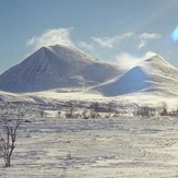
Storsølnkletten