– Lat/Long: 50.73° N 116.79° W
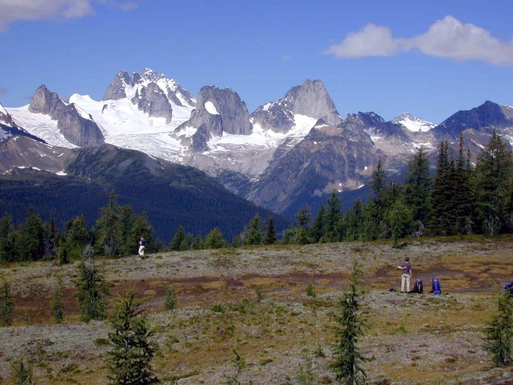
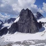
 Snowpatch Spire
Weather Forecast, CanadaIssued: 5 am Mon 03 Aug Local TimeUpdates in: hr min sUpdate imminent
Issued: 5 am Mon 03 Aug Local Time
Updates in:
Update imminent hr min s

Issued: 5 am Mon 03 Aug Local Time
Updates in:
Update imminent hr min s
Days 1–3 Weather SummaryMostly dry. Freeze-thaw conditions (max 9°C on Wed afternoon, min -3°C on Mon morning). Wind will be generally light. | Days 4–6 Weather SummarySome drizzle, heaviest during Sat morning. Very mild (max 12°C on Thu afternoon, min 5°C on Sat night). Wind will be generally light. | |||||||||||||||||
Monday 3 | Tuesday 4 | Wednesday 5 | Thursday 6 | Friday 7 | Saturday 8 | |||||||||||||
AM | PM | night | AM | PM | night | AM | PM | night | AM | PM | night | AM | PM | night | AM | PM | night | |
some clouds | cloudy | some clouds | clear | some clouds | some clouds | clear | clear | clear | clear | clear | some clouds | clear | clear | clear | rain shwrs | risk tstorm | rain shwrs | |
Cloud base (m) | 2900 | 3100 | 6400 | 4250 | 6500 | 6200 | 6600 | 5700 | 4600 | 4200 | 3900 | |||||||
km/h | ||||||||||||||||||
 |  |  |  |  |  | |||||||||||||
— | — | — | — | — | — | — | — | — | — | — | — | — | — | — | — | — | — | |
mm | — | — | — | — | — | — | — | — | — | — | — | — | — | — | — | 0.6 | 0.4 | 0.2 |
max °C | -1 | 3 | 2 | 2 | 6 | 5 | 5 | 9 | 9 | 9 | 12 | 12 | 10 | 10 | 9 | 6 | 7 | 7 |
min °C | -3 | 1 | 1 | 1 | 5 | 4 | 4 | 8 | 8 | 8 | 11 | 11 | 9 | 10 | 6 | 6 | 7 | 5 |
chill °C | -3 | -1 | 1 | 1 | 2 | 2 | 2 | 6 | 7 | 6 | 9 | 9 | 7 | 7 | 4 | 4 | 4 | 3 |
Freezing level m | 2750 | 3250 | 3400 | 3250 | 3750 | 3900 | 3850 | 4300 | 4400 | 4300 | 4500 | 4600 | 4400 | 4350 | 4250 | 3950 | 4000 | 4050 |
6:16 | — | — | 6:16 | — | — | 6:18 | — | — | 6:20 | — | — | 6:22 | — | — | 6:22 | — | — | |
— | — | 9:29 | — | — | 9:27 | — | — | 9:25 | — | — | 9:23 | — | — | 9:22 | — | — | 9:20 | |
Loading...
Snowpatch Spire Weather (Days 0-3):
The weather forecast for Snowpatch Spire is: Mostly dry. Freeze-thaw conditions (max 9°C on Wed afternoon, min -3°C on Mon morning). Wind will be generally light.
Snowpatch Spire Weather (Days 3-6):
Some drizzle, heaviest during Sat morning. Very mild (max 12°C on Thu afternoon, min 5°C on Sat night). Wind will be generally light.
This table gives the weather forecast for Snowpatch Spire at the specific elevation of 3084 m. Our advanced weather models allow us to provide distinct weather forecasts for several elevations of Snowpatch Spire. To see the weather forecasts for the other elevations, use the tab navigation above the table. For a wider overview of the weather, consult the Weather Map of British-Columbia.
| Weather Station | Temp. | Weather | Wind | Gusts | Cloud / Visibility |
|---|---|---|---|---|---|
Mount 7 | |||||
Golden Airport | |||||
Swansea Mtn | |||||
Yoho Park- BC | |||||
Nakusp Airport | |||||
* NOTE: not all weather observatories update at the same frequency which is the reason why some locations may show data from stations that are further away than known closer ones.
Snowpatch Spire Photos
View all
Columbia Mountains photos (2) |
photos from mountains in Canada (457) |
all photos
 Upload new photo
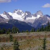
Snow Patch, et al from Chalice Ridge
Snowpatch Spire