– Lat/Long: 40.53° N 0.03° E
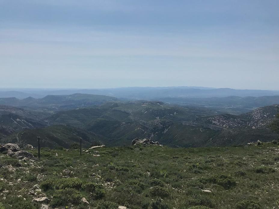
 Serra de Vallivana
Weather Forecast, SpainIssued: 1 pm Mon 03 Aug Local TimeUpdates in: hr min sUpdate imminent
Issued: 1 pm Mon 03 Aug Local Time
Updates in:
Update imminent hr min s

Issued: 1 pm Mon 03 Aug Local Time
Updates in:
Update imminent hr min s
Days 1–4 Weather SummaryLight rain (total 4mm), mostly falling on Thu morning. Warm (max 24°C on Mon afternoon, min 19°C on Thu morning). Wind will be generally light. | Days 5–7 Weather SummaryLight rain (total 9mm), mostly falling on Thu night. Warm (max 26°C on Sat night, min 19°C on Thu night). Winds increasing (calm on Thu night, fresh winds from the SW by Sat night). | ||||||||||||||||
Mon 3 | Tuesday 4 | Wednesday 5 | Thursday 6 | Friday 7 | Saturday 8 | ||||||||||||
PM | night | AM | PM | night | AM | PM | night | AM | PM | night | AM | PM | night | AM | PM | night | |
cloudy | risk tstorm | clear | clear | clear | clear | clear | clear | risk tstorm | risk tstorm | rain shwrs | clear | clear | clear | clear | clear | clear | |
Cloud base (m) | 5450 | 7400 | 7350 | ||||||||||||||
km/h | |||||||||||||||||
 |  |  |  |  |  | ||||||||||||
— | — | — | — | — | — | — | — | — | — | — | — | — | — | — | — | — | |
mm | — | 0.2 | — | — | — | — | — | — | 4 | 0.3 | 8 | — | — | — | — | — | — |
max °C | 24 | 24 | 23 | 24 | 24 | 22 | 24 | 23 | 20 | 23 | 23 | 19 | 24 | 23 | 23 | 24 | 26 |
min °C | 23 | 23 | 23 | 23 | 22 | 22 | 23 | 21 | 19 | 22 | 19 | 19 | 22 | 23 | 23 | 23 | 22 |
chill °C | 23 | 23 | 23 | 23 | 22 | 22 | 23 | 21 | 19 | 22 | 19 | 19 | 22 | 23 | 23 | 23 | 22 |
Freezing level m | 4600 | 4350 | 4450 | 4600 | 4700 | 4650 | 4750 | 4700 | 4600 | 4600 | 4750 | 4650 | 4650 | 4800 | 4800 | 4850 | 4800 |
— | — | 6:58 | — | — | 7:00 | — | — | 7:01 | — | — | 7:01 | — | — | 7:03 | — | — | |
— | 9:13 | — | — | 9:12 | — | — | 9:10 | — | — | 9:08 | — | — | 9:07 | — | — | 9:07 | |
Loading...
Serra de Vallivana Weather (Days 0-3):
The weather forecast for Serra de Vallivana is: Light rain (total 4mm), mostly falling on Thu morning. Warm (max 24°C on Mon afternoon, min 19°C on Thu morning). Wind will be generally light.
Serra de Vallivana Weather (Days 3-6):
Light rain (total 9mm), mostly falling on Thu night. Warm (max 26°C on Sat night, min 19°C on Thu night). Winds increasing (calm on Thu night, fresh winds from the SW by Sat night).
This table gives the weather forecast for Serra de Vallivana at the specific elevation of 1275 m. Our advanced weather models allow us to provide distinct weather forecasts for several elevations of Serra de Vallivana. To see the weather forecasts for the other elevations, use the tab navigation above the table. For a wider overview of the weather, consult the Weather Map of Spain.
| Weather Station | Temp. | Weather | Wind | Gusts | Cloud / Visibility |
|---|---|---|---|---|---|
Club RC De l´Ebre | |||||
lightning 12km NW of Valderrobres | |||||
lightning 14km ESE of Alcañiz | |||||
lightning 6km NW of Mas de las Matas | |||||
lightning 7km ENE of Alcorisa | |||||
lightning 7km W of Calanda | |||||
Castellon -Almazora |
* NOTE: not all weather observatories update at the same frequency which is the reason why some locations may show data from stations that are further away than known closer ones.
Serra de Vallivana Photos
View all
photos (6) |
Sistema Ibérico photos (30) |
photos from mountains in Spain (451) |
all photos
 Upload new photo
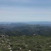
From Turmell's peak to Xert
El Turmell