– Lat/Long: 47.77° N 15.81° E
 Schneeberg (Alps)
Weather Forecast, AustriaIssued: 1 pm Mon 03 Aug Local TimeUpdates in: hr min sUpdate imminent
Issued: 1 pm Mon 03 Aug Local Time
Updates in:
Update imminent hr min s

Issued: 1 pm Mon 03 Aug Local Time
Updates in:
Update imminent hr min s
Days 1–4 Weather SummaryMostly dry. Warm (max 25°C on Tue afternoon, min 21°C on Wed morning). Wind will be generally light. | Days 5–7 Weather SummaryModerate rain (total 14mm), heaviest on Thu afternoon. Warm (max 23°C on Thu afternoon, min 12°C on Fri night). Wind will be generally light. | ||||||||||||||||
Mon 3 | Tuesday 4 | Wednesday 5 | Thursday 6 | Friday 7 | Saturday 8 | ||||||||||||
PM | night | AM | PM | night | AM | PM | night | AM | PM | night | AM | PM | night | AM | PM | night | |
clear | clear | clear | clear | clear | clear | clear | clear | clear | heavy rain | rain shwrs | some clouds | light rain | rain shwrs | clear | clear | clear | |
Cloud base (m) | 5000 | 4400 | 9100 | 2350 | 900 | 900 | 6700 | ||||||||||
km/h | |||||||||||||||||
 |  |  |  |  |  | ||||||||||||
— | — | — | — | — | — | — | — | — | — | — | — | — | — | — | — | — | |
mm | — | — | — | — | — | — | — | — | — | 10 | 2 | — | 1.2 | 0.2 | — | — | — |
max °C | 23 | 23 | 23 | 25 | 24 | 22 | 25 | 23 | 21 | 23 | 21 | 15 | 13 | 14 | 13 | 16 | 16 |
min °C | 23 | 23 | 22 | 24 | 23 | 21 | 24 | 21 | 21 | 20 | 16 | 14 | 13 | 12 | 12 | 15 | 15 |
chill °C | 23 | 23 | 22 | 24 | 23 | 21 | 24 | 21 | 21 | 20 | 15 | 13 | 12 | 10 | 10 | 15 | 15 |
Freezing level m | 4500 | 4550 | 4550 | 4550 | 4650 | 4500 | 4550 | 4550 | 4450 | 4450 | 4400 | 4150 | 4150 | 4050 | 4000 | 4000 | 3900 |
— | — | 5:35 | — | — | 5:37 | — | — | 5:39 | — | — | 5:39 | — | — | 5:41 | — | — | |
— | 8:29 | — | — | 8:28 | — | — | 8:25 | — | — | 8:24 | — | — | 8:22 | — | — | 8:22 | |
Loading...
Schneeberg (Alps) Weather (Days 0-3):
The weather forecast for Schneeberg (Alps) is: Mostly dry. Warm (max 25°C on Tue afternoon, min 21°C on Wed morning). Wind will be generally light.
Schneeberg (Alps) Weather (Days 3-6):
Moderate rain (total 14mm), heaviest on Thu afternoon. Warm (max 23°C on Thu afternoon, min 12°C on Fri night). Wind will be generally light.
This table gives the weather forecast for Schneeberg (Alps) at the specific elevation of 1500 m. Our advanced weather models allow us to provide distinct weather forecasts for several elevations of Schneeberg (Alps). To see the weather forecasts for the other elevations, use the tab navigation above the table. For a wider overview of the weather, consult the Weather Map of Austria.
| Weather Station | Temp. | Weather | Wind | Gusts | Cloud / Visibility |
|---|---|---|---|---|---|
Reichena / ax | |||||
Gutenstein Mariahilfberg | |||||
Semmering | |||||
Hohe Wan / ochkogelhaus | |||||
Lilienfel / arschberg | |||||
Wiener Neustadt | |||||
Flugplatz Wiener Neustadt-Ost Airport |
* NOTE: not all weather observatories update at the same frequency which is the reason why some locations may show data from stations that are further away than known closer ones.
Schneeberg (Alps) Photos
View all
Northern Limestone Alps photos (8) |
Alps photos (1485) |
photos from mountains in Austria (215) |
all photos
 Upload new photo
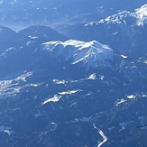
Schneeberg from the air, 13 Jan
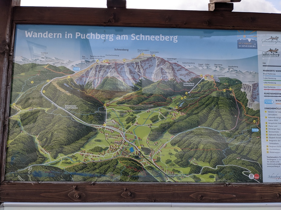
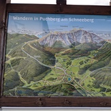
Wandern in Puchberg am Schneeberg
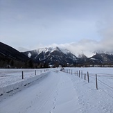
Schneeberg (January)
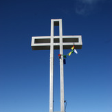
schneeberg
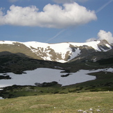
Schneeberg (Alps)