– Lat/Long: 46.56° N 7.83° E
 Schilthorn
Weather Forecast, SwitzerlandIssued: 1 pm Mon 03 Aug Local TimeUpdates in: hr min sUpdate imminent
Issued: 1 pm Mon 03 Aug Local Time
Updates in:
Update imminent hr min s

Issued: 1 pm Mon 03 Aug Local Time
Updates in:
Update imminent hr min s
Days 1–4 Weather SummaryModerate rain (total 18mm), heaviest on Tue night. Warm (max 28°C on Mon afternoon, min 20°C on Mon night). Wind will be generally light. | Days 5–7 Weather SummaryModerate rain (total 18mm), heaviest on Thu night. Warm (max 24°C on Sat afternoon, min 16°C on Thu night). Wind will be generally light. | ||||||||||||||||
Mon 3 | Tuesday 4 | Wednesday 5 | Thursday 6 | Friday 7 | Saturday 8 | ||||||||||||
PM | night | AM | PM | night | AM | PM | night | AM | PM | night | AM | PM | night | AM | PM | night | |
risk tstorm | risk tstorm | clear | risk tstorm | rain shwrs | clear | risk tstorm | rain shwrs | rain shwrs | risk tstorm | rain shwrs | some clouds | risk tstorm | rain shwrs | clear | rain shwrs | rain shwrs | |
Cloud base (m) | 3350 | 5150 | 3250 | 4950 | 3300 | 2550 | 8900 | 3400 | |||||||||
km/h | |||||||||||||||||
 |  |  |  |  |  | ||||||||||||
— | — | — | — | — | — | — | — | — | — | — | — | — | — | — | — | — | |
mm | 0.2 | 3 | — | 2 | 5 | — | 4 | 4 | 0.2 | 7 | 10 | — | 0.8 | 0.1 | — | 0.3 | 0.1 |
max °C | 28 | 22 | 24 | 27 | 20 | 23 | 25 | 21 | 23 | 23 | 18 | 19 | 20 | 19 | 21 | 24 | 21 |
min °C | 25 | 20 | 21 | 23 | 20 | 21 | 23 | 20 | 21 | 20 | 16 | 16 | 20 | 18 | 18 | 23 | 19 |
chill °C | 25 | 20 | 21 | 23 | 20 | 21 | 23 | 20 | 21 | 20 | 16 | 16 | 20 | 18 | 18 | 23 | 19 |
Freezing level m | 4550 | 4450 | 4350 | 4500 | 4400 | 4300 | 4400 | 4400 | 4250 | 4200 | 4100 | 4050 | 4100 | 4200 | 4150 | 4200 | 4400 |
— | — | 6:11 | — | — | 6:13 | — | — | 6:13 | — | — | 6:15 | — | — | 6:16 | — | — | |
— | 8:58 | — | — | 8:55 | — | — | 8:54 | — | — | 8:52 | — | — | 8:52 | — | — | 8:50 | |
Loading...
Schilthorn Weather (Days 0-3):
The weather forecast for Schilthorn is: Moderate rain (total 18mm), heaviest on Tue night. Warm (max 28°C on Mon afternoon, min 20°C on Mon night). Wind will be generally light.
Schilthorn Weather (Days 3-6):
Moderate rain (total 18mm), heaviest on Thu night. Warm (max 24°C on Sat afternoon, min 16°C on Thu night). Wind will be generally light.
This table gives the weather forecast for Schilthorn at the specific elevation of 1000 m. Our advanced weather models allow us to provide distinct weather forecasts for several elevations of Schilthorn. To see the weather forecasts for the other elevations, use the tab navigation above the table. For a wider overview of the weather, consult the Weather Map of Switzerland.
Schilthorn Photos
View all
Bernese Alps photos (163) |
Alps photos (1485) |
photos from mountains in Switzerland (649) |
all photos
 Upload new photo
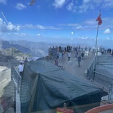
 See 10 more Schilthorn photos
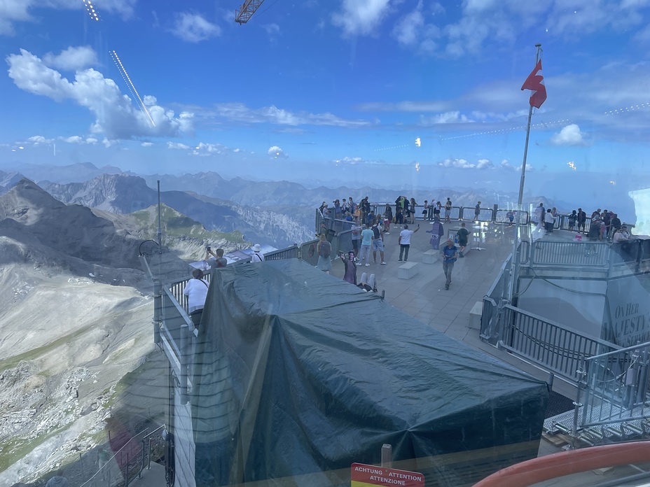
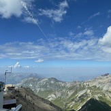
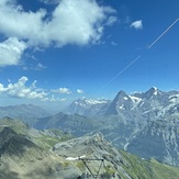
View from restaurant
View from restaurant
View from restaurant
View from restaurant
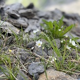
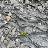
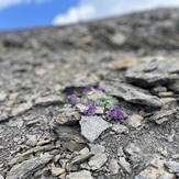
Alpine flowers
Alpine flowers
Alpine flowers