– Lat/Long: 56.67° N 4.10° W
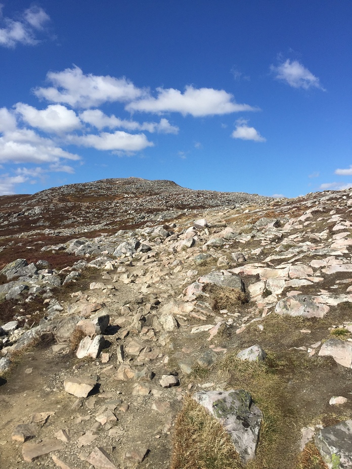
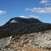
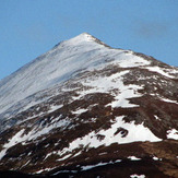
 Schiehallion
Weather Forecast, United KingdomIssued: 12 pm Mon 03 Aug Local TimeUpdates in: hr min sUpdate imminent
Issued: 12 pm Mon 03 Aug Local Time
Updates in:
Update imminent hr min s

Issued: 12 pm Mon 03 Aug Local Time
Updates in:
Update imminent hr min s
Days 1–3 Weather SummaryHeavy rain (total 23mm), heaviest during Mon night. Very mild (max 13°C on Tue afternoon, min 8°C on Wed night). Wind will be generally light. | Days 4–6 Weather SummaryLight rain (total 3mm), mostly falling on Fri night. Very mild (max 13°C on Thu afternoon, min 7°C on Thu night). Wind will be generally light. | |||||||||||||||||
Monday 3 | Tuesday 4 | Wednesday 5 | Thursday 6 | Friday 7 | Saturday 8 | |||||||||||||
AM | PM | night | AM | PM | night | AM | PM | night | AM | PM | night | AM | PM | night | AM | PM | night | |
light rain | light rain | mod. rain | light rain | light rain | light rain | rain shwrs | light rain | rain shwrs | rain shwrs | some clouds | some clouds | light rain | rain shwrs | light rain | light rain | light rain | light rain | |
Cloud base (m) | 800 | 300 | 650 | 300 | 300 | 300 | 250 | 500 | 400 | 750 | 1850 | 2750 | 600 | 750 | 950 | 300 | 600 | 750 |
km/h | ||||||||||||||||||
 |  |  |  |  |  | |||||||||||||
— | — | — | — | — | — | — | — | — | — | — | — | — | — | — | — | — | — | |
mm | 1.2 | 1 | 6 | 3 | 3 | 2 | 4 | 2 | 0.9 | 0.2 | — | — | 0.1 | 0.6 | 0.7 | 0.4 | 0.5 | 0.3 |
max °C | 11 | 12 | 11 | 12 | 13 | 13 | 13 | 13 | 11 | 12 | 13 | 10 | 11 | 13 | 10 | 12 | 12 | 10 |
min °C | 11 | 11 | 11 | 12 | 12 | 12 | 13 | 12 | 8 | 10 | 12 | 7 | 10 | 12 | 10 | 11 | 11 | 10 |
chill °C | 10 | 10 | 9 | 10 | 11 | 11 | 13 | 11 | 6 | 9 | 11 | 5 | 8 | 10 | 8 | 8 | 8 | 7 |
Freezing level m | 2500 | 2700 | 3000 | 3200 | 3250 | 3100 | 2700 | 2750 | 2350 | 2000 | 2350 | 2300 | 2100 | 2200 | 2650 | 2850 | 3150 | 2550 |
5:18 | — | — | 5:20 | — | — | 5:22 | — | — | 5:24 | — | — | 5:26 | — | — | 5:28 | — | — | |
— | 9:23 | — | — | 9:22 | — | — | 9:19 | — | — | 9:16 | — | — | 9:15 | — | — | 9:13 | — | |
Loading...
Schiehallion Weather (Days 0-3):
The weather forecast for Schiehallion is: Heavy rain (total 23mm), heaviest during Mon night. Very mild (max 13°C on Tue afternoon, min 8°C on Wed night). Wind will be generally light.
Schiehallion Weather (Days 3-6):
Light rain (total 3mm), mostly falling on Fri night. Very mild (max 13°C on Thu afternoon, min 7°C on Thu night). Wind will be generally light.
This table gives the weather forecast for Schiehallion at the specific elevation of 500 m. Our advanced weather models allow us to provide distinct weather forecasts for several elevations of Schiehallion. To see the weather forecasts for the other elevations, use the tab navigation above the table. For a wider overview of the weather, consult the Weather Map of United Kingdom.
Schiehallion Photos
View all
Grampians photos (167) |
Scottish Highlands photos (301) |
photos from mountains in United Kingdom (2125) |
all photos
 Upload new photo
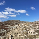
Schiehallion ridge
Schiehallion summit
Schiehallion