– Lat/Long: 47.91° N 7.90° E
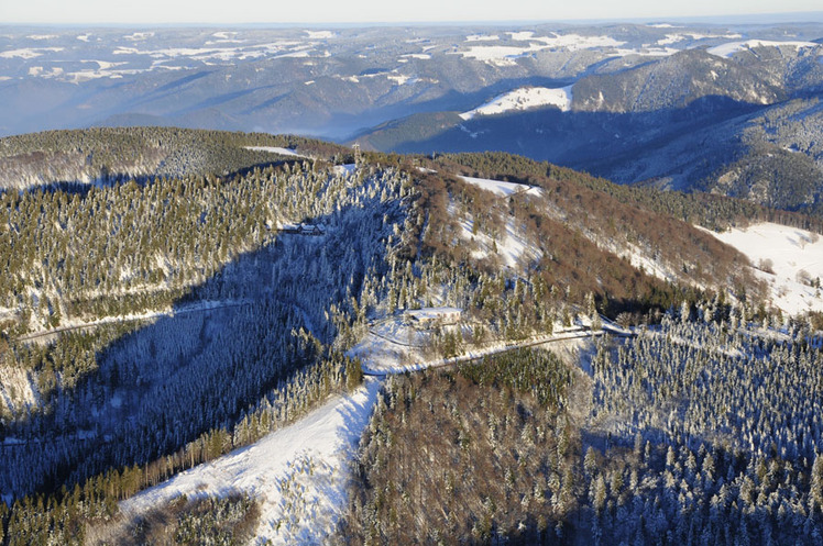
 Schauinsland
Weather Forecast, GermanyIssued: 7 pm Fri 31 Jul Local TimeUpdates in: hr min sUpdate imminent
Issued: 7 pm Fri 31 Jul Local Time
Updates in:
Update imminent hr min s

Issued: 7 pm Fri 31 Jul Local Time
Updates in:
Update imminent hr min s
Days 1–4 Weather SummaryLight rain (total 5mm), mostly falling on Fri night. Warm (max 26°C on Mon afternoon, min 16°C on Fri night). Wind will be generally light. | Days 5–7 Weather SummaryLight rain (total 2mm), mostly falling on Mon night. Warm (max 26°C on Tue afternoon, min 21°C on Tue morning). Winds decreasing (fresh winds from the WSW on Mon night, light winds from the SSW by Tue night). | ||||||||||||||||||
Saturday 1 | Sunday 2 | Monday 3 | Tuesday 4 | Wednesday 5 | Thursday 6 | ||||||||||||||
night | AM | PM | night | AM | PM | night | AM | PM | night | AM | PM | night | AM | PM | night | AM | PM | night | |
rain shwrs | rain shwrs | risk tstorm | clear | clear | clear | clear | clear | some clouds | rain shwrs | clear | clear | rain shwrs | clear | clear | clear | rain shwrs | some clouds | clear | |
Cloud base (m) | 3900 | 1850 | 9350 | 9500 | 3950 | 3400 | 5150 | 5050 | 6950 | 6300 | 2900 | ||||||||
km/h | |||||||||||||||||||
 |  |  |  |  |  |  | |||||||||||||
— | — | — | — | — | — | — | — | — | — | — | — | — | — | — | — | — | — | — | |
mm | 3 | 1 | 1 | — | — | — | — | — | — | 1.5 | — | — | 0.6 | — | — | — | 0.1 | — | — |
max °C | 21 | 16 | 18 | 19 | 19 | 24 | 23 | 24 | 26 | 24 | 22 | 26 | 25 | 21 | 25 | 25 | 21 | 24 | 22 |
min °C | 16 | 16 | 18 | 18 | 18 | 22 | 22 | 23 | 26 | 22 | 21 | 24 | 22 | 21 | 24 | 21 | 21 | 23 | 19 |
chill °C | 15 | 15 | 18 | 18 | 18 | 22 | 22 | 23 | 26 | 22 | 21 | 24 | 22 | 21 | 24 | 21 | 21 | 23 | 19 |
Freezing level m | 4050 | 4100 | 4150 | 4300 | 4250 | 4300 | 4400 | 4450 | 4550 | 4500 | 4450 | 4500 | 4550 | 4500 | 4400 | 4450 | 4300 | 4250 | 4300 |
— | 6:03 | — | — | 6:05 | — | — | 6:05 | — | — | 6:07 | — | — | 6:09 | — | — | 6:09 | — | — | |
— | — | — | 9:04 | — | — | 9:02 | — | — | 9:00 | — | — | 9:00 | — | — | 8:58 | — | — | 8:57 | |
Loading...
Schauinsland Weather (Days 0-3):
The weather forecast for Schauinsland is: Light rain (total 5mm), mostly falling on Fri night. Warm (max 26°C on Mon afternoon, min 16°C on Fri night). Wind will be generally light.
Schauinsland Weather (Days 3-6):
Light rain (total 2mm), mostly falling on Mon night. Warm (max 26°C on Tue afternoon, min 21°C on Tue morning). Winds decreasing (fresh winds from the WSW on Mon night, light winds from the SSW by Tue night).
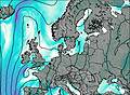
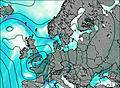
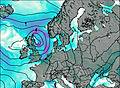
This table gives the weather forecast for Schauinsland at the specific elevation of 1284 m. Our advanced weather models allow us to provide distinct weather forecasts for several elevations of Schauinsland. To see the weather forecasts for the other elevations, use the tab navigation above the table. For a wider overview of the weather, consult the Weather Map of Germany.
| Weather Station | Temp. | Weather | Wind | Gusts | Cloud / Visibility |
|---|---|---|---|---|---|
Schauinsland | |||||
Feldber / chwarzwald | |||||
Spiesshorn | |||||
Kandel Süd DGFC | |||||
Kandel West DGFC | |||||
Hochfirst | |||||
Hintereck | |||||
Heue Bergalingen | |||||
Colmar Meyenheim | |||||
LFGB Mulhouse |
* NOTE: not all weather observatories update at the same frequency which is the reason why some locations may show data from stations that are further away than known closer ones.
Schauinsland Photos
View all
Minor ranges of Europe photos (96) |
photos from mountains in Germany (124) |
all photos
 Upload new photo
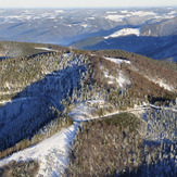
Schauinsland