
– Lat/Long: 18.36° N 71.98° W
 Pic la Selle
Weather Forecast, HaitiIssued: 1 pm Sun 02 Aug Local TimeUpdates in: hr min sUpdate imminent
Issued: 1 pm Sun 02 Aug Local Time
Updates in:
Update imminent hr min s

Issued: 1 pm Sun 02 Aug Local Time
Updates in:
Update imminent hr min s
Days 1–4 Weather SummaryModerate rain (total 16mm), heaviest on Mon night. Very mild (max 14°C on Sun night, min 12°C on Mon night). Wind will be generally light. | Days 5–7 Weather SummaryModerate rain (total 10mm), heaviest on Wed night. Very mild (max 13°C on Thu night, min 12°C on Wed afternoon). Wind will be generally light. | ||||||||||||||||
Sun 2 | Monday 3 | Tuesday 4 | Wednesday 5 | Thursday 6 | Friday 7 | ||||||||||||
PM | night | AM | PM | night | AM | PM | night | AM | PM | night | AM | PM | night | AM | PM | night | |
risk tstorm | risk tstorm | clear | risk tstorm | risk tstorm | clear | risk tstorm | risk tstorm | clear | risk tstorm | risk tstorm | clear | risk tstorm | risk tstorm | clear | rain shwrs | risk tstorm | |
Cloud base (m) | 6300 | 2500 | 8450 | 9050 | |||||||||||||
km/h | |||||||||||||||||
 |  |  |  |  |  | ||||||||||||
— | — | — | — | — | — | — | — | — | — | — | — | — | — | — | — | — | |
mm | 2 | 4 | — | 1.8 | 6 | — | 0.6 | 0.7 | — | 2 | 5 | — | 1.8 | 0.2 | — | 0.8 | 0.4 |
max °C | 13 | 14 | 13 | 13 | 14 | 13 | 13 | 13 | 12 | 12 | 12 | 12 | 12 | 13 | 13 | 13 | 13 |
min °C | 13 | 13 | 13 | 13 | 12 | 13 | 13 | 12 | 12 | 12 | 12 | 12 | 12 | 13 | 13 | 12 | 13 |
chill °C | 12 | 11 | 11 | 11 | 10 | 11 | 11 | 10 | 10 | 10 | 10 | 10 | 10 | 11 | 11 | 10 | 11 |
Freezing level m | 4650 | 4750 | 4800 | 4700 | 4750 | 4750 | 4650 | 4700 | 4700 | 4550 | 4700 | 4750 | 4750 | 4800 | 4900 | 4700 | 4850 |
— | — | 6:26 | — | — | 6:26 | — | — | 6:26 | — | — | 6:26 | — | — | 6:26 | — | — | |
7:22 | — | — | 7:21 | — | — | 7:21 | — | — | 7:20 | — | — | 7:20 | — | — | 7:19 | — | |
Loading...
Pic la Selle Weather (Days 0-3):
The weather forecast for Pic la Selle is: Moderate rain (total 16mm), heaviest on Mon night. Very mild (max 14°C on Sun night, min 12°C on Mon night). Wind will be generally light.
Pic la Selle Weather (Days 3-6):
Moderate rain (total 10mm), heaviest on Wed night. Very mild (max 13°C on Thu night, min 12°C on Wed afternoon). Wind will be generally light.
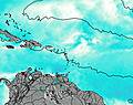
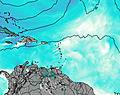
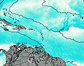
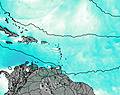
This table gives the weather forecast for Pic la Selle at the specific elevation of 2680 m. Our advanced weather models allow us to provide distinct weather forecasts for several elevations of Pic la Selle. To see the weather forecasts for the other elevations, use the tab navigation above the table. For a wider overview of the weather, consult the Weather Map of Haiti.
| Weather Station | Temp. | Weather | Wind | Gusts | Cloud / Visibility |
|---|---|---|---|---|---|
Port-Au-prince Airport | |||||
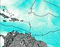
lightning 25km E of Rio Limpio | |||||
lightning 4km WSW of Carice | |||||
lightning 21km WSW of Juncalito Abajo | |||||
lightning 12km N of El Pino | |||||
lightning 5km N of Sabaneta | |||||
lightning 10km SW of Acul du Nord | |||||
thunderstorm affecting Moncion | |||||
* NOTE: not all weather observatories update at the same frequency which is the reason why some locations may show data from stations that are further away than known closer ones.