– Lat/Long: 44.62° N 5.92° E
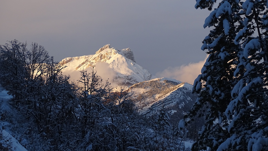
 Pic De Bure
Weather Forecast, FranceIssued: 1 pm Mon 03 Aug Local TimeUpdates in: hr min sUpdate imminent
Issued: 1 pm Mon 03 Aug Local Time
Updates in:
Update imminent hr min s

Issued: 1 pm Mon 03 Aug Local Time
Updates in:
Update imminent hr min s
Days 1–4 Weather SummaryLight rain (total 10mm), mostly falling on Tue night. Warm (max 30°C on Mon afternoon, min 19°C on Tue night). Wind will be generally light. | Days 5–7 Weather SummaryMostly dry. Warm (max 28°C on Sat afternoon, min 17°C on Thu night). Wind will be generally light. | ||||||||||||||||
Mon 3 | Tuesday 4 | Wednesday 5 | Thursday 6 | Friday 7 | Saturday 8 | ||||||||||||
PM | night | AM | PM | night | AM | PM | night | AM | PM | night | AM | PM | night | AM | PM | night | |
clear | some clouds | some clouds | clear | risk tstorm | clear | some clouds | clear | clear | risk tstorm | risk tstorm | clear | clear | clear | clear | clear | clear | |
Cloud base (m) | 3500 | 6750 | 5500 | 4700 | 6200 | 6250 | 4150 | ||||||||||
km/h | |||||||||||||||||
 |  |  |  |  |  | ||||||||||||
— | — | — | — | — | — | — | — | — | — | — | — | — | — | — | — | — | |
mm | — | — | — | — | 10 | — | — | — | — | 0.4 | 0.2 | — | — | — | — | — | — |
max °C | 30 | 26 | 26 | 28 | 21 | 25 | 29 | 27 | 25 | 25 | 22 | 22 | 26 | 23 | 23 | 28 | 25 |
min °C | 29 | 22 | 22 | 27 | 19 | 21 | 28 | 22 | 22 | 25 | 17 | 17 | 26 | 18 | 19 | 27 | 21 |
chill °C | 29 | 22 | 22 | 27 | 19 | 21 | 28 | 22 | 22 | 25 | 17 | 17 | 26 | 18 | 19 | 27 | 21 |
Freezing level m | 4650 | 4450 | 4400 | 4400 | 4500 | 4450 | 4600 | 4500 | 4450 | 4500 | 4500 | 4450 | 4500 | 4550 | 4550 | 4600 | 4600 |
— | — | 6:24 | — | — | 6:26 | — | — | 6:26 | — | — | 6:28 | — | — | 6:28 | — | — | |
— | 9:00 | — | — | 8:58 | — | — | 8:57 | — | — | 8:55 | — | — | 8:53 | — | — | 8:52 | |
Loading...
Pic De Bure Weather (Days 0-3):
The weather forecast for Pic De Bure is: Light rain (total 10mm), mostly falling on Tue night. Warm (max 30°C on Mon afternoon, min 19°C on Tue night). Wind will be generally light.
Pic De Bure Weather (Days 3-6):
Mostly dry. Warm (max 28°C on Sat afternoon, min 17°C on Thu night). Wind will be generally light.
This table gives the weather forecast for Pic De Bure at the specific elevation of 1000 m. Our advanced weather models allow us to provide distinct weather forecasts for several elevations of Pic De Bure. To see the weather forecasts for the other elevations, use the tab navigation above the table. For a wider overview of the weather, consult the Weather Map of France.
| Weather Station | Temp. | Weather | Wind | Gusts | Cloud / Visibility |
|---|---|---|---|---|---|
Devoluy Altisurface | |||||
Embrun | |||||
TC Montfrais g4 | |||||
TMX clos giraud g2 | |||||
ST -Auban -Sur -Durance | |||||
Villar Saint Pancrace | |||||
lightning 13km NNE of Jausiers | |||||
lightning 22km NE of Guillestre | |||||
Valence - Chabeuil Airport | |||||
lightning 4km E of Villargondran |
* NOTE: not all weather observatories update at the same frequency which is the reason why some locations may show data from stations that are further away than known closer ones.
Pic De Bure Photos
View all
Savoy Alps photos (141) |
Alps photos (1485) |
photos from mountains in France (302) |
all photos
 Upload new photo
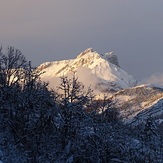
le pilier Est du Pic de Bure
Pic de Bure 2709m