
– Lat/Long: 9.30° S 77.32° W
 Perlilla
Weather Forecast, PeruIssued: 12 pm Fri 31 Jul Local TimeUpdates in: hr min sUpdate imminent
Issued: 12 pm Fri 31 Jul Local Time
Updates in:
Update imminent hr min s

Issued: 12 pm Fri 31 Jul Local Time
Updates in:
Update imminent hr min s
Days 1–3 Weather SummaryModerate rain (total 11mm), heaviest on Fri afternoon. Mild temperatures (max 7°C on Fri morning, min 1°C on Fri night). Wind will be generally light. | Days 4–6 Weather SummaryMostly dry. Mild temperatures (max 8°C on Mon afternoon, min 1°C on Tue night). Wind will be generally light. | |||||||||||||||||
Friday 31 | Saturday 1 | Sunday 2 | Monday 3 | Tuesday 4 | Wednesday 5 | |||||||||||||
AM | PM | night | AM | PM | night | AM | PM | night | AM | PM | night | AM | PM | night | AM | PM | night | |
rain shwrs | rain shwrs | rain shwrs | rain shwrs | risk tstorm | rain shwrs | clear | rain shwrs | rain shwrs | clear | rain shwrs | rain shwrs | clear | rain shwrs | rain shwrs | clear | rain shwrs | rain shwrs | |
Cloud base (m) | 5000 | 5750 | 5600 | 4300 | 5650 | 4650 | 4300 | 5800 | 4250 | 5750 | 4300 | 5800 | 4300 | 4400 | 5500 | 4650 | ||
km/h | ||||||||||||||||||
 |  |  |  |  |  | |||||||||||||
— | — | — | — | — | — | — | — | — | — | — | — | — | — | — | — | — | — | |
mm | 0.3 | 4 | 2 | 0.2 | 4 | 0.1 | — | 0.1 | 0.2 | — | 0.1 | 0.2 | — | 0.2 | 0.1 | — | 0.3 | 0.1 |
max °C | 7 | 6 | 3 | 6 | 6 | 3 | 7 | 7 | 3 | 7 | 8 | 3 | 7 | 7 | 3 | 7 | 6 | 3 |
min °C | 5 | 4 | 1 | 4 | 4 | 1 | 4 | 5 | 1 | 5 | 5 | 2 | 5 | 5 | 1 | 5 | 4 | 1 |
chill °C | 3 | 3 | -1 | 3 | 1 | -4 | 0 | 2 | -2 | 2 | 3 | 0 | 2 | 3 | -3 | 2 | 1 | -3 |
Freezing level m | 5150 | 5350 | 4900 | 5050 | 5300 | 4800 | 5150 | 5450 | 4850 | 5250 | 5550 | 4900 | 5300 | 5450 | 4850 | 5200 | 5350 | 4900 |
6:24 | — | — | 6:24 | — | — | 6:22 | — | — | 6:22 | — | — | 6:22 | — | — | 6:22 | — | — | |
— | 6:06 | — | — | 6:07 | — | — | 6:07 | — | — | 6:07 | — | — | 6:07 | — | — | 6:07 | — | |
Loading...
Perlilla Weather (Days 0-3):
The weather forecast for Perlilla is: Moderate rain (total 11mm), heaviest on Fri afternoon. Mild temperatures (max 7°C on Fri morning, min 1°C on Fri night). Wind will be generally light.
Perlilla Weather (Days 3-6):
Mostly dry. Mild temperatures (max 8°C on Mon afternoon, min 1°C on Tue night). Wind will be generally light.
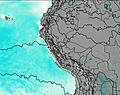
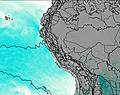
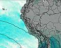
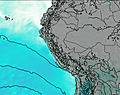
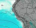
This table gives the weather forecast for Perlilla at the specific elevation of 4500 m. Our advanced weather models allow us to provide distinct weather forecasts for several elevations of Perlilla. To see the weather forecasts for the other elevations, use the tab navigation above the table. For a wider overview of the weather, consult the Weather Map of Peru.
| Weather Station | Temp. | Weather | Wind | Gusts | Cloud / Visibility |
|---|---|---|---|---|---|
Huaraz Ant / omandante FAP Germán Arias Graziani Airport | |||||
Tingo Maria Airport | |||||
Huánuc / lférez FAP David Figueroa Fernandini Airport | |||||
Trujillo Airport | |||||
Lima Jorge Chávez International Airport | |||||
Pucallpa Airport | |||||
Tarapoto Airport |
* NOTE: not all weather observatories update at the same frequency which is the reason why some locations may show data from stations that are further away than known closer ones.