– Lat/Long: 33.98° N 76.02° E
 Nun Kun
Weather Forecast, IndiaIssued: 4 am Tue 14 Jul Local TimeUpdates in: hr min sUpdate imminent
Issued: 4 am Tue 14 Jul Local Time
Updates in:
Update imminent hr min s

Issued: 4 am Tue 14 Jul Local Time
Updates in:
Update imminent hr min s
Days 1–3 Weather SummaryA moderate fall of snow, heaviest on Wed afternoon. Temperatures will be well below freezing (max -7°C on Thu night, min -13°C on Tue morning). Winds decreasing (fresh winds from the SW on Wed morning, calm by Thu afternoon). | Days 4–6 Weather SummaryA heavy fall of snow, heaviest during Sun afternoon. Temperatures will be well below freezing (max -6°C on Fri afternoon, min -8°C on Fri night). Wind will be generally light. | |||||||||||||||||
Tuesday 14 | Wednesday 15 | Thursday 16 | Friday 17 | Saturday 18 | Sunday 19 | |||||||||||||
AM | PM | night | AM | PM | night | AM | PM | night | AM | PM | night | AM | PM | night | AM | PM | night | |
some clouds | snow shwrs | some clouds | some clouds | snow shwrs | some clouds | some clouds | snow shwrs | snow shwrs | some clouds | snow shwrs | snow shwrs | some clouds | snow shwrs | snow shwrs | some clouds | snow shwrs | snow shwrs | |
km/h | ||||||||||||||||||
 |  |  |  |  |  | |||||||||||||
— | 2 | — | — | 4 | — | — | 4 | 1 | — | 3 | 1 | — | 5 | 2 | — | 7 | 3 | |
mm | — | — | — | — | — | — | — | — | — | — | — | — | — | — | — | — | — | — |
max °C | -13 | -11 | -11 | -11 | -10 | -10 | -10 | -8 | -7 | -7 | -6 | -7 | -6 | -7 | -7 | -7 | -7 | -8 |
min °C | -13 | -12 | -12 | -12 | -10 | -10 | -10 | -9 | -8 | -7 | -7 | -8 | -7 | -7 | -8 | -8 | -7 | -8 |
chill °C | -22 | -20 | -18 | -22 | -18 | -16 | -16 | -9 | -14 | -10 | -11 | -14 | -10 | -10 | -13 | -15 | -13 | -13 |
Freezing level m | 5350 | 5450 | 5150 | 5600 | 5650 | 5400 | 5850 | 5950 | 5950 | 6250 | 6250 | 5900 | 6250 | 6150 | 5900 | 6200 | 6100 | 5850 |
Cloud base (m) | 5150 | 5750 | 5300 | 5950 | 5800 | 5600 | 6100 | 5500 | 6100 | 6200 | 6000 | 5400 | 5350 | 6150 | 5100 | 7400 | 6150 | 6100 |
5:24 | — | — | 5:24 | — | — | 5:26 | — | — | 5:26 | — | — | 5:26 | — | — | 5:28 | — | — | |
— | 7:37 | — | — | 7:37 | — | — | 7:37 | — | — | 7:36 | — | — | 7:36 | — | — | 7:35 | — | |
Loading...
Nun Kun Weather (Days 0-3):
The weather forecast for Nun Kun is: A moderate fall of snow, heaviest on Wed afternoon. Temperatures will be well below freezing (max -7°C on Thu night, min -13°C on Tue morning). Winds decreasing (fresh winds from the SW on Wed morning, calm by Thu afternoon).
Nun Kun Weather (Days 3-6):
A heavy fall of snow, heaviest during Sun afternoon. Temperatures will be well below freezing (max -6°C on Fri afternoon, min -8°C on Fri night). Wind will be generally light.
This table gives the weather forecast for Nun Kun at the specific elevation of 7135 m. Our advanced weather models allow us to provide distinct weather forecasts for several elevations of Nun Kun. To see the weather forecasts for the other elevations, use the tab navigation above the table. For a wider overview of the weather, consult the Weather Map of India.
* NOTE: not all weather observatories update at the same frequency which is the reason why some locations may show data from stations that are further away than known closer ones.
Nun Kun Photos
View all
Punjab Himalaya photos (21) |
Greater Himalaya photos (378) |
photos from mountains in India (87) |
all photos
 Upload new photo
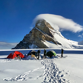
 See 15 more Nun Kun photos
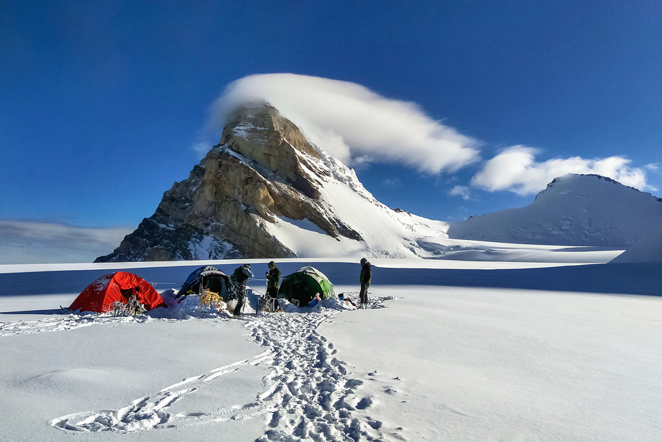
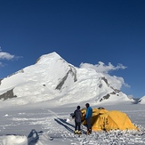
Camp 2 Mt. Kun (7077mt)
Nun-Kun massif
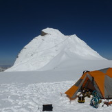
Camp 3 (Mt. Kun 7077mt)
Nun Camp I
Mt Nun from Nun Kun icefield
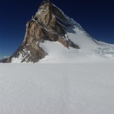
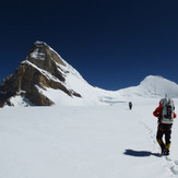
Approaching Kun from Camp 2
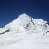
Mt Nun(7135m).