– Lat/Long: 37.05° N 3.31° W
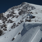
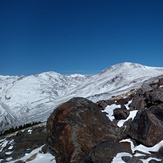
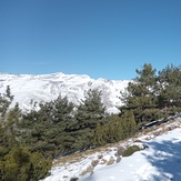
 Mulhacen
Weather Forecast, SpainIssued: 7 pm Sat 01 Aug Local TimeUpdates in: hr min sUpdate imminent
Issued: 7 pm Sat 01 Aug Local Time
Updates in:
Update imminent hr min s

Issued: 7 pm Sat 01 Aug Local Time
Updates in:
Update imminent hr min s
Days 1–4 Weather SummaryMostly dry. Warm (max 29°C on Sat night, min 21°C on Tue morning). Wind will be generally light. | Days 5–7 Weather SummaryMostly dry. Warm (max 29°C on Wed afternoon, min 22°C on Tue night). Wind will be generally light. | ||||||||||||||||||
Sunday 2 | Monday 3 | Tuesday 4 | Wednesday 5 | Thursday 6 | Friday 7 | ||||||||||||||
night | AM | PM | night | AM | PM | night | AM | PM | night | AM | PM | night | AM | PM | night | AM | PM | night | |
clear | clear | clear | clear | clear | some clouds | clear | clear | clear | clear | clear | clear | clear | clear | clear | clear | clear | clear | clear | |
Cloud base (m) | 6400 | 9350 | 5300 | 5300 | |||||||||||||||
km/h | |||||||||||||||||||
 |  |  |  |  |  |  | |||||||||||||
— | — | — | — | — | — | — | — | — | — | — | — | — | — | — | — | — | — | — | |
mm | — | — | — | — | — | — | — | — | — | — | — | — | — | — | — | — | — | — | — |
max °C | 29 | 27 | 29 | 28 | 26 | 28 | 26 | 24 | 28 | 26 | 25 | 29 | 27 | 26 | 29 | 28 | 26 | 29 | 28 |
min °C | 24 | 24 | 29 | 23 | 23 | 27 | 22 | 21 | 27 | 22 | 22 | 28 | 23 | 23 | 28 | 24 | 24 | 28 | 24 |
chill °C | 24 | 24 | 29 | 23 | 23 | 27 | 22 | 21 | 27 | 22 | 22 | 28 | 23 | 23 | 28 | 24 | 24 | 28 | 24 |
Freezing level m | 5000 | 4950 | 5050 | 5050 | 4800 | 4800 | 4950 | 4900 | 5000 | 5000 | 5000 | 5000 | 5000 | 5000 | 5100 | 5050 | 5050 | 5150 | 5150 |
— | 7:18 | — | — | 7:18 | — | — | 7:20 | — | — | 7:20 | — | — | 7:20 | — | — | 7:22 | — | — | |
— | — | — | 9:19 | — | — | 9:17 | — | — | 9:16 | — | — | 9:15 | — | — | 9:15 | — | — | 9:14 | |
Loading...
Mulhacen Weather (Days 0-3):
The weather forecast for Mulhacen is: Mostly dry. Warm (max 29°C on Sat night, min 21°C on Tue morning). Wind will be generally light.
Mulhacen Weather (Days 3-6):
Mostly dry. Warm (max 29°C on Wed afternoon, min 22°C on Tue night). Wind will be generally light.
This table gives the weather forecast for Mulhacen at the specific elevation of 1500 m. Our advanced weather models allow us to provide distinct weather forecasts for several elevations of Mulhacen. To see the weather forecasts for the other elevations, use the tab navigation above the table. For a wider overview of the weather, consult the Weather Map of Spain.
| Weather Station | Temp. | Weather | Wind | Gusts | Cloud / Visibility |
|---|---|---|---|---|---|
Granad / ase Aerea | |||||
Sierra Nevada | |||||
Tabernas III |
* NOTE: not all weather observatories update at the same frequency which is the reason why some locations may show data from stations that are further away than known closer ones.
Mulhacen Photos
View all
Sierra Nevada photos (45) |
Baetic System photos (59) |
photos from mountains in Spain (451) |
all photos
 Upload new photo
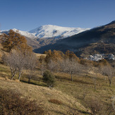
 See 20 more Mulhacen photos
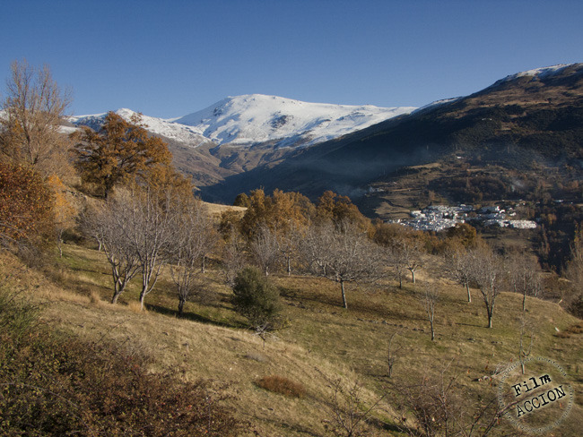
Mulhacen from the south valley in fall
Near Mulhacen
Alkazaba, Mulhacen and Veleta from Sierra Nevada (left to right)
north face
Mulhacen II and south ridge
Mulhacen II
Laguna Larga - Sierra Nevada