– Lat/Long: 36.29° N 137.72° E
 Mt Chogatake – Climbing, Hiking & Mountaineering information

Mt Chogatake Guide
- Elevation: 2664
- Difficulty: -
- Best months to climb: April, May, June, July, August, September, October
- Convenient center: Matsumoto
Mt Chogatake climbers Notes
Click here to read 1 more climbing note for Mt Chogatake or submit your own |
| Select a
mountain summit from the menu |
||
|
Select a Mountain Summit
|
||
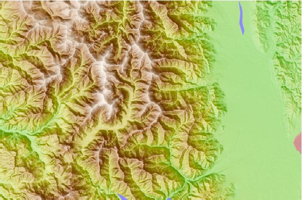
Use this relief map to navigate to mountain peaks in the area of Mt Chogatake.
10 other mountain peaks closest to Mt Chogatake:
| 1. | 岳沢小屋 (2655 m) | 0.1 km |
| 2. | 焼岳小屋 (1622 m) | 2.3 km |
| 3. | 岩魚留小屋 (2605 m) | 2.4 km |
| 4. | Jonen Dake (2857 m) | 4.1 km |
| 5. | 徳本峠小屋 (1564 m) | 4.1 km |
| 6. | 徳澤園 (1568 m) | 4.3 km |
| 7. | 北穂高小屋 (2450 m) | 4.8 km |
| 8. | 槍ヶ岳山荘 (1831 m) | 4.9 km |
| 9. | 薬師岳山荘 (2350 m) | 5.8 km |
| 10. | ヒュッテ大槍 (2683 m) | 6.5 km |