
– Lat/Long: 12.47° N 42.40° E
 Mousa Ali
Weather Forecast, EritreaIssued: 2 pm Mon 03 Aug Local TimeUpdates in: hr min sUpdate imminent
Issued: 2 pm Mon 03 Aug Local Time
Updates in:
Update imminent hr min s

Issued: 2 pm Mon 03 Aug Local Time
Updates in:
Update imminent hr min s
Days 1–4 Weather SummarySome drizzle, heaviest during Mon afternoon. Warm (max 25°C on Wed afternoon, min 21°C on Tue morning). Winds decreasing (strong winds from the NNW on Mon night, light winds from the NW by Wed morning). | Days 5–7 Weather SummaryMostly dry. Warm (max 24°C on Thu afternoon, min 20°C on Fri morning). Mainly strong winds. | ||||||||||||||||
Mon 3 | Tuesday 4 | Wednesday 5 | Thursday 6 | Friday 7 | Saturday 8 | ||||||||||||
PM | night | AM | PM | night | AM | PM | night | AM | PM | night | AM | PM | night | AM | PM | night | |
rain shwrs | some clouds | clear | clear | rain shwrs | clear | clear | rain shwrs | rain shwrs | clear | some clouds | clear | clear | rain shwrs | some clouds | some clouds | rain shwrs | |
Cloud base (m) | 5100 | 4850 | 4750 | 4800 | 5050 | 5000 | 5550 | 5600 | 5200 | 5300 | 5550 | 6150 | |||||
km/h | |||||||||||||||||
 |  |  |  |  |  | ||||||||||||
— | — | — | — | — | — | — | — | — | — | — | — | — | — | — | — | — | |
mm | 0.3 | — | — | — | 0.4 | — | — | 0.2 | 0.3 | — | — | — | — | 0.3 | — | — | 0.5 |
max °C | 23 | 23 | 22 | 24 | 23 | 23 | 25 | 24 | 22 | 24 | 23 | 21 | 23 | 22 | 21 | 23 | 23 |
min °C | 22 | 22 | 21 | 23 | 23 | 22 | 24 | 22 | 21 | 23 | 21 | 20 | 22 | 20 | 20 | 22 | 21 |
chill °C | 22 | 22 | 21 | 23 | 23 | 22 | 24 | 22 | 21 | 23 | 21 | 20 | 22 | 20 | 20 | 22 | 21 |
Freezing level m | 5300 | 5200 | 5100 | 5300 | 5250 | 5250 | 5350 | 5350 | 5250 | 5250 | 5250 | 5100 | 5150 | 5200 | 5200 | 5150 | 5300 |
— | — | 5:56 | — | — | 5:56 | — | — | 5:56 | — | — | 5:56 | — | — | 5:56 | — | — | |
6:36 | — | — | 6:35 | — | — | 6:35 | — | — | 6:34 | — | — | 6:34 | — | — | 6:34 | — | |
Loading...
Mousa Ali Weather (Days 0-3):
The weather forecast for Mousa Ali is: Some drizzle, heaviest during Mon afternoon. Warm (max 25°C on Wed afternoon, min 21°C on Tue morning). Winds decreasing (strong winds from the NNW on Mon night, light winds from the NW by Wed morning).
Mousa Ali Weather (Days 3-6):
Mostly dry. Warm (max 24°C on Thu afternoon, min 20°C on Fri morning). Mainly strong winds.
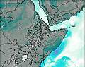
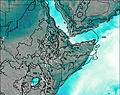
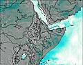
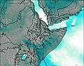
This table gives the weather forecast for Mousa Ali at the specific elevation of 2028 m. Our advanced weather models allow us to provide distinct weather forecasts for several elevations of Mousa Ali. To see the weather forecasts for the other elevations, use the tab navigation above the table. For a wider overview of the weather, consult the Weather Map of Eritrea.
| Weather Station | Temp. | Weather | Wind | Gusts | Cloud / Visibility |
|---|---|---|---|---|---|
Aden International Airport | |||||
Gizan Airport | |||||
Ataq Airport | |||||
Addis Abab / ole | |||||
Nejran Airport | |||||
Abha Airport | |||||
Khamis Mushait Air Base Airport | |||||
* NOTE: not all weather observatories update at the same frequency which is the reason why some locations may show data from stations that are further away than known closer ones.