
– Lat/Long: 37.40° S 146.14° E
 Mount Terrible
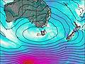
Weather Forecast, AustraliaIssued: 3 am Thu 30 Jul Local TimeUpdates in: hr min sUpdate imminent
Issued: 3 am Thu 30 Jul Local Time
Updates in:
Update imminent hr min s

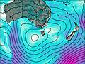
Issued: 3 am Thu 30 Jul Local Time
Updates in:
Update imminent hr min s
Days 1–3 Weather SummaryMostly dry. Mild temperatures (max 6°C on Fri morning, min 2°C on Thu morning). Winds increasing (calm on Fri night, fresh winds from the NNW by Sat night). | Days 4–6 Weather SummaryA light covering of new snow mostly falling on Mon morning. Becoming milder with light rain (total 5mm) on Mon afternoon. Mild temperatures (max 6°C on Sun morning, min 1°C on Sun night). Winds decreasing (strong winds from the NNW on Sun night, light winds from the SW by Tue night). | |||||||||||||||||
Thursday 30 | Friday 31 | Saturday 1 | Sunday 2 | Monday 3 | Tuesday 4 | |||||||||||||
AM | PM | night | AM | PM | night | AM | PM | night | AM | PM | night | AM | PM | night | AM | PM | night | |
cloudy | rain shwrs | some clouds | some clouds | clear | clear | clear | clear | clear | clear | rain shwrs | snow shwrs | light snow | light snow | light snow | light rain | light rain | light rain | |
Cloud base (m) | 700 | 600 | 700 | 700 | 1000 | 1050 | 9200 | 1850 | 1600 | 650 | 600 | 600 | 600 | 600 | 600 | |||
km/h | ||||||||||||||||||
 |  |  |  |  |  | |||||||||||||
— | — | — | — | — | — | — | — | — | — | — | 1 | 3 | 2 | 2 | — | — | — | |
mm | — | 0.3 | — | — | — | — | — | — | — | — | 0.3 | — | — | 3 | — | 0.5 | 0.7 | 0.5 |
max °C | 2 | 2 | 3 | 6 | 6 | 3 | 6 | 6 | 3 | 6 | 6 | 4 | 1 | 2 | 2 | 3 | 3 | 3 |
min °C | 2 | 2 | 2 | 4 | 4 | 2 | 5 | 4 | 3 | 5 | 4 | 1 | 1 | 2 | 1 | 3 | 3 | 2 |
chill °C | -1 | -1 | -2 | 2 | 2 | -2 | 1 | 0 | -2 | -1 | -2 | -5 | -5 | -4 | -5 | -2 | -1 | -2 |
Freezing level m | 1250 | 1300 | 1350 | 1500 | 1850 | 1900 | 1750 | 1950 | 2000 | 1950 | 1850 | 1800 | 1150 | 1300 | 1250 | 1450 | 1550 | 1450 |
7:16 | — | — | 7:16 | — | — | 7:15 | — | — | 7:13 | — | — | 7:13 | — | — | 7:11 | — | — | |
— | 5:25 | — | — | 5:27 | — | — | 5:28 | — | — | 5:29 | — | — | 5:30 | — | — | 5:30 | — | |
Loading...
Mount Terrible Weather (Days 0-3):
The weather forecast for Mount Terrible is: Mostly dry. Mild temperatures (max 6°C on Fri morning, min 2°C on Thu morning). Winds increasing (calm on Fri night, fresh winds from the NNW by Sat night).
Mount Terrible Weather (Days 3-6):
A light covering of new snow mostly falling on Mon morning. Becoming milder with light rain (total 5mm) on Mon afternoon. Mild temperatures (max 6°C on Sun morning, min 1°C on Sun night). Winds decreasing (strong winds from the NNW on Sun night, light winds from the SW by Tue night).
This table gives the weather forecast for Mount Terrible at the specific elevation of 1000 m. Our advanced weather models allow us to provide distinct weather forecasts for several elevations of Mount Terrible. To see the weather forecasts for the other elevations, use the tab navigation above the table. For a wider overview of the weather, consult the Weather Map of Victoria.