
– Lat/Long: 53.62° N 119.72° W
 Mount Talbot
Weather Forecast, CanadaIssued: 11 am Tue 28 Jul Local TimeUpdates in: hr min sUpdate imminent
Issued: 11 am Tue 28 Jul Local Time
Updates in:
Update imminent hr min s

Issued: 11 am Tue 28 Jul Local Time
Updates in:
Update imminent hr min s
Days 1–3 Weather SummaryLight rain (total 5mm), mostly falling on Tue afternoon. Warm (max 21°C on Thu afternoon, min 7°C on Tue night). Wind will be generally light. | Days 4–6 Weather SummaryModerate rain (total 17mm), heaviest on Sat afternoon. Warm (max 20°C on Fri afternoon, min 3°C on Sun night). Winds increasing (calm on Fri night, fresh winds from the WSW by Sat night). | |||||||||||||||||
Tuesday 28 | Wednesday 29 | Thursday 30 | Friday 31 | Saturday 1 | Sunday 2 | |||||||||||||
AM | PM | night | AM | PM | night | AM | PM | night | AM | PM | night | AM | PM | night | AM | PM | night | |
rain shwrs | rain shwrs | rain shwrs | rain shwrs | some clouds | some clouds | some clouds | some clouds | some clouds | some clouds | some clouds | some clouds | rain shwrs | rain shwrs | rain shwrs | light rain | light rain | rain shwrs | |
Cloud base (m) | 2200 | 2800 | 2500 | 3050 | 5900 | 5450 | 4750 | 3450 | 3250 | 1850 | 2700 | 2300 | 2050 | 2000 | ||||
km/h | ||||||||||||||||||
 |  |  |  |  |  | |||||||||||||
— | — | — | — | — | — | — | — | — | — | — | — | — | — | — | — | — | — | |
mm | 0.1 | 4 | 1.3 | 0.3 | — | — | — | — | — | — | — | — | 1.7 | 12 | 1.2 | 0.2 | 2 | 0.1 |
max °C | 15 | 13 | 10 | 13 | 16 | 14 | 18 | 21 | 17 | 18 | 20 | 18 | 16 | 12 | 11 | 7 | 6 | 6 |
min °C | 13 | 12 | 7 | 9 | 15 | 9 | 13 | 20 | 11 | 14 | 19 | 13 | 14 | 11 | 6 | 7 | 6 | 3 |
chill °C | 13 | 10 | 6 | 8 | 14 | 9 | 13 | 20 | 11 | 14 | 19 | 13 | 13 | 10 | 2 | 3 | 4 | 1 |
Freezing level m | 3400 | 3200 | 2900 | 2800 | 3150 | 3450 | 3700 | 3900 | 3900 | 3700 | 3850 | 4100 | 3900 | 3150 | 2650 | 2400 | 2350 | 2500 |
6:05 | — | — | 6:07 | — | — | 6:09 | — | — | 6:11 | — | — | 6:13 | — | — | 6:15 | — | — | |
— | — | 10:01 | — | — | 10:00 | — | — | 9:59 | — | — | 9:57 | — | — | 9:54 | — | — | 9:53 | |
Loading...
Mount Talbot Weather (Days 0-3):
The weather forecast for Mount Talbot is: Light rain (total 5mm), mostly falling on Tue afternoon. Warm (max 21°C on Thu afternoon, min 7°C on Tue night). Wind will be generally light.
Mount Talbot Weather (Days 3-6):
Moderate rain (total 17mm), heaviest on Sat afternoon. Warm (max 20°C on Fri afternoon, min 3°C on Sun night). Winds increasing (calm on Fri night, fresh winds from the WSW by Sat night).
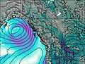
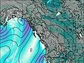
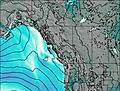
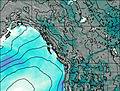
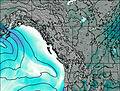
This table gives the weather forecast for Mount Talbot at the specific elevation of 1500 m. Our advanced weather models allow us to provide distinct weather forecasts for several elevations of Mount Talbot. To see the weather forecasts for the other elevations, use the tab navigation above the table. For a wider overview of the weather, consult the Weather Map of British-Columbia.
| Weather Station | Temp. | Weather | Wind | Gusts | Cloud / Visibility |
|---|---|---|---|---|---|
lightning 103km W of Grande Cache | |||||
Hendrickson Creek- Alta | |||||
Willow Creek 1- Alta | |||||
Jasper Warden Airport | |||||
Jasper Warden- Alta | |||||
lightning 128km NE of Williams Lake | |||||
lightning 65km SW of Valleyview | |||||
Blue River Cs- BC | |||||
Blue River Airport |
* NOTE: not all weather observatories update at the same frequency which is the reason why some locations may show data from stations that are further away than known closer ones.