
– Lat/Long: 49.50° N 114.59° W
 Mount Pengelly
Weather Forecast, CanadaIssued: 11 pm Fri 17 Jul Local TimeUpdates in: hr min sUpdate imminent
Issued: 11 pm Fri 17 Jul Local Time
Updates in:
Update imminent hr min s

Issued: 11 pm Fri 17 Jul Local Time
Updates in:
Update imminent hr min s
Days 1–4 Weather SummaryLight rain (total 6mm), mostly falling on Fri night. Very mild (max 15°C on Sat afternoon, min 9°C on Sat night). Winds decreasing (gales from the WSW on Sat night, calm by Mon afternoon). | Days 5–7 Weather SummaryMostly dry. Very mild (max 19°C on Wed afternoon, min 10°C on Mon night). Winds increasing (calm on Tue night, strong winds from the SW by Thu afternoon). | ||||||||||||||||||
Saturday 18 | Sunday 19 | Monday 20 | Tuesday 21 | Wednesday 22 | Thursday 23 | ||||||||||||||
night | AM | PM | night | AM | PM | night | AM | PM | night | AM | PM | night | AM | PM | night | AM | PM | night | |
risk tstorm | clear | clear | clear | clear | clear | clear | clear | some clouds | cloudy | some clouds | clear | clear | some clouds | some clouds | some clouds | some clouds | clear | clear | |
Cloud base (m) | 1800 | 1900 | 3200 | 2550 | 3550 | 5600 | 9000 | 4250 | 5250 | 6350 | 6600 | ||||||||
km/h | |||||||||||||||||||
 |  |  |  |  |  |  | |||||||||||||
— | — | — | — | — | — | — | — | — | — | — | — | — | — | — | — | — | — | — | |
mm | 6 | — | — | — | — | — | — | — | — | — | — | — | — | — | — | — | — | — | — |
max °C | 13 | 14 | 15 | 12 | 10 | 14 | 12 | 10 | 13 | 11 | 13 | 17 | 15 | 16 | 19 | 16 | 16 | 19 | 17 |
min °C | 11 | 12 | 15 | 9 | 10 | 13 | 9 | 9 | 12 | 10 | 12 | 16 | 12 | 14 | 18 | 13 | 15 | 18 | 13 |
chill °C | 8 | 8 | 12 | 4 | 6 | 10 | 7 | 7 | 11 | 8 | 10 | 16 | 11 | 14 | 18 | 11 | 13 | 17 | 10 |
Freezing level m | 4750 | 4500 | 4500 | 4200 | 4050 | 4150 | 4300 | 4150 | 4250 | 4750 | 4600 | 4800 | 4900 | 4850 | 5000 | 4950 | 4700 | 4850 | 4800 |
— | 5:50 | — | — | 5:52 | — | — | 5:52 | — | — | 5:54 | — | — | 5:54 | — | — | 5:56 | — | — | |
— | — | — | 9:37 | — | — | 9:36 | — | — | 9:35 | — | — | 9:34 | — | — | 9:31 | — | — | 9:30 | |
Loading...
Mount Pengelly Weather (Days 0-3):
The weather forecast for Mount Pengelly is: Light rain (total 6mm), mostly falling on Fri night. Very mild (max 15°C on Sat afternoon, min 9°C on Sat night). Winds decreasing (gales from the WSW on Sat night, calm by Mon afternoon).
Mount Pengelly Weather (Days 3-6):
Mostly dry. Very mild (max 19°C on Wed afternoon, min 10°C on Mon night). Winds increasing (calm on Tue night, strong winds from the SW by Thu afternoon).
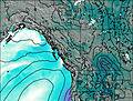
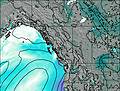
This table gives the weather forecast for Mount Pengelly at the specific elevation of 2586 m. Our advanced weather models allow us to provide distinct weather forecasts for several elevations of Mount Pengelly. To see the weather forecasts for the other elevations, use the tab navigation above the table. For a wider overview of the weather, consult the Weather Map of British-Columbia.
| Weather Station | Temp. | Weather | Wind | Gusts | Cloud / Visibility |
|---|---|---|---|---|---|
lightning 29km E of Fernie | |||||
Crowsnest- Alta | |||||
lightning 37km WNW of Pincher Creek | |||||
Morrissey Ridge | |||||
Sparwood Cs- BC | |||||
Sparwood Airport | |||||
Pincher Creek Airport | |||||
Pincher Creek- Alta |
* NOTE: not all weather observatories update at the same frequency which is the reason why some locations may show data from stations that are further away than known closer ones.